Introduction
I had planned to spend the second half of June 2024 exploring the Cairngorms, in North-Eastern Scotland. However, with the forecast of rain and single-digit temperatures, I abruptly changed tack, and in the space of a couple of days had organised for a trip to Corsica and the GR20 – a walk that has vaguely been on my bucket list for decades.
Spoiler alert: I started at the beginning, walked it, and finished at the end. This is not a blow by blow account, but a short record of that trip. At the end I’ll offer some observations and hints on the GR20.
Diary
Saturday 15 June 2024
Long day of travel from home to the trail-head. My rapid investigations lead me to fly to Marseilles, and from there to Calvi, which I reach some time after 7pm. I decide to kill a couple of hours by walking to the start-town of Calenzana, but this is just a plod along roads, which isn’t much fun. I was about to call it a day and squirrel into the bush to camp, when a fellow pulled up and gave me a lift for the final 4km. The campsite in town looks grimly full. I walk 400m up the trail and find a spot to crash. This is the only wild-camp I do all trip.

Sunday 16 June 2024
Double stage. I’m woken at 5:30am by head-torches and chatter as the truly early-birds start passing me close-by. Annoyingly I have to return to Calenzana, where there is a water fountain right at the start of the trail. I’m wary about not having enough water, and thus proceed to carry about 4l over a series of streams and springs. Eventually the penny drops that I can probably source on route and I reduce the amount considerably.
The guide I have (lifted from the internet) says 10km, 1570m ascent, 6h:30m for the first stage. It’s really tough scrambling upwards. I have lunch at Refuge d’Ortu di u Piobbu, which seems very empty – I think today’s walkers are all ahead of me. Second stage is 8km, 667m ascent, 917m descent (which is tough too!) and supposedly 7h. I arrive in Refuge de Carrozzu, extremely weary and late in the day. The Refuge is shoe-horned into a canyon, and is rammed. Eventually I find a body-sized patch of flat ground up a slope and string up the tarp for a not-very-good camp. I’ve brought a kilo of muesli with me, and I’m keen to reduce weight a bit, so supper on that.
The better organised French are drinking expensive beers in the Refuge and partake of the basic (but better-than-muesli) supper laid on.
 Long early morning shadows
 Walking in shade – handy in the heat.
 Col.
Col.
Monday 17 June 2024
Brutal section 6km, 790m ascent, 638m descent, 6h. Actually it does take me less time than this. I note that when I get up a 6am, the camp is largely empty. There is obviously a value in using the cool of the morning (including the long shadows cast by the hills) to get a good start on the walk. It’s a complete workout: hauling myself bodily up the rock-faces. Really tough.
I’m aware that I need to pace myself if I’m going to complete the trail. I determine this will be a one-stage-day, and having reached Refuge d’Asco Stagnu, I call it quits and purchase a huge cheese sandwich (delicious local cheese). I pitch on the ski-slopes and I’m horizontal for most of the afternoon.
 Bridge
 Path is on the left. Indistinct.
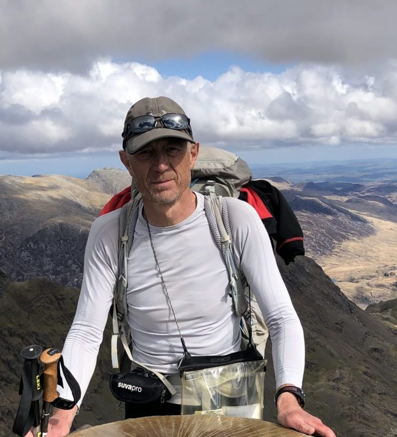
 My rig. Worked for me, but conditions were good.
Tuesday 18 June 2024.
Another double-section day. Morning to Refuge de Tighjettu: 8km, 999m ascent, 738m descent, 6h. This is the last of the truly challenging scrambling sections with an immense climb to Col de Minuta and then down the other side. Lunched at the Refuge. Set off from there in the heat of the afternoon, but it was downhill for a good way, and I stopped and refreshed by a few streams as I went. Final climb up to Refuge de Ciottulu di i Mori (at 1991 m, the highest point of the stage) 607m ascent, 78m descent, 4h.
Nicer camping area, although one shower and one toilet. I give up on the queue for showers and flannel wash. Have to shout at my neighbours to STOP TALKING!, as they rabbit on past 10pm. Thankfully they immediately shut up. Lovely spot looking down the valley.
 WTF: huge climbs the norm
 Navigation involves following the guy in front.
 GR20 is not the place for solitude
 A relatively easy scramble (folk are upright)
Wednesday 19 June 2024
First bit to Castel di Vergio feels like it’s all downhill and on relatively easy paths at that. CdV is another ski-station on a road. The Epicerie is better stocked than I’m used to, and I pick up some fruit, fresh bread and cheese. I lunch sitting outside the shop. With better planning, this would have been a good place to over-night: everything is nicer and cheaper than the Refuges, this being on a road and therefore not reliant on helicopter transport.
Afternoon: on to Refuge de Manganu. The terrain has definitely eased up a bit. Much less scrambling now and this is almost “normal” mountain walking (for a Brit like me). The showers are hot. This was a long day, and felt like a big distance. I note my Garmin is giving readings of distance and altitude gained far in excess of the official figures. Normally I reckon the Garmin quite accurate. Nice campsite, although cattle wandering through the tents. I’m alerted to a cow standing right by my entrance – thankfully it withdraws when I shoo it away.
Several walkers interested in my tarp set-up. It’s minimalist and lightweight, but I have to agree that it would struggle in a proper mountain storm.
I know I’m not replacing all the calories I’m burning. I can afford to lose a bit of weight, but not much. Must try to eat more.
 Another haul
 More trees as you go south
 Lac de Creno
Thursday 20 June 2024.
Was planning on a double stage today, but, high on the hills, I was physically sick. It’s food poisoning – probably from the water. I’m sweaty and weak. Thankfully it’s only a descent into the camp, but it’s steep, rocky and jarring. I have to draw on reserves of resilience and resolve, and I’m verbalising my stock of absolutely at the limit songs, “….gotta keep cool now, gotta take care ….”. At the camp I crash down. I filch some sugar and salt for a rudimentary rehydration solution, and spend the afternoon quaffing that. I’m sick once again, but then I slowly get better. I doze all afternoon, and by evening, against all bodily desires, I force down a bowl of pasta. Only four hours walking.
Refuge de Pietra Piana (1842 m). Ascent 830 m; descent is 589 m; 10 km long; 6h30. Thankfully took me less.

Friday 21 June 2024
Another short day. I’m still weak and wisely determined not to go for the double stage to Vizzavona. I reach Refuge de l’Onda before noon, and treat myself to a pizza before establishing my camp and dozing for the afternoon. According to the guide 10km, 643m ascent, 1033m descent 5h30m.
Saturday 22 June 2024
Walk to Vizzavona. This is considered the dividing point between the tougher northern section and the soft southern part. It’s an up-and-over, with a steep climb out of the Refuge and then a long, long descent into “town”. This was a haunt of Victorian Brits, and one passes the lovely Cascades Anglais, but I decide not to dawdle and crack on to the end. I’m early in camp, which gives me the choice of pitch. The site is flat, but gravelly. I get the shade. At the shop I purchase 1.5l of Orangina – mainly for sentiment for holidays half-a-century ago. However, the 600 calories therein are just what I need. A one-horse town, with a hotel, bar and train-station. A couple I’ve been chatting to along the way have booked into the hotel – a smart plan.


Sunday 23 June 2024
I need to do one more double-section day if I’m to finish the walk within my schedule. I reckon I’m now recovered and today’s the day. A good choice, as there is a qualitative change in toughness, with a long early path today contouring through beautiful pine woods. First stage to Bergeries de Capannelle is notionally 15km, 890m ascent, 224m descent and 5h30m. It takes me less.
After lunch a long-old-haul to Refuge de Prati 16km, 642m ascent, 408m descent, 6h.
That’s over 30km even according to the on-line guide. My Garmin says much more. I’m tired by not shattered.


Monday 24 June 2024
After my bout of sickness, I’m back to strength now. After yesterday’s efforts I realise I can push on. I’m everyday reminded I’m a long-way off the pace in terms of speed. Most folk younger than me are faster. This is both linked to the regular need for explosive power to get up hill, and the agility and flex needed to descend. One loses both with age. But stamina does persist and I am able to keep on. I am that wrinkled tortoise.
I am to do a one-and-a-half stage day today. I’ve also noted that in this southern section there are more options in regard to alternatives to the Refuges. So easier to split a stage. First is get to the Refuge at Usciolu. The route is packed it seems, and the refuge when I get there at noon more so. It feels claustrophobic, and there’s a lot of chatter about imminent thunder-storms. This was 11km, 677m ascent 747m descent, 5h45m.
[This bit, not recommended!] I can’t face hanging around, and after boshing a bit of food, head out again into the gloomy skies. The path is not quite on the ridge, but close enough. I determine that my escape will be into the woods about 30m below, which I’ll take if I start seeing lightening hitting the earth. It does rain. There are regular rumbles of thunder. But there don’t appear to be any strikes from heaven to earth. I crack on and, I have to say, I’m elated. It’s the view that does it: the beautiful changing light, the clouds swirling through the forests. It is breath-taking. And I live to tell the tale. As I descend the skies brighten, the rain stops and I’m dry by the time I reach what reminds me of Cornish moorland.
I stop at the first Bergere (de Bassata) that I reach. As it turns out a mistake: I was feeling strong and could have cracked on for another 6km to Croci – giving me a head-start on tomorrow.

Tuesday 25 June 2024
Overnight my bag of food has been stolen. Presumably a fox, although there are guilty looking dogs around the Bergere. I’m keen to get away, and trust that I’ll be able to pick up some food in the establishments in the next few km, which turns out to be the case. The terrain really does feel like a moor in southern England, although it turns steeply up hill for a good old haul to reach Refuge Asinao, which I arrive at in time for lunch. A young German lad gifts me 250g of couscous (he has another 1kg in his bag!) and I’ve bread purchased this morning. I’m down to basic carbs now.
That’s completed the stage I started yesterday in the storms. I now set off for the penultimate stage to Palari, which I reach late afternoon. The setting is breathtaking with views over a vertiginous drop to sun-kissed hills beyond. But for the gravelly ground, the camp is pleasant and spacious. Not for the first-time I shower in what feels like melt-water.


Wednesday 26 June 2024.
It’s all downhill now. Nearly. A pretty lovely forest walk. It feels like a breeze, although it is still four hours tough walking over rocky ground. There is no finish line, although I should have probably stopped at the first bar reached to have a celebratory drink. I crack on through the little town of Conca, and having emerged at the other end, start hitch-hiking. An odd transition.


Information
I struggled in my two days of hasty planning to find authoritative helpful information for this walk. I would probably have done well to get hold of the Cicerone Guide (https://www.cicerone.co.uk/trekking-the-gr20-corsica) by Paddy Dillon. Alternatives are available, if you speak French or German.
A useful website was https://www.thehikinglife.com/2017/03/a-quick-dirty-guide-to-corsicas-gr2 which in turn referred me to http://corsica.forhikers.com/ . This latter did contain handy route summaries, but it is dated – from 2013.
This is the website of the Park, which includes the facility to book accommodation: https://pnr-resa.corsica/ . The message is coming out that you shouldn’t start the walk, unless your accommodation is booked. My experience was that there was no problem with my own tent. But I did note that often there was no spaces in the hut or in the additional pre-erected tents. It may be more difficult though, in the high-season of July and August.
You don’t need maps for step-by-step navigation. The route is flashed the whole way with red and white stripes. The job is to identify the next one, walk to it, repeat. This is the only way to go. However, for the reassurance of having something, I downloaded the Komoot and Wikiloc maps for Corsica along with the actual route. However, more useful than either was the Cartes IGN App (see https://www.ign.fr/ ). What I discovered was that if I browsed over the whole of Corsica whilst WiFi was available, then the maps I then viewed were still available off-line. The whole App would probably be a lot more useful if I could read French better. Another Ap is OutdoorsGPS or OutdoorsFrance – the paid-for premium version does offer unlimited downloads of the IGN maps (I didn’t get this, so cannot comment on the quality).
Observations
I’m 62 years old. I’m fit and trim, but this walk brought home to me the impact of aging. One has neither the power or agility of youth. So the following tips may be useful to anyone, but they are particularly written for the more mature walker.
- Don’t carry a single gramme you don’t need to.
- But be aware that you won’t be able to purchase any kit or much other than food on the route. So you need to balance necessity, provision for exigency, and weight. As food can be purchased along the way, don’t carry too much of that. But know that you’ll be crying out for fresh-stuff towards the end.
- Water. Have the means to take water from streams. That means a having a filter like a Sawyer or Katadyn. If you can find a website or Facebook page that lists current water sources on route, cherish that.
- Don’t wild-camp. In the UK I’m normally up for responsible wild-camping. But in my view it probably isn’t responsible here. If it were allowed, there would be an awful lot of it, but within a very narrow corridor of the route. I think this isn’t sustainable. (The route is extraordinarily free from litter – respect to walkers and authorities!)
- Walking shoes are probably best. This is a dry and rocky walk. There is no stream-fording. But the scrambling may be a bit easier with shoes rather than boots. I wore trainers – which was idiotic – they were ruined by the end, and I needed to fabricate ways to hold them together for the last couple of days!
- It costs €30 to stay overnight in the hut. It costs €18 per person to camp. It costs an additional €15 to hire a tent (which will shelter up to two). Evening meal is €20-25. Breakfast €10. Lunch €10. Most of the refuges have a small offering for lunch (sandwich, pizza, etc). All the refuges have a small Epicerie which will sell you basic food, such as pasta and sauce, generally at a mark-up of 100-200% on normal prices. Most refuges would not sell bread (though one or two did). It is generally cheaper and nicer to stay in the non-official Begeres, which tend to be near roads, and thus not reliant on helicopter supply. There are more-and-more of these as you go southwards. There are also hotels at Stagnu (end stage 3), Castel del Vergio (mid stage 6), Vizzavona (end stage 9) and Bavella (two hours before end stage 14).
- The beds in pre-erected tents and huts are clearly booked well in advance. If you want to reduce your weight, plan these (along possibly with hotels and bergeres). The downside is being tied to a schedule. You need to take your own sleeping bag, but mattresses are provided.
- You don’t get much for your €18 in the camps. There is often only one toilet and one shower. The shower was usually freezing cold. There is never toilet paper nor soap. The pitches are often not flat and are gravelly. Cooking facilities, including gas was always provided. Often limited pots and pans.
- Cash is king. Most of the refuges only took cash, and where cards were accepted, there were usually minimum spend limits and/or exclusions (eg accommodation must be paid by cash). There is no cashpoint en route. This means you need to do-the-maths and set off with quite a wad of notes.
- As above, a map is not useful for step-by-step navigation. You always need to have a red/white flash in sight, or be confident you are following the path (the flashes are less frequent where the path is obvious). If you haven’t seen a flash for more than a minute, stop and review.
- There was activity in the camp well before dawn (and this was June), with most folk away by 7am – often much before then. There is wisdom to this in enjoying the cooler and shadier time of day, plus giving a big margin to reach your destination. Also, thunder storms tend to occur in the afternoons (this can’t be relied on though), so factoring in a possible break in the day is wise. Doubling up stages is possible, but choose your stage to do this.
- I flew into Calvi and walked to the trail-head. This was not a great deal of fun. Get a taxi – which you’ll almost certainly be able to fill with other walkers in the same situation.
- Plan for the end of the trail. The task is to get from Conca to the main coastal road at Sainte Lucie, and from there to (probably) Ajaccio or Bastia. I managed to hitch hike all the way to Bastia – but I think that was with a deal of good fortune. An option might be to get a hire-car delivered to you in Conca or arrange for a taxi to pick you up. Buses are reputedly available, but there seems to be a number of competing firms, so working through the timetables is challenging (see https://gr20-infos.com/en/transportation/bus-lines/ or https://www.corsicabus.org/index.html . Also, plan a way to spend a bit of time relaxing and sight-seeing before leaving the island.
- Be sure to have a journey on the railway line, see https://cf-corse.corsica/ . For €50 you can have a week of unlimited travel. Anyone who is even half a train-nut should consider this!