
A recreational route is a longer walk (or cycle) using a series of rights-of-way, sometimes necessarily also going along roads or by-ways. These tend to be longer walks, often requiring a number of days to complete. The Ordnance Survey has this to say about them:
These are routes created by local authorities, Government agencies or volunteer organisations. They mainly follow existing rights of way and are signposted typically by whichever organisation created the route. If the route is also an existing right of way, it will be maintained by a local authority. Any sections that are not part of existing rights of way may be maintained by the corresponding organisation. Local authorities give us permission to show these routes, but they may not actively promote the routes or give them priority over other rights of way.
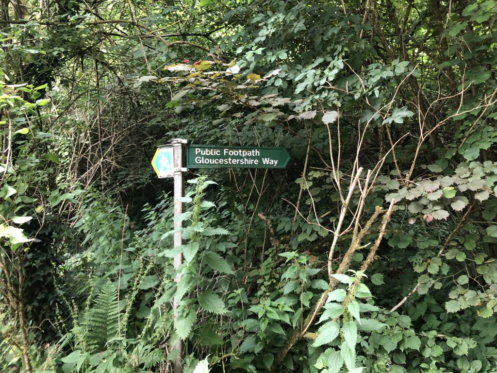
Recreational routes are shown on both OS map series with diamonds (green on 1:25000, pink on 1:50000). Note 1:50000 only shows those that are over 40km in length.
National Trails are different from recreational routes, and receive greater funding from various public bodies, such as Natural England. Each route has a dedicated National Trail officer, who supports the continued maintenance of the route. They are also marked with diamonds on OS maps, but with the additional acorn symbol. Those passing through Gloucestershire are:
There are a greater number of recreational routes passing through the county, some like the Macmillan Way and the Monarch’s Way being of considerable extent. But some stay closer to home, and this site is promoting three in particular:
- The Gloucestershire Way, which runs from Chepstow to Tewkesbury, having visited Stow-on-the-Wold en route.
- The Wysis Way, which links Offa’s Dyke at Monmouth with the Thames Path near Cirencester.
- The Three Choirs Way, which is a circular walk running between Gloucester, Hereford and Worcester cathedrals, celebrating the annual Three Choirs Festival.
Guide-books
Please see the respective pages (linked above) for step-by-step guides to the routes plus downloadable GPX files. One aspiration of the Eleven Rivers group (for more information on this group – see below), is to develop a variety of on-line and printed guide-books to encourage more walkers to enjoy these routes. We have hopes that Cicerone – the major UK publisher of outdoor guides – will adopt these routes and agree to publish a guide. In the meantime, Gerry Stewart’s current guidebooks are available for purchase from Eleven Rivers. More information here.
Eleven Rivers
A consortium of interested individuals, walking organisations and government agencies has formed to promote these routes. The objectives include:
- Maintaining and improving signage;
- Clearance of vegetation and blockages from paths;
- Where possible and appropriate, improving the quality of paths and replacing stiles with gates (or nothing at all);
- Increasing awareness and usage of the paths through promotional activities, improved on-line resources and updated guide-books.
Meetings of the steering group: Agenda and Minutes
Meetings of this group are open to all. Minutes and agenda are available for download from the downloads page, here.
Constitution
The meeting on 02 October 2023 unanimously adopted the proposed constitution.