
Block
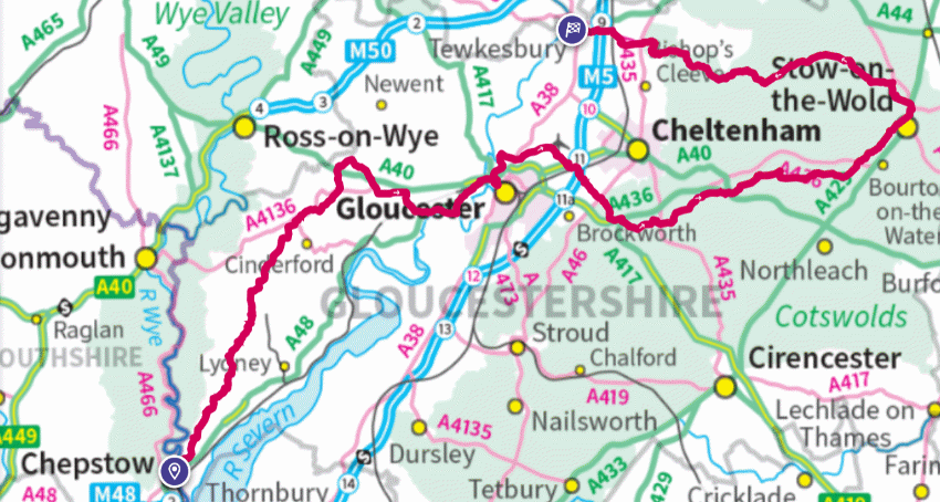
The Gloucestershire Way is a walk of over 160 kilometres (100 miles). It starts on the old bridge connecting England and Wales in Chepstow, and runs north through the Forest of Dean before turning east towards Gloucester. It skirts the city, following the Severn for a while, and then crosses to Crickley Hill before traversing the Cotswolds to Stow. There it turns back west, and finishes at Tewkesbury.
The guidebook full of anecdote, history and explanation, last updated by Gerry Stewart in 2022, can still be obtained here.
There is a page devoted to the walk on the Long Distance Walkers’ Association Website.
The Gloucestershire branch of the Ramblers’ Association also has information.
See also the route guide below.
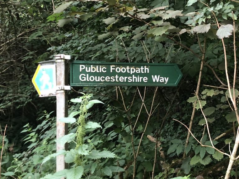
A consortium of Gloucestershire walkers is looking to engage with various local agencies to promote the walk better and to ensure this fine route is properly celebrated and lasts into the future. Although it is largely in a good state (see below), the signage could be improved in places – particularly those sections which follow quiet country roads.
A full route survey was undertaken during the summer of 2022. The highlights of this were:
- By-and-large the route follows that described in Gerry Stewart’s guidebook and the line shown on OS maps (see below for GPX).
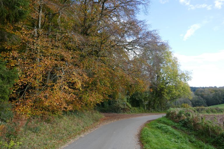
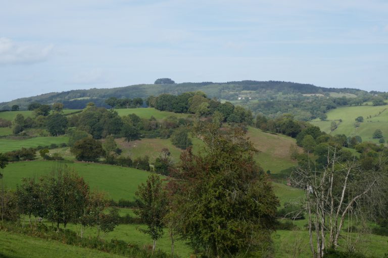
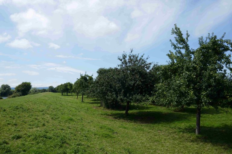
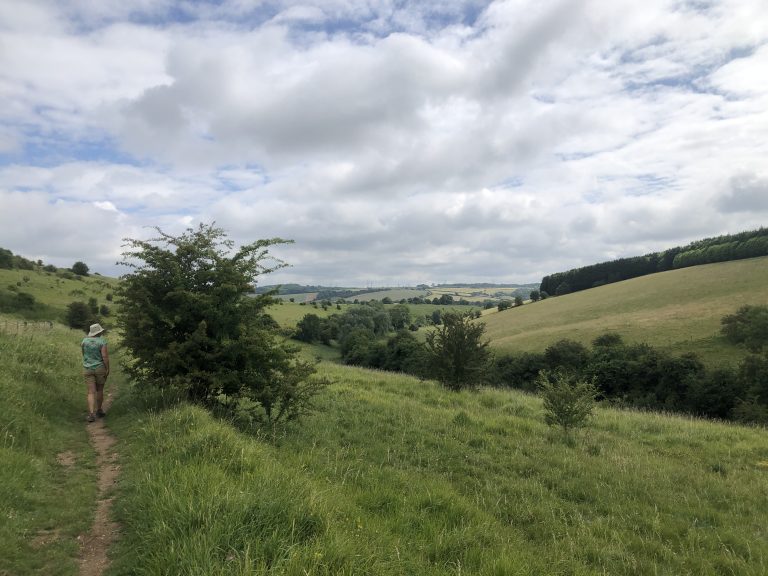
- The quality of the route has stood the test of time. The landscape varies from Forest to Vale to Cotswold Hill. It is a rich and rewarding walk.
- The walk is overwhelmingly along footpaths and bridlepaths, with some use of access land, particularly in the Forest of Dean. There are a few short sections of road-walking which connect the footpaths, and one longer section on quiet roads between Stow-on-the-Wold and Condicote.
- The only significant area of blockage was the section which follows the River Severn around Gloucester from SO 82448 19046 (end of foot bridge crossing Severn into Gloucester) to SO 82866 20875 (the point where the path emerges onto Sandhurst Lane – just past the former pub building). A GPX file for the suggested deviation is available below. At this time the deviation is recommended over the original route, although plans are afoot for this section to be cleared – watch this space!
Route guide
Disclaimer: The route descriptions and associated GPX are provided in good-faith after considerable checking and review. However, they are a guide only, and any walker needs to check the route for him or herself using appropriate maps. The walker also needs to assess and manage for him/herself the hazards that this kind of route presents.
Acknowledgements: This route was originally devised and described by Gerry Stewart. His guide is still available (see link above) and is recommended. The text here borrows heavily (with permission) from the original guide, although it has been updated to reflect changes in the route.
Having recently walked the routes, any errors in the text, maps or GPX are mine alone. Observations will be gratefully received. The guide here is largely confined to route directions, For more colour and interest, buy Gerry Stewart’s book!
Direction Chepstow – Tewkesbury
Introduction
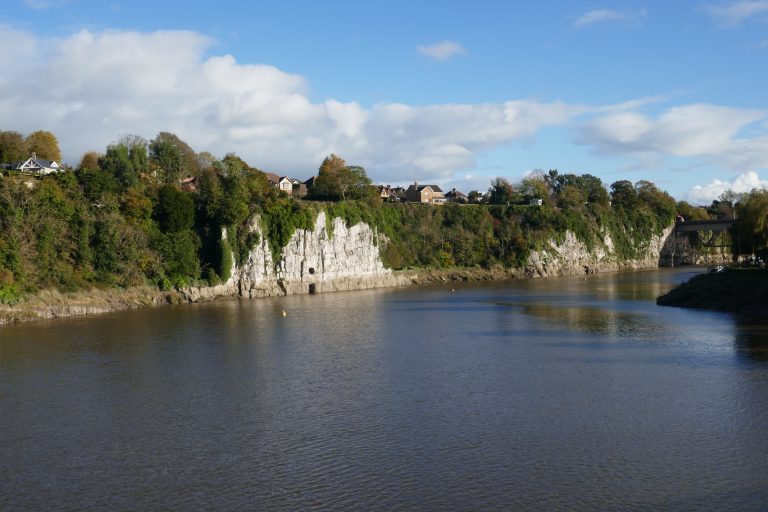
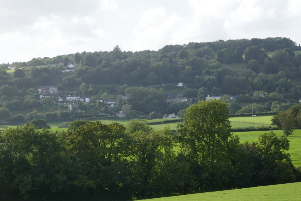
The ancient boarder town of Chepstow, with its castle and strategic position on the River Wye provides an excellent backdrop for the start of this walk. This section climbs from the tidal reaches of the Wye through lush farmland and into the Forest of Dean. Some of the smaller coppices and woodlands on the way still feel mysterious and magical, and the homesteads and farms are dispersed and sometimes isolated. But the evidence of human activity and its influence on the landscape is everywhere. As height is gained, there are spectacular views of the Severn from its estuary to the meandering loops higher up in Gloucestershire.
Chepstow has all the amenities of a small town. En route, a diversion into Bream will add little distance, and here there are food shops and pubs. There are no amenities at the end of the stage, although Parkend village is about 1500m away, where there is a shop and pubs.
Chepstow has a railway station and a transport hub. Buses pass through Bream and with planning the walker may be able to return to Chepstow or Lydney stations via buses from Bream or Coleford. There is a steam train with stations at Parkend, Bream and Lydney, but research and planning should be undertaken beforehand.
This section of the route requires the OS map of the 1:25000 series:
- OL14 – Wye Valley & Forest of Dean
Maps will appear on this site when we have sorted the copyright and logistical issues. In the meantime GPX files for the section are available below. Forests can be tricky places to navigate, it being easy to lose one’s bearings. Compass directions have been incorporated into the route guide for this section.
The route
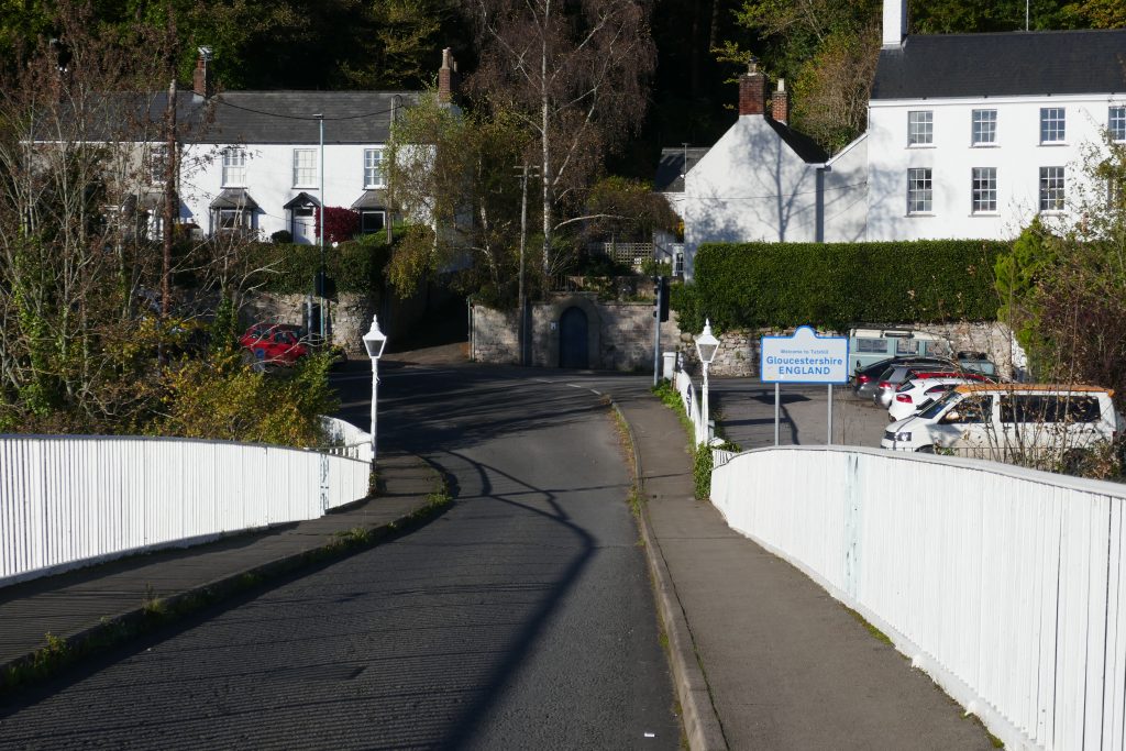
Leave Chepstow by crossing the old Wye Bridge, where the centre panels mark the boundary between Wales and England. Walk up the pedestrian lane, Old Hill, directly ahead. Half-way up, Offa’s Dyke National Trail joins from an alley on the right, and runs coincident for the next 320m. Mount stone steps to a road, cross this and continue ahead up Mopla Road. Shortly, Offa’s Dyke departs over a stile on the left, but continue on the road to its junction with the B4428. Continue on for about 200m, crossing the road, and then turn right into Elm Road passing the barrier wall, and turn immediately left into a narrow footpath between gardens. Reach an old sandstone stile, which cross into fields and continue ahead to reach a cast-iron kissing-gate. In the next field turn right slightly to walk to the top right corner. Cross Bishton Lane directly, and take the right-forking path towards a gap in the right-hand field boundary, and pass through this and walk to the top right corner of the next field, by Bishton Farm.
 Wye
Wye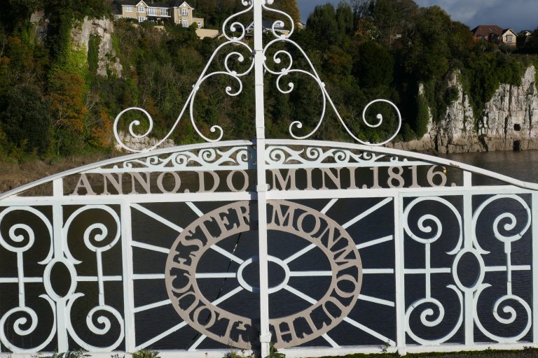 England to the left of me, Wales to the right ….
 Wye
Wye Old gate
 Autumn evening shadows
Walk on a narrow track between the farm and a copse to reach a broader track which angles left uphill. Take this to fields and then bear right to follow the field boundary for about 250m until reaching a large open gateway on the right to the lane. Take this and turn left to follow the lane for about 230m. Just before the lane rises to cross the disused Wye Valley Railway, look for a turn left into a field, where follow the boundary rightwards which soon turns to run parallel with the Wye Valley Greenway. (The Greenway is worth exploring, if you have time, but it is not possible to emerge back onto the Gloucestershire Way if it is taken northwards).
After about 450m, reach Netherhope Lane, which cross leftwards, to pick up a green lane going up hill between houses. Exit the path into a field, and walk to the kissing gate ahead. Pass through this, and then cross the next three fields close by the left-hand boundary to reach an old orchard, which cross to a stone stile which gives onto a track.
Turn right and shortly reach a lane, where turn right, going downhill for about 250m. After passing a lane joining from the right, look for the footpath on the left going uphill. Take this, and after 200m emerge into fields and continue on the same line, to pick up a hedge on the right, with the field falling away steeply on the left. Continue walking on the same line, still ascending, picking up a hedge on the left, which leads to a stile into woodland.
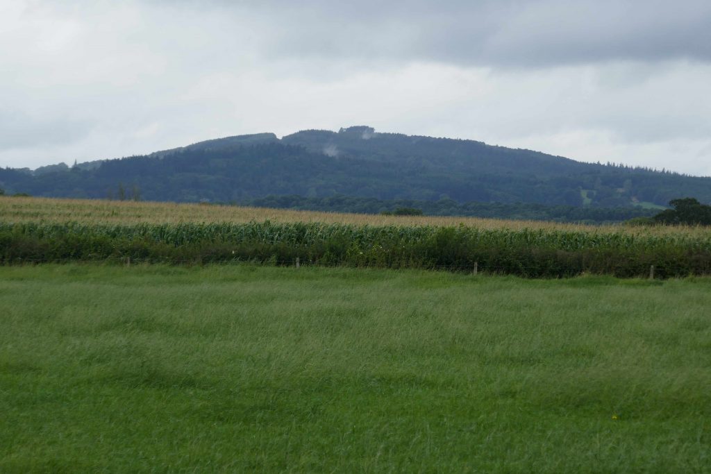
On entering the wood, immediately take the right fork. After 210m reach a crossing track. The Gloucestershire Way is straight on, but a few metres to the right is Jubilee Rock, which was installed in 1897 as celebration of Queen Victoria’s jubilee year. However, the one-time fine views of the Severn and Gloucestershire, are now wholly occluded by new tree growth.
 Jubilee Stone
After a further 170m, look out for an easily missed right-fork and take this, walking a further 180m to reach a lane. If you have taken the correct route, a small lane proceeds straight ahead (if you missed the fork, turn right and walk the short distance to this junction). Walk (north) 600m down this dead-end lane to its end, where continue onto an enclosed footpath. This soon emerges onto a scrubby field, which cross, keeping the right-hand boundary close by. Exit through the far field boundary onto a track. To the right is Ashwell Lodge, but cross the track slightly left to re-enter woodland. After about 170m, cross a forest-road, slightly right and continue soon to pick up a paddock on the right and emerge onto a lane, where turn left. After 140m, look out for a footpath on the right into woodland, follow this round old quarry workings, and emerge into a field which cross next to the right-hand boundary. Enter the next field, and here turn half-right to follow the field downhill to a (hidden) gate in the lower corner. Through this, go down a green lane, with the boundary on the right to reach a stony farm-track.
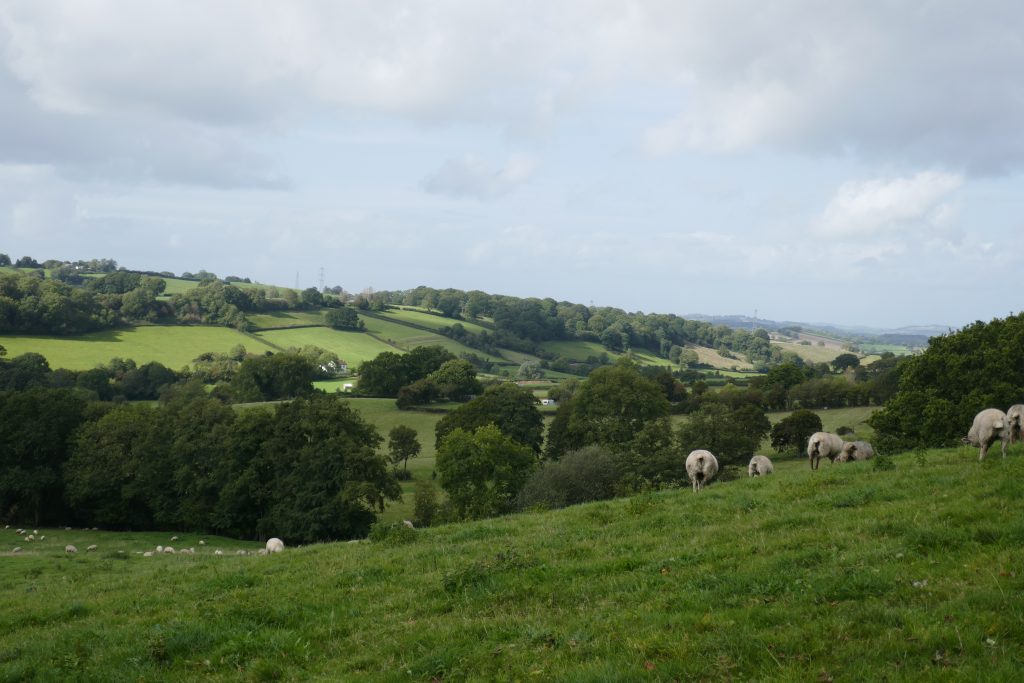
Turn right, and follow the track for 110m to a kissing gate on the left with concrete steps to the field. Take this, and aim to emerge from the holloway into the field on the right as soon as possible, and continue downhill to the valley bottom. Turn right, and follow the valley bottom, as it curves leftwards through two fences. As Slade Farm is passed, above and left, look to gently angle left up the slope towards a kissing gate, which joins the farm driveway well beyond the farm. Follow the track for about 300m to a lane, where turn left and almost immediately, turn left onto a strong track uphill (north) into woods (don’t make the mistake of taking the smaller track south, which doubles back on the way just come). At a hairpin bend, follow the hairpin round, soon to reach a gate with an open wooden barn behind. Continue on the track, with breath-taking views of the Severn and the Cotswolds escarpment beyond.
The track reaches a lane: turn right and walk 750m, with fabulous views all around. Where the lane makes a sharp right, turn left into woodland, initially walking up hill, but then descending and curving left. The path through these woods can be tricky to find, but it follows the line where the slope steepens to the left. Pass on the right of an old farm building, and enter a paddock which cross half-right to a gap in the hedge ahead. Cross the next field straight across, to reach a green-lane, where turn right, and walk 270m to a lane. Turn left, and walk about 370m to a crossroads and a further 420m to a small parking spot on the right, where to the left the Gloucestershire Way enters Clanna Wood.
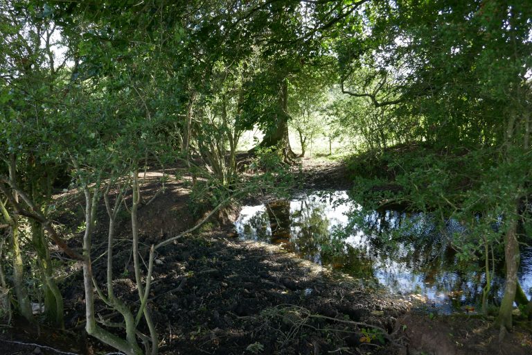
Pass over a couple of small bridges, after which at a meeting of paths, take the one straight-ahead, going directly up hill. On reaching a double fronted cottage, turn right in front of the cottage to find a narrow path going downhill. Enter a field, and follow the right-hand boundary to a kissing gate onto a lane. Turn right, and walk about 100m to find a footpath on the left into woods. Where this forks, after about 40m, take the right-fork, to contour through the woods (hereafter avoiding any paths forking steeply downhill). The path crosses a shoulder and travels downhill to emerge from the woods at a stream, which has to be crossed three times, before the path diverges uphill leaving the stream in the valley on the left. Cross into a field, where there is a note that the path has been diverted, but this must have been some years ago, as the route follows that shown on the current OS map.
Walk down left to cross the stream over a bridge and walk round keeping a pond on the right. Pass this and walk to a second pond, and round this, bearing hard right at the end to walk up a track from which a stile crosses the fence-line on the left. Over this, turn right to follow the fence up hill, where it curves round to meet a cross track. Take this right towards, Willsbury Farm where, in the farm yard, turn left to pass between buildings towards a concrete track beyond a gate. Walk the 300m to an old toll-house by a lane, and here turn left, and after a few metres, look for a path on the right into fields. Turn three-quarters right to identify a gap in the hedge and make for this. In the next field, angle slightly left towards the furthest left corner. Cross into the next field, now walking downhill (with Bream in the foreground and Cinderford beyond), and continue diagonally towards the furthest corner to a gate that is concealed from view until the last moment. This gives onto a lane, where turn left and walk to the busy B4231.
The old guidebook discussed a path running parallel to the road, but currently this is not accessible. Unfortunately, therefore, the walker on reaching the B4231 should turn right, and with attention and CAUTION, walk the 330m until the first house on the right is reached, opposite this, on the left-hand side of the road is a track. Cross over and take this, walking away from the road. The track curves right over open ground, reaching a sealed road crossing and ahead is a lane with houses going downhill. Where the lane turns right, a path continues on, going steeply downhill beneath power lines. The path reaches a driveway, which gives onto a lane. Carry on downhill to reach a hard turning area to the right of the lane.

Here, look on the left for the footpath going uphill, this shortly joins a stronger track converging from the left, and here bear right uphill (north-east). Continue along this track, which descends slightly until after 400m it meets a crossing track, where turn left uphill (north-west). After 90m, reach a strong crossing track where turn left (west) and then right (north) to crest the hill. At a T-junction of tracks, turn right (north-east) downhill. After about 160m, the main track bears left, but carry straight on down a smaller path through pines. This descends to a more open area with lines overhead. Cross a small bridge and turn right (east) and, after 80m meet a crossing track, where turn left (north-west), back into woods. After about 60m, fork right (north) along a good track, climbing northwards away from the valley bottom. About 400m after the fork, meet a crossing track, where turn right to continue in a northerly direction. Now follow this strong track as it curves leftwards and goes downhill. Where it meets another track turn right, shortly to reach the busy Parkend-Coleford road.
Downloads
Introduction
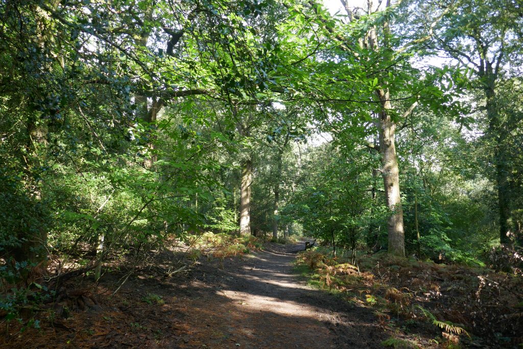
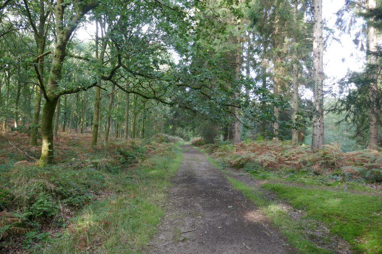
This section traverses the glorious Forest of Dean. These are ancient and wonderful woodlands where there has been some effort at preservation for centuries. But this area also has a rich industrial heritage, and this too is evident through the walk. In particular the Forest is criss-crossed with old tram and railway lines, many of which are now repurposed for recreation. The walker is in for a treat.
The start of this section is on the cycleway that links the township of Coleford with Parkend village. Coleford has large shops and accommodation options, whereas Parkend has just a single shop and two pubs. There are limited refreshment options en route, although mobile food outlets may pop up on busier days. Speech House Hotel is an option towards the start of the day. It is not difficult to contrive a deviation into the large town of Cinderford, where there are shops, accommodation and public transport options. As noted in the text, using the Wysis Way alternative takes the walker into Mitcheldean, another small town with all amenities. Just before the ascent to May Hill, a small deviation into Longhope allows a visit to the Yew Tree Inn, the bakery (check opening times) or the village store (cash preferred).
There is a train station at Lydney (unfortunately on the wrong side of town). For a stylish start, it may be possible to arrive at Parkend on a steam train. Stagecoach buses (23) run regularly from Gloucester to Coleford via Lydney and Parkend. There is a transport hub at Cinderford, with buses (24) running along the A4151 and A40 to Gloucester. A bus (33) runs from Gloucester to Ross along the A40, with a detour into Mitcheldean.
This section of the route requires the OS map of the 1:25000 series:
- OL14 – Wye Valley & Forest of Dean
Maps will appear on this site when we have sorted the copyright and logistical issues. In the meantime GPX files for the section are available below. Forests can be tricky places to navigate, it being easy to lose one’s bearings. Compass directions have been incorporated into the route guide for this section.
The route
Having crossed the Parkend-Coleford Road, proceed up the driveway behind the Mary Rose Young gallery and other cottages, shortly to cross an old railway bed, which now serves as a pleasant cycle way between Coleford (4.5km) and Parkend (1.4km). Take the track straight-ahead, to the left of a telegraph pole and a metal post made from a repurposed railway line. After a few metres, fork left onto the path. After about 470m, at a junction of tracks, take the right-most of the two paths ahead. After 600m further, the path crosses a stronger track, but keep straight on, almost due north.
 Mary Rose Young gallery
 New role for old track
 Gorgeous Forest
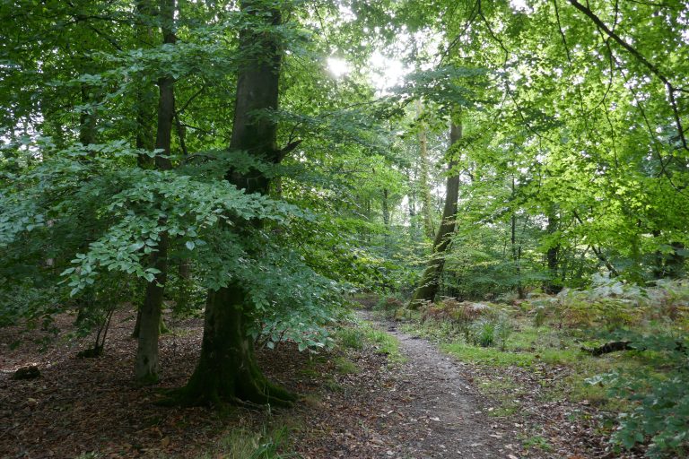
This is Nagshill Plantation: idyllic woodland walking through mixed broad-leaf trees. Below right is a small stream.
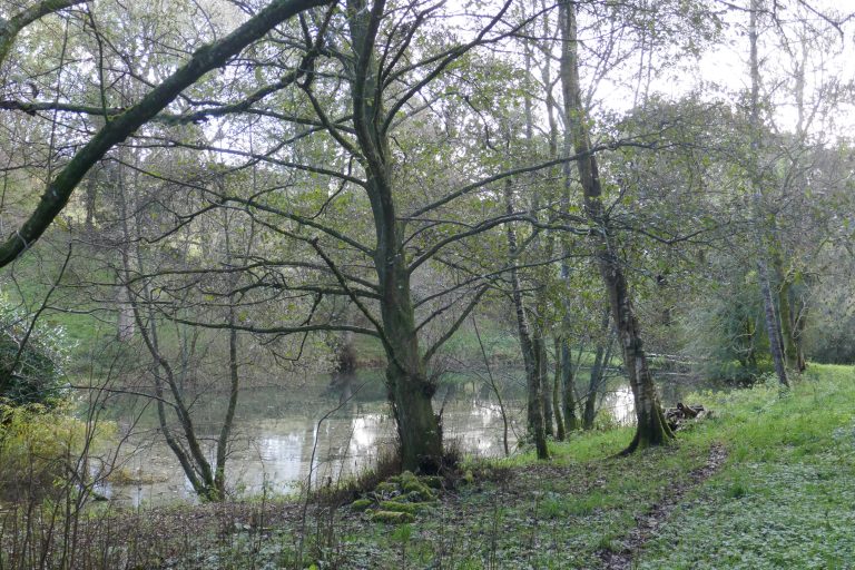
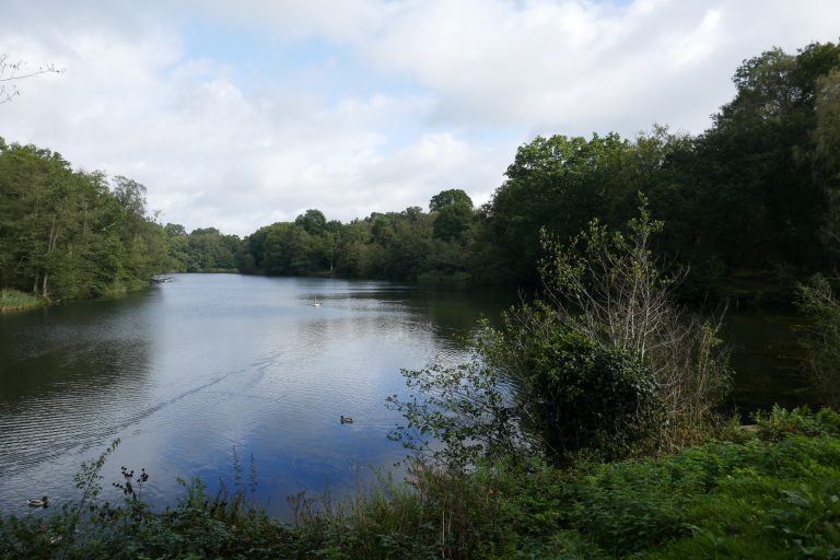
After walking through the woods for nearly 1km, reach a forestry road, where turn right and bear round the track and continue downhill to a road (there is a short section of old-tramway on the right, which can be taken). Cross the road and angle left downhill past Forest of Dean Stone Firms Limited towards Cannop pond. Bear right to cross a bridge over the sluice and continue, to cross leftwards the line of the old railway, now a cycle lane. Look for the hand-gate ahead into woodland.
The path soon develops into a track between stands of conifers. After 500m, just after leaving the conifers, on meeting a cross-track, turn left. Head north along the track gently descending and then rising from a stream-crossing. After 620m take the strong track to the right, which climbs west up the hillside. Continue over the first cross track, and after about 630m, at a junction of five tracks, take the second from the left, to head north. After about 400m, take the left fork, now on a muddier track. After about 500m, cross over an easily missed ditch and dyke boundary, follow the path round, and ahead is a hard-stand for parking and the busy B4226. Just before this, look for a path on the right, which filters through trees and scrub, travelling parallel to the B4226, to reach Speech House Hotel.
(An alternative route to Speech House is to walk over the hard-stand to the road, and either turn right to walk along the verge, or penetrate the woods ahead where after about 15m is a strong footpath.)
Cross the minor road and then walk a few paces to be in front of Speech House before crossing the B4226 and walking directly into the woodland along a rough track. After about 40m, at a T-junction of paths, turn right, and walk about 600m past picnic areas and car-parks on the right, and a modern sculpture (part of a Sculpture Trail) on the left. After the car-park, look for a track bearing off left, initially north-east, but which turns leftwards, crossing a track, where it now turns right, now on a stronger track with a pond on the right. Pass through a wooden gate to a junction of tracks, carry straight-on leaving the stony forestry track for a grassier one, going north-east. After 300m, take the left fork that follows the boundary of a plantation of conifers, and soon converges with a boundary fence. At the corner with a crossing fence, go through the gate, and continue in the same direction, going down hill, and passing over a crossing track where normally it is exceedingly muddy. Keep going on the well-defined if muddy track (northwards) which after about 400m meets a dry forestry road. Turn right and almost immediately left, now on a sealed roadway. Pass the sign for “Drybrook Station”. There is now the option either to take the stronger path on the right, which runs on the raised old-tramway route. Or alternatively, walk a few metres further, to find on the right a path slightly lower (and often muddier), which is the official way, and is now co-incident with the Wysis Way.
 Owner
Owner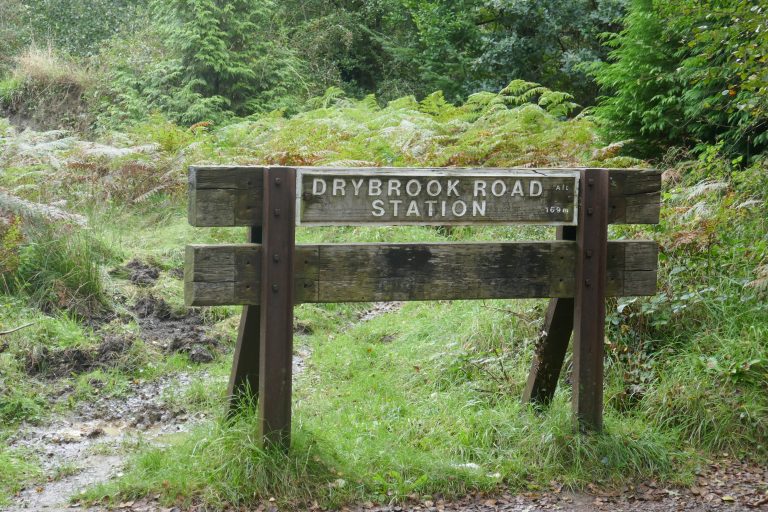 Industrial Heritage
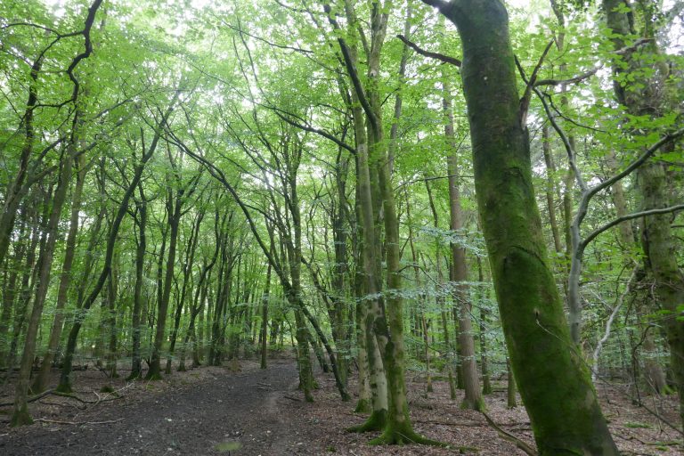 Young woods
The two alternatives converge about 500m east, soon meeting a fork, where take the left-hand option. Presently, look for a path turning left into woodland and take this (it runs slightly to the east of the line showed on OS maps), now walking north and uphill. Pass over two crossing tracks, and after about 580m crest the hill and walk down a further 180m to reach a crossing forestry road. The route is straight on through a small clump of trees, but if this is not clear, turn right on the track walk 50m to the junction and then turn left. Continue on the track northwards about 100m, looking for a wooden gate into woodland on the right, opposite the old brick-works buildings on the left.
The route meanders through Hawkes Well plantation, but it is clear enough on the ground. After about 700m, it meets a crossing track, and here turn left, along a stronger track keeping on for about 400m to reach the A4151. Cross this slightly left, to round the corner of the house and continue into an area of scrub which cross to a road and then continue onto a hard-track to a metal gate on the left of which is a stile. Cross this and follow the garden boundaries to a stile which gives into a garden, which cross angling right, passing through a gap in an old railway embankment. Cross a stile into woodland, and continue north-west to reach the wall of a large lawn. Pick this up and follow the wall on the left to its corner, where exit the woods onto a small track. Cross this directly and go back into the forest, now travelling northwards. Presently this reaches the busy A4136 Gloucester – Monmouthshire Road.
Turn right, and walk 100m to spot the route going north into woods. Cross the road to the path. Pass through bracken and pass under electricity wires, now diverging right from these, going directly up hill, north-east, on a clear track. After about 500m, at the hill crest, spot a blue shipping container which should be on the right. The track bears slightly right, continuing for another 500m east-north-east, to reach a car-park where turn right to reach a road.
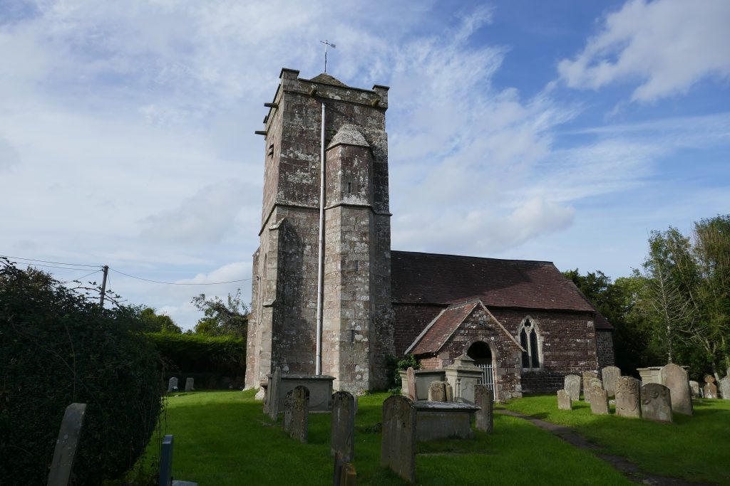
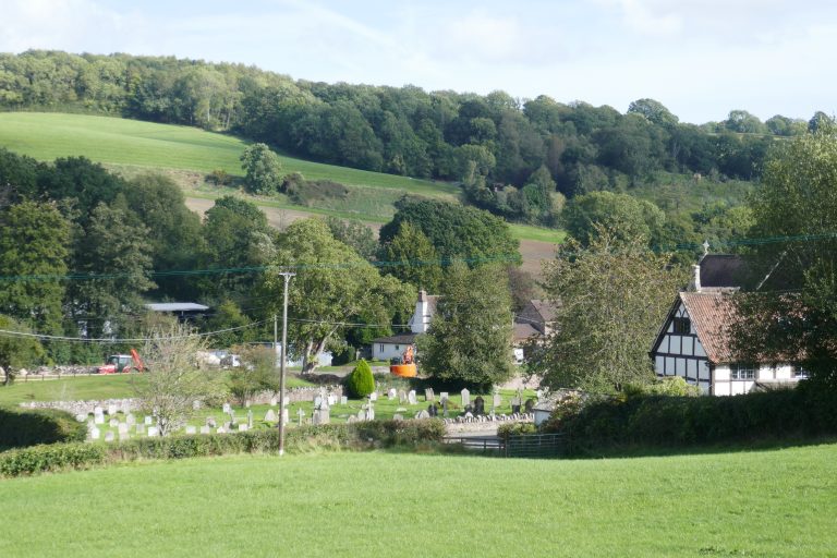
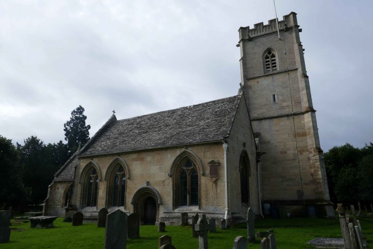
The Wysis Way here departs northwards. This provides an alternative route to May Hill, which for the urban delights of Mitcheldean is to be preferred, but otherwise use the old road ahead to reach the busy A4136. Cross this rightwards, and pick up the small road marked The Rocks and Hazel Hill to walk steeply downhill, taking the left fork almost immediately. After 300m, at a junction of roads, Hazel Hill turns sharp right, don’t take this, but the road ahead, which continues downhill. Where this road forks, take the right fork, but now look immediately on the left for the footpath going down hill with a stream on the left. Take this and after 350m emerge into a turning place in front of houses, and continue on the driveway. In front of a cottage called Edgehill, the driveway takes a hairpin bend and proceeds downwards to the lane. Walk about 50m past Green Farm, and turn right into a restricted byway, which becomes a green lane into the valley, where it bears leftwards up the far side, reaching a road after 400m. Take care! The sight-lines here are poor and cars are frequent and fast. Turn left and after 150m turn right into Church Lane to Abenhall Church.
Pass the church, and stay on the lane as it turns right up hill, and after 50m find the footpath up steps through the hedge into fields. Walk up the first field keeping the hedge close by on the right to find a hidden stile in the far corner. Through this, in the next field angle slightly left, and on passing through the porous boundary into the next field, on the ridge top, adjust to reach the pond that sits right on the crest. May Hill is now in view ahead, behind are the settlements of Plump Hill and Mitcheldean.
Continue down the next field, with the boundary hard by on the left. Cross into woods and, keeping the same line emerge into another field, again staying by the left-hand boundary going down hill. Near the bottom, look for a hidden stile on the left and take this into a short close path that emerges into the farmyard at Whitmore Farm. Turn left and pass between two farm buildings with corrugated steel roofs. After these, look immediately to the right for a footpath through brush that shortly emerges into field. Look up, and orientate slightly to the left of the trees on May Hill. Cross the field on this line, soon to pick out the stile in the far hedge. Cross this, and in the next field turn slightly right to pick up the farm track that leads through another field boundary to Marshes Farm. Go between the somewhat derelict buildings and exit onto a layby on the A4136.
Cross the road, to the footpath opposite, and go up the hill to a stile, cross this, and then bear right to cross the next field, keeping the right-hand field boundary close by. Find the stile in top boundary and cross this into an enclosed track around the hillside. With a wooden chalet-like building ahead, cross the stile and turn right to the path downhill. At a meeting of tracks, turn left to follow the driveway that contours the hillside. Where this turns up to a house, bear off right onto a footpath. Cross two fields staying close by the left-hand field boundary. Cross a lane and enter a larger field, keeping the same line. Exit onto a lane, turn right, and follow the lane round a tight bend. Immediately after look for the path on the left over a small footbridge. Cross the next field with the boundary close by on the right. At the lane, turn left, walk up the hill, and look for steps up the bank on the right. Take these into a field, which cross downhill diagonally, passing by an oak tree, to its far corner where there is a hidden exit onto the road.
Turn left and walk along the road to its junction with the A40, where continue for 150m and look for the Gloucestershire Way on the right into the disused pub car-park, and find the kissing gate into a field, where angle left towards a footbridge. Cross the old railway embankment and walk on to exit onto a lane, where the Wysis Way is rejoined. Turn right and take the first right up a metalled bridleway past houses. Where this shortly forks, take the right fork going up the hill. This starts as a holloway, but on reaching some large ash trees, the field opens up, and here follow the fence running right to a field gate and pass through this. Cross the next field to a clump of trees, and filter through the trees slightly rightwards to find another stile. Exit into a larger field now with a fence going up hill, and follow this through three fields to May Hill Farm. As the farm road turns towards the buildings, bear off onto a footpath on the right, that continues up the hill, soon to reach a lane. Here turn left and after a few steps turn right onto a bridleway past an A-framed house, still going straight up-hill. Shortly take the left fork, and continue on up, to gain the tree covered summit.
Alternatives
A glance at the map will show myriad alternative routes through the Forest of Dean. The Gloucestershire Way tends to avoid the hard-surfaced former railway lines, preferring to leave these for the pleasure of the innumerable cyclists who utilize this amenity. But in muddier periods, these alternatives may be easier.
As noted in the text, the walker could deviate along the Wysis Way between Plump Hill and May Hill. This takes one through Mitcheldean where there are shops and transport options.
Downloads
Introduction
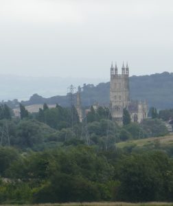
This section starts on top of May Hill. The summit here drops away on all sides, so the views in every direction are simply splendid. There follows a lovely walk through woods, which form the finale of the Forest of Dean. The route then passes through attractive farmland before arriving at the River Severn which leads to Gloucester, and its grand buildings and amenities. (If you can get a picture of the cathedral without pylons in the foreground – let me know!)
There are occasional opportunities for refreshments. Soon after leaving May Hill, a diversion along the Wysis Way will find the Glass House Inn. Crossing the A40, the Leaf garden centre nearby has a cafe. For other options, it is possible to divert into Huntley, and rejoin the route without adding much distance. After this, there is nothing until the final approach into Gloucester along the A40, at Over Farm or the neaby Toby Inn. Gloucester of course has everything.
Buses run regularly along both the A40 and the A48, connecting Gloucester and Cinderford. There is a train station at Gloucester, but the first stop on the line running along the Severn is at Lydney, which is not much help for this stage.
This section of the route requires the OS map of the 1:25000 series:
- Explorer179 – Gloucester, Cheltenham & Stroud
- OL14 – Wye Valley & Forest of Dean
Maps will appear on this site when we have sorted the copyright and logistical issues. In the meantime GPX files for the section are available below.
The route
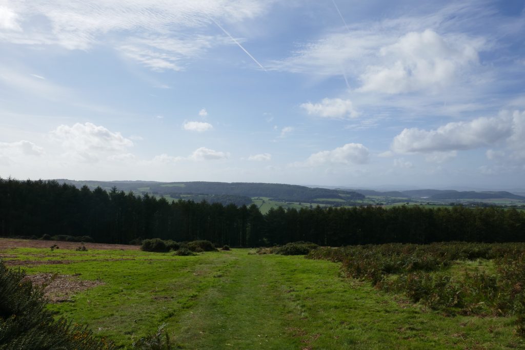
On May Hill, standing at the trigonometric point, with the clump of trees behind, look to the left where a track heading southwards downhill towards the far Severn can be discerned. Take this. As the track descends and leaves the National Trust area, it narrows, with mixed woodland on the left. Reach a crossing of paths in front of a house, and carry straight on (avoid following the Wysis Way, which forks left). After 120m at a fork, keep left, and 170m later reach a lane. Here turn right and after 10m look for a path to the left going downhill. At the next crossing lane, cross slightly right and go over a stile into a field.
 May Hill views: Rain over Lord Hereford’s Knob (really!)
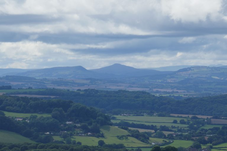 May Hill views: Sugar Loaf, Abergavenny
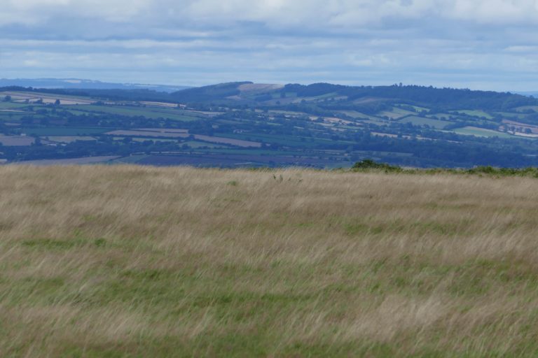 May Hill views: Herefordshire
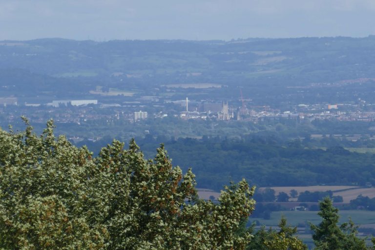 May Hill views: Gloucester
Stay close to the left boundary through the first small field, and in the next field angle slightly right towards a stile and gateway just right of a red stone house. Through this, bear left to pass in front of the house to reach a lane at the valley bottom.
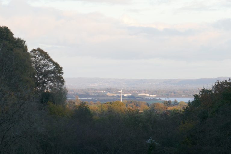
Cross over, to find an enclosed pathway, which goes up hill, shortly opening onto a field. Carry straight on, towards the woods ahead, not being deviated by the old wind turbine on the left. Enter the woods by a gateway, and continue 870m over Bright’s Hill and then down to reach steps by a school that exit into a small parking area. Here turn right down the short driveway to reach the busy A40 Gloucester – Ross Road. (Garden Centre and cafe nearby). Cross to the stile opposite, and cross the next field keeping close by the left boundary. Pass over a driveway through two stiles. In the next field, turn half-right keeping the higher ground to the left, and at the shoulder look for the gateway in the far right corner, which gives onto the A4136 Gloucester – Monmouth road.
Cross this right, and enter a field to follow a stream on the left for 470m, where look out for a footbridge on the left, which cross into a large field. In winter or if the field is fallow, it may be possible to follow the right-hand boundary, next to the stream (saving over 400m of distance). However, the designated footpath goes straight on over the field to the far boundary. Here it turns right and after 100m turns half-right to now cross back over the field diagonally to meet the stream in what is now the far-right corner. Here exit the field through a gate and turn left. The Gloucestershire Way now proceeds due east for the next 2.6km.
Cross three large fields, keeping close by the left-hand field boundary, to reach a lane. Here maintain the same line, and after 250m, where the road turns right, go straight-on into a driveway to Whitlow Farm. About 320m along the driveway, just prior to the farm buildings look for a stile on the left into a paddock. Take this, and bear rightwards to walk across to the woods and proceed through a series of paddocks, keeping the woods on the left. In the final paddock the woods end, and cross the next much larger field keeping the right-hand boundary close by, to reach another lane. Cross this to a bridleway and continue, soon reaching another lane.
Continue straight, but shortly look to turn right into fields. A boundary runs away, and stay close to this to cross the field, although it may be necessary to alternate sides if the fields are cropped. In the next field bear leftwards towards the far left corner to cross a footbridge over a brook. Cross the next field diagonally left, orientating towards the highest point of the wooded hummock ahead. Take the right of two field gates and, having crossed a stream via a concrete bridge, turn left into the next field either by the hand-gate at the corner or a field gate a few metres further on. Follow the right-hand field boundary for about 200m, passing a hidden pond. Don’t take the field gate, but look for the stile into a thick hedge a few metres further on. Cross over the next field diagonally to reach the far side, where pick up the right boundary and follow this through a crossing boundary. In a scrubby field when the boundary turns right, keep straight on to the far corner and cross a stile. Now follow the right-hand boundary, which bears right to reach the railway line.
Go through the shiny kissing gates to cross the railway tracks with extreme care (there are good sight lines, but the trains will be fast here: if you can see one, WAIT!). The path here deviates slightly from the line shown on OS maps. Turn immediately left to a stile and then turn right shortly to cross another stile and then walk between farm buildings, with a brick barn to the left. Exit the farm-yard to a lane, and turn left and walk 200m watching out for a footpath on the left. The line of the path may be affected by crops, but look initially to pick up the fence line on the left. This should reach a reinstated path through the fields, but if not, look to keep the higher ground of Denny Hill ahead and right. Reach a bridge over a ditch, and continue straight-on, keeping the higher ground well to the right. Crossing the shoulder, look to the far field boundary to spot a substantial footbridge and make for that. In the next field, bear slightly right aiming for the telegraph pole in the furthest corner. There may be temporary paddocks installed, but the path line should be clear. A stile gives onto a lane, where turn right and after a few metres, turn left into a driveway to find an enclosed footpath on the right of the gates. Take this, shortly to emerge into an orchard. Bear right towards a protruding right-angle of the garden boundaries, and here bear slightly left looking for a gate in the far hedge that gives onto the A48.
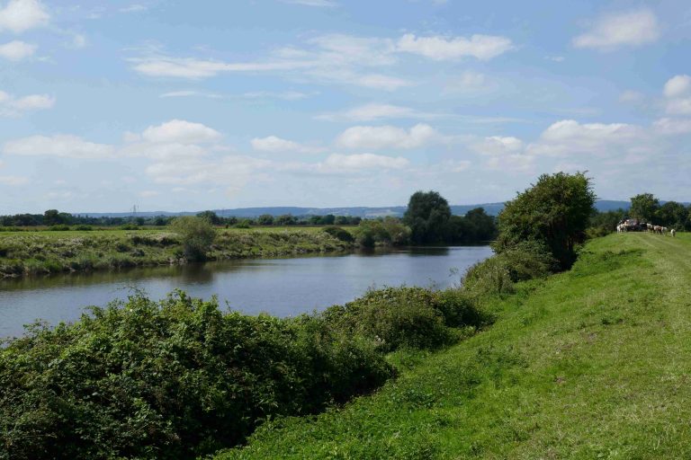
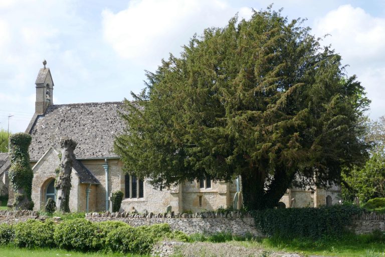
On reaching the busy A48 Gloucester – Chepstow road, cross over directly and turn left to walk along the road with the River Severn on the right. Walk about 230m, then turn right into the riverside field, and gain the high river bank where, turn left. Walk through the hen-run behind Severnside Cottage and then emerge into a layby and resume walking along the A48 to a fork, where turn right and find the footpath back to the riverside. The Gloucestershire Way proceeds along the riverbank, passing Minsterworth Church after 400m, and then continuing for another 1.55km.
The riverbank can be followed all the way to Over (Telford’s) Bridge crossing the Severn, but the Gloucestershire Way turns turns leftwards away from the river at a large sluice, just before power lines ahead (this route walks three sides of a field, and it is possible to short cut by turning left immediately on entering this field, seeing the sluice and power lines on the far side). Cross a stile in the left corner, and follow the drainage ditch on the right up and over a dyke and then to a footbridge. Here the ditch turns left, but the path is straight on and in the next field, bear slightly left to meet the fence of a paddock which runs by the side of a garage and in the driveway bear right to a gate onto a lane. Cross the lane slightly right, cross the stile into the next field, and cross this close to the left boundary to another stile, which exits to a lane at a junction. Again, cross right and cross two small fields and then a third larger one, in which aim for a protruding hedge corner from where the exit gate will come into view.
Exit through this onto a layby on the A48, turn right to pass a driveway and then right over a stile into a well-maintained garden. Cross this, to the left of a pond, to a kissing gate in the far boundary. Spot Gloucester Cathedral, almost directly ahead. Turn half-left, to cross the paddock to a stile, cross this, turn left and in quick succession cross two more stiles reaching a wider field, where turn half right to pass under a mature oak tree beyond which is a stile onto a metalled road and 20m further is a stile in the field boundary. In the next field, a line of telegraph poles is running away, aim for the furthest-most pole. As this is neared, a hand-gate is sighted. Pass through this and over the metalled road into a scrubby field. On the same line, find a hidden bridge over a stream, close by a telegraph pole.
Beyond this is an open area in front of a farm house, walk directly across this to a gate and walk across the next field aiming to the left of farm-buildings. Pass over a metalled lane to another gate, and cross the following field staying close to the right boundary, to reach a bridge over a ditch. The next, much larger field, is likely to be cropped or ploughed, but the path is on the same line that has just been walked, meeting a protruding right-angle in the field boundary on the far side, about 320m away. Here keep on the same line, with a wood to the left, and shortly cross a stony track. Continue in the same direction, with a bund to the left, follow this as it turns left to meet the railway embankment, where turn right. Follow this through a broken field boundary, 60m beyond which is a stile on the left. (Underpasses shown on the OS map are not accessible.) This gives onto the railway line, which needs to be crossed with extreme care (there are good sight lines, but the trains will be fast here: if you can see one, WAIT!). Over the railway, turn right and follow the track for about 500m to a right-angle turn left, and there continue up to the A40 Gloucester – Ross road.
At the road turn right and endure 950m of road-walking to a path on the right leading up onto the old Over Bridge (“Telford’s Bridge”). Cross this, and having descended on the far side to reach a T-junction of paths, turn right. After about 20m, the Gloucestershire Way is sign-posted left, through scrub, soon picking up the railway line on the right. After 250m pass under the busy road-bridge, and shortly pass through a kissing gate into fields. After another 200m, there are red-brick arches carrying the railway, and pass under the first of these, shortly to reach a kissing gate, ornamented to celebrate the millennium. Go through this, and pick up the track ahead through trees. After 300m, this passes through a gate, where a metalled track bears slightly left, shortly to reach a side road which exits onto the busy gyratory A430. With care, cross the side road, and then walk along the A430 until there is a footpath forking left off, which shortly reaches a minor road. Walking parallel to the main road to the right, continue on the minor road, shortly a path bears off right, passing under the traffic to reach a pedestrian bridge over the Severn. Take this to the stage end at its eastern side.
Alternatives
Walkers will note that the Gloucestershire Way runs coincident with the Geopark Way for much of this section. At the point where the Gloucestershire Way turns away from the Severn (past Minsterworth) the option is there to stay by the river all the way to Over Bridge, which is the route taken by the Geopark Way.
Downloads
Introduction
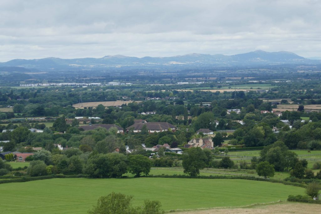
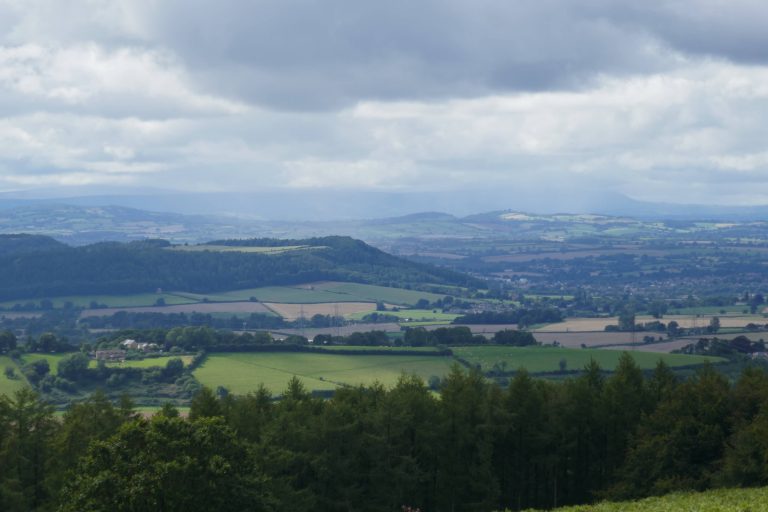
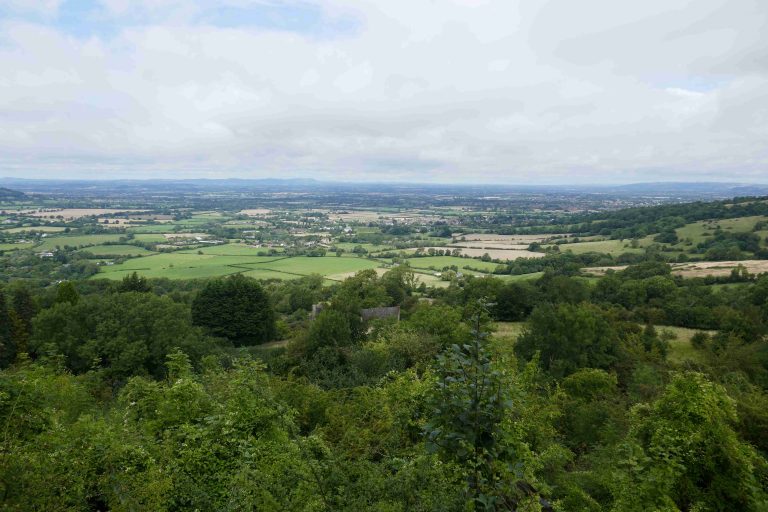
This stage wanders across the Severn vale from Gloucester to the top of the Cotswold escarpment. A walker undertaking the whole Way might choose to detour into Gloucester, to visit the exceptional cathedral and other delights of the city. The route finds quiet paths to cross the flat-lands; although a number of busy roads are encountered, they are swiftly left behind. The reward at the end of the day is the fabulous panoramic view from the top of Crickley Hill, which (along with the preceding steep climb!) is truly breath-taking.
There are plenty of amenities in Gloucester, and minor deviations from the route will take the walker into the city centre or alternatively there is a large retail park on the suggested alternative route (along the A417).
On the A38, to the south there is the Queen’s Head pub. To the north is a petrol station with convenience store. On the B4063, to the west is the Hare and Hounds pub; further west is Churchdown where there are shops. On the A46, close by the route is Dawn Nurseries, which has a cafe; the Greenway Spa Hotel and The Cheese Rollers pub are also options. There is a Post Office in Shurdington village, which is a little further away. On the top of Crickley Hill, a little to the east of the Gloucestershire Way is a small cafe. The Air Balloon pub has closed.
There are plenty of public transport options to reach Gloucester. There are regular bus services along the A38, the B4063 and the A46. From any of the crossing points it is easy to reach either Cheltenham or Gloucester. There is no service at Crickley Hill.
This section of the route requires the OS map of the 1:25000 series:
- Explorer179 – Gloucester, Cheltenham & Stroud
Maps will appear on this site when we have sorted the copyright and logistical issues. In the meantime GPX files for the section are available below.
The route
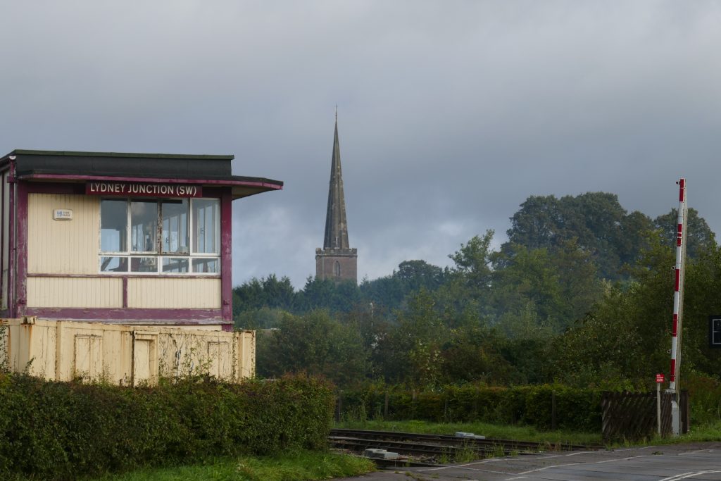
At the moment, the stretch of the Gloucestershire Way that follows the River Severn west of Gloucester, from Westgate Bridge (SO 82448 19046) to Sandhurst Lane (SO 82866 20875), cannot be recommended. The path is heavily overgrown as it has been for some years. It is hoped that during 2023 this will be cleared, but it now seems that this will not be before Autumn. The deviation recommended is the most direct route, but of course the walker has the option of others. A visit to Gloucester’s magnificent cathedral would for many mitigate the drudgery of a short amount of road walking.
Having crossed the pedestrian Westgate bridge, turn left to walk under the busy road bridge, and then turn right to follow the metalled road up towards a car park and then gain the pavement. Here turn left, and now follow this pavement along St Oswald’s Road for 1.4km passing school playing fields, going under the railway bridge, and then through a large retail park. With a busy roundabout visible ahead, take the left turn into Sandhurst Lane. Walk about 1.3km along the Lane, passing an old pub building, to reach Horsbere Brook with sturdy flow gates, just before which the Gloucestershire Way is rejoined.
From this point, continue along the road, passing an old manor house, Abloads Court, and at a fork keep right. After about 330m turn right through a kissing gate onto a footpath between two mature oak trees. Cross the field, keeping close by the left-hand boundary. Shortly a handsome red-brick house becomes visible to the left, but keep on to a kissing gate in the far fence. Through this, cross the next field (the line of the path is usually visible, but if heavily cropped, it may be easier to turn right, to follow the field boundary). From the kissing gate in the far boundary, the bridge over Broadboard Brook is concealed by the rising ground in front, but walk under the power lines, keeping the near pylon well to the left, and Churchdown Hill ahead. Once the top of the hill is gained, the bridge ahead becomes visible, and make for that. Having crossed the bridge, keep walking on much the same line, to join with Horsbere Brook on the far side of the field. Follow this, passing under a pylon, to reach the A38 Gloucester – Tewkesbury Road at Longford Bridge.
Churchdown hill visible in the middle distance, Cotswold escarpment beyond.
Cross the road directly, and on entering the field, turn left and walk about 20m before swinging rightwards, to cross the field diagonally, to reach Broadboard Brook (which will be followed on the left for the next 3.5km, in the process becoming Hatherley Brook) at the far left corner. Go through the kissing gate, and stay with the brook close by on the left. At the next field, pass through a more substantial hedge-line, and be sure to turn hard-left to stay with the brook, shortly crossing a concrete bridge over a ditch. Continue on the path next to brook, which becomes sealed for the last few hundred metres to reach Frog Furlong Lane. Cross this slightly left to find the wooded footpath into the Brickhampton Golf Course. Continue to follow what is now Hatherley Brook on the left, passing through the golf course. Don’t take any of the possible left-turns crossing the Brook (including at the second / thirteenth tee) until, after 1.75km, a small wooden footbridge is reached, which is next to an old brick culvert. Cross this, and continue walking another 400m, with the brook (now Norman’s Brook) on the right, to reach the B4063 Gloucester – Cheltenham Road at Half Way Bridge.
Turn right, and walk 100m looking for the footpath on the opposite side of the road. Take this, which holds close to the perimeter fence of Gloucestershire Airport for about 1.5km. Eventually the path turns leftwards to run parallel with the busy A40 dual carriageway and then reaches an underpass. Go under the road and follow the track right, shortly reaching a choice of routes: to the right the 41 cycleway, to the left a footpath. Take the left option and, keeping the field-boundary on the right, again walk parallel to the A40 – this time westwards – for about 240m to reach Norman’s Brook. Don’t cross the brook, but instead turn left and walk through fields, keeping the brook nearby on the right.
After about 700m, pass through a kissing gate onto a concrete farm track. Cross this and continue walking with the brook on the right towards the right of farm buildings ahead. Pass through two kissing gates into a field, and cross this diagonally right towards an underpass in the railway embankment. Emerging from this, cross the next fields parallel to the M5, initially converging with the motorway, then walking away from it, over a concrete farm-bridge and up a small hill to the road.
Turn left, to cross the M5 motorway, and look for a footpath just after the bridge on the right. Take this and walk down the bank to a path next to the motorway. Pass through two field boundaries onto what looks like a green lane and after about 60m look for a gate on the left into a field. The path crosses the field diagonally to a point where the boundary kinks (about 40m right of the far corner) – although if cropped, it may be easier to turn right and walk round the field edge. Having passed through a kissing gate, cross the next field with first a solid boundary on the left which gives way to a line of old ash trees. Pass through two kissing gates, to reach a narrow path with a paddock on the left. This leads to a foot-bridge over the brook. Walk up the field beyond, staying close to the right-hand boundary to reach a lane. Cross this slightly right, to enter an enclosed path signed for Badgeworth church. On entering the churchyard, turn hard left and exit through the lych gate.
At the village green turn left, walk down the hill, and shortly turn right along a lane in front of two houses. Where the lane bends right, continue straight to enter a field through a gate. The line of the path is unclear on the ground, but the aim is to go up the rising ground on the left and hold the higher ground, which is above the brook to the left. Continue towards a gate in the far hedge, but instead of passing through this, turn left and drop down to a foot-bridge over the brook. Bear left through the trees around the stream and cross a stile into a field. Here turn right, and now follow the brook through four field boundaries for about 700m. Eventually housing appears ahead, aim to the right of the garden fences, entering an enclosed path between the stream and fence. After about 80m, the path forks and here turn right over a bridge. Enter the field, and walk about 50m in the same direction (at right angle to the stream), but then look to turn left up a bank and walk along a green lane with a hedge on the right and the Cotswold escarpment directly ahead.
On meeting a hard track turn left and then bear right to continue in the same direction towards the escarpment and, more immediately, the A46 Cheltenham-Stroud road. Here there are bus-stops, the nearby nurseries have coffee shops, and about 700m away is Shurdington, with pubs and shops.
Turn left at the A46 and then first right by Dawn Nurseries. Follow this road for about 500m, to where the road turns right and there is a driveway to houses ahead, which is the route. Just before the cottage, turn right to a footpath over a stream that runs next to the garden fence. Cross a stile and turn half-left to cross the field diagonally to another stile into paddocks. Here the land-owner offers the option to walk round the paddocks or alternatively cross diagonally two paddocks. Cross a stile into the next field, and walk up the hill towards a gap in the field boundary, where there is a bridge over a stream. Continue on the same line, walking towards Greenfield Farm. The path crosses one fence, and then turns towards the farmhouse, to exit fields onto a lane directly in front of the house. Here turn left, to enter the farmyard, and bear first right and then left to resume going up hill between farm buildings. On exiting through a gate into fields, turn hard right to pass a field boundary, and then turn half-left to continue climbing the hill, the line of the path being on a slight ridge with small streams to right and left. Gradually the path drifts right, and crosses the boundary near two large ash trees. The next field is crossed at a softer-angle to the slope, to the opposite boundary, where the stile is made from a large stone. Turn half-left to cross the next field diagonally up hill and then pass through less clear field boundaries into scrub, with a house with beams above and on the left. Continue on much the same line, rising steeply towards a metal farm building, which is just to the left of a gateway and old stone stile which gives onto a lane.
Keep turning around to take in the wide view of the Severn Vale.
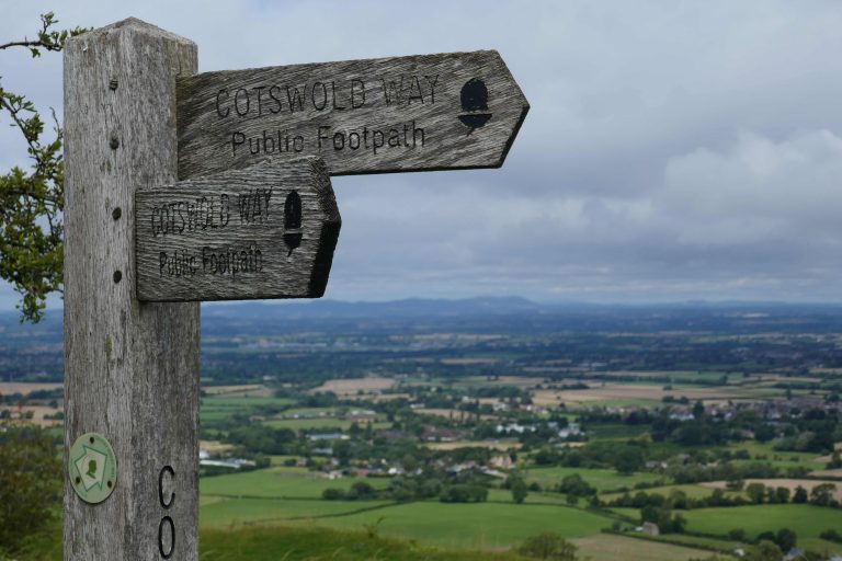
Here turn left, and shortly turn right up a flight of wooden steps to resume climbing the hill. The steps give onto a minor ridge, soon reaching a wire fence on the right. Follow this, which enters open country and meets the Cotswold Way which is marked by a wooden signpost (at SO 92541 16096). The Gloucestershire Way now runs coincident with the Cotswold Way (and the Gustav Holst Way) down hill, loosely following the right-hand field-boundary for about 1km to the A417 and the Air Balloon roundabout.
An alternative in Crickley Hill park is to turn left on the Cotswold Way, and walk up hill to the high viewing point and cafe, and then find one of the many alternative routes to the Air Balloon roundabout.
See section 5 in regard to advice about the developments in this area. In summary, the Air Balloon pub is now shut, and a walker might want beforehand to investigate the current state of developments in the construction of the new road. There is currently little provision for pedestrians crossing this busy intersection, which is extremely hazardous. The best option maybe to turn left and walk down the A436 and cross that via the island, rather than attempt the double crossing of the A417. The objective (if continuing to section 5) is to reach the far side of the A417 and walk a short distance up the hill.
Downloads
Introduction
The section of the Gloucestershire Way from Crickley to Salperton includes a series of quiet and beautiful Cotswold hamlets and traverses a series of ridges. The start at the Air Balloon roundabout is, however, noisy and hazardous, and considerable care needs to be taken crossing the roads. The task is to get to the eastern side of the A417 as it goes up the hill towards Swindon. The safest route may be to turn left down the A436 to a point past the roundabout cross there, and then proceed up the hill on the eastern side.
After years of delay, the A417 at this point is having a major upgrade and work has now started on the site. The Air Balloon pub is now closed. The walker may need to be prepared for some diversions to the route, which we will try to alert here. Information about the development and disruptions can be found here: https://nationalhighways.co.uk/our-roads/south-west/a417-missing-link/. PROW information here: Temporary closures – Highways (gloucestershire.gov.uk)
There are no shops on the route. With modest deviations from the route, the walker could reach: The Seven Springs, (Seven Springs); The Cowley Manor Hotel (Cowley); The Green Dragon Inn (Cockleford). All lie to the west of the A435 Cheltenham-Cirencester Road, near Coberley. The Kilkenny Inn, is about 700m from the route at Foxcote. The Frogmill Inn lies directly on the route just before reaching Shipton.
Public transport options are limited. There are no services to Crickley Hill. An energetic walker might consider starting 3.5km earlier on the route, at the A46 Shurdington Road, where there are regular Stagecoach bus services from Cheltenham, Gloucester and Stroud. Pullmans operates service 801 that passes near Shipton. At the time of writing, the Stagecoach 51 Cheltenham-Cirencester route has been diverted, and passes near Shipton. But with or without diversion, this bus passes near Coberley on the A435. Check before setting out. From Salperton, the nearest bus stops are on the A436, again the Pullmans 801 between Cheltenham and Moreton-in-Marsh.
This section of the route requires the OS maps of the 1:25000 series:
- Explorer179 – Gloucester, Cheltenham & Stroud
- OL45 – The Cotswolds
Maps will appear on this site when we have sorted the copyright and logistical issues. In the meantime GPX files for the section are available below.
The route
About 150m up the hill from the Birdlip (Air Balloon) roundabout, look out for a footpath entering the wood, called Emma’s Grove. After passing through a kissing gate, the path curves first right and then left going gently up hill to the far corner, where it exits via another kissing gate. At the time of writing, with work on the A417 now underway, the walker is marshalled by parallel fences up the hill to a hedge and then through the hedge to more parallel fences that reach a small road. Cross this slightly right and take the metalled road going ahead.
Stay on the road to pass closed dog kennels on the left (the OS line here, to the left of the buildings is not currently open). [I suspect this whole area will be redeveloped shortly, so buildings may disappear, but the line of the track will remain]. Stay on the track which reaches a kissing gate that gives into an enclosed footpath.
Shortly this opens up as the path goes down towards a valley with views ahead. Before reaching the valley bottom, just before a metal gate, the path meets an old green road, turn left here and follow the track which contours around the hillside above Coldwell Bottom for 1.1km, and joins a narrow lane where turn right.
Walk along the lane for 150m and, when this bears right, continue onto a track and presently take the left fork of two tracks. After 250m the track enters a field, where maintain the same line close to the left field boundary, down to a stream which cross and walk up to the road at Coberley, where turn right.
In his guide book, Gerry Stewart offers the option to avoid Coberley, which shortens the route slightly, but increases the hazard in crossing the A435. A gpx for this is available below, but this option is not recommended.
Pretty Cotswold village of Coberley
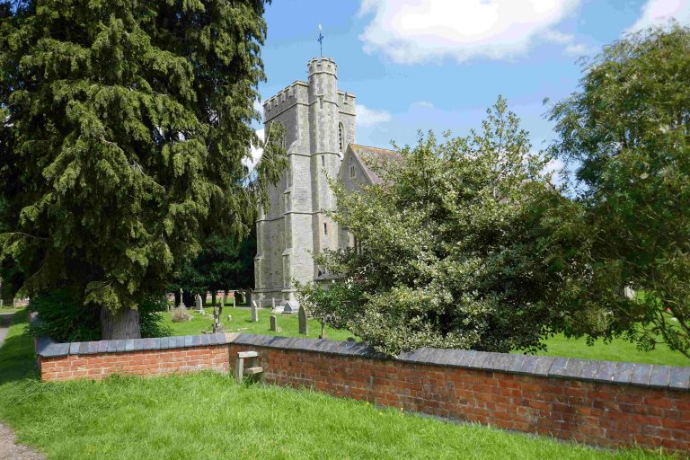
Walk 350m along the road, crossing the infant river Churn, past Coberley court and the entrance to the church and look for the path on the right that runs alongside the buildings. Pass through two field boundaries and then pass ponds on the left to another gate. Pass through this and then turn half-left and orientate towards the highest point in the hills ahead, to cross the field to a hidden gap onto the A435.
Take care! Cross this fast busy road to follow the bridleway about 500m across the large field to woods on the far side. Pass through the plantation woods, going up hill, to reach the lane at Upper Coberley, where turn left. Walk 750m through this pretty hamlet, turning left at a T-junction, to find the path entering a field on the right near power lines.
The line of the path is first to the left foot of the pylon then towards the leftmost corner of woods ahead. On reaching the woods, turn left to pass through a field boundary then, keeping the edge of the woods to the right, follow the field edge until it joins another bridleway from the left, where exit right past the garden of Needlehole. Follow the stone way right for 1.25km to where it joins a lane, where turn left. Follow this quiet lane for 1.15km to the crest of a hill, and there take the footpath right. Initially follow the fence which is shortly crossed, so it is on the left. Descend the hill, erring left first towards a telegraph pole and then, when it comes into sight, a gateway on a track.
On reaching the track, turn left to walk along an avenue of trees, and after 200m look for the path turning half right, which angles diagonally across fields, between fences, towards a gate into woodland. Pass through the wood, to emerge into paddocks, and walk down past a horse-schooling area and buildings and onto the road at Foxcote. Turn right and then immediately left, and follow the cul-de-sac round until it reaches a field gate. Pass through three fields, staying close to the left hand field boundary, to reach a road. Cross this, and enter the field opposite. Staying close by the right hand field boundary, pass through the field to emerge onto the golf course access driveway. Turn left here and shortly reach the busy A436. Here turn right into a bridleway, which rises to cross the line of the old Cheltenham – Cirencester railway line, and then drops to cross the infant river Coln before passing behind the Frogmill Inn, where refreshments can be obtained.
From the Inn, continue along the old road, and then along a short section of the A436, to its junction with the busy A40. Cross this with care and continue down the road into Shipton Oliffe, but after a few metres, take the footpath to the right. The walker here is marshalled between fences through a series of paddocks, leave the last of these through a hand-gate, and here turn left to follow a wall towards a stream. Turn right along the stream to a small bridge. Cross this and the driveway to enter a short footpath between houses and reach the village street at Shipton.
Turn right, to walk through this pretty village. After about 630m, at a house called The Lilacs fork left uphill, and go straight at the next crossroads, past the Reading Room on the right. The road bears left uphill, and presently the Gloucestershire Way turns right into North Farm. Follow the track for about 1.1km, past Toddmoor House, to a fork by an electricity pole where a dirt track to the left leaves the metalled road. Take this for another 500m, to a road.
Cross the road slightly right and walk down an avenue into the secluded hamlet of Hampen. Approaching the houses, take the right fork into the village and walk through. After passing the last barn, turn right into a field, initially walking alongside the barn wall. The path bears gently left, to cross the path of a stream (often dry) after 150m and then walk directly up hill to rejoin the road. Turn right and follow the road left round the corner and then take the road to the right, which, after houses becomes a dirt track. Follow this for about 1km to a junction with a small road. Cross the road and follow the road ahead down into Salperton, turning right at the war memorial.
GPX downloads
Introduction
This is a wonderful Cotswold section, with grand airy vistas, picturesque villages and magical closed footpaths. Most of the way is easily navigated.
There are opportunities for refreshment at The Hub, in Notgrove; the Plough Inn, in Cold Aston and the The Slaughters Country Inn, in Lower Slaughter. There is also a wide range of shops, food retailers and accommodation at Stow-on-the-Wold.
Stow is reasonably well served by buses, but reaching Salperton by public transport is not possible. An option might be to start walking from the A40 near Shipton, making a longer day of it if going all the way to Stow, or alternatively breaking at Notgrove or at the A436 near Bourton. Check options at Traveline or Pulham Coaches.
This section of the route requires the OS map of the 1:25000 series:
- OL45 – The Cotswolds
Maps will appear on this site when we have sorted the copyright and logistical issues. In the meantime GPX files for the section are available below.
The route
Approaching the village of Sapperton, the Gloucestershire Way turns right at the War Memorial. Go along the road up the hill, passing the entrances to Salperton Park and its neighbouring church. The road curves round to the left, and the views open up ahead and right. Continue walking along the road for about 1.6km to pass Farhill Farm. Where the track enters the farmyard, continue straight-on, down the hill, with the field boundary on the left. At the bottom of the first field, pass through (or round) the gate into a larger field, and continue down the hill with rising ground to both left and right. At the valley bottom, pass through a gate and turn right and then shortly bear slightly left directly towards an ancient hollow ash tree, behind which is a gate. Turn left, and follow the field boundary on the left up the hill. Pass through two fields with gates, heading towards Kites Hill Barn. Pass this and continue, now on a metalled track, to the road. Here turn left and after 150m turn right towards Notgrove village.
A charming pretty Cotswold village with lovely old houses. Now with a hub serving food and drink.
Walk through the village. There is an option to turn left to Notgrove Hub for refreshment, but otherwise carry straight on between stone pillars signed ‘Manor Farm, Glebe Farm and Church’. This curves to the right past a barn. A detour to the church will attract some, but the Gloucestershire Way turns left through a field gate. Cross the field diagonally, descending to the valley and then ascending the opposite slope. Exit the field onto a track and turn right, and after about 50m turn left into an avenue of beech trees. After 900m the avenue exits onto a road, where turn right towards Cold Aston.
Another pretty village with pub.
After 800m the road reaches the village centre, and the Plough Inn, where refreshments are available. The Gloucestershire Way continues along the road to the left of the small green, with its huge sycamore tree. After 1.1km of road-walking, reach a coppice, where the path enters a field, but then continues in the same direction, but now with the field boundary on the right, which expands into a woodland. At the boundary crossing the path, pass through the inconspicuous gap into the next field, and continue along the field edge to the valley bottom. Look for a gap and bridge about 20m to the left of the corner and exit the field onto a track. Cross this slightly left, looking for a path going up the hill that again follows the field edge on the right.
On reaching the busy A436, cross straight over, and follow a field boundary on the right, that shortly curves right and exits onto a lane. Turn left, and walk downhill. At an apparent fork in the road with farm buildings to the left, turn right to continue downwards, to cross the river Windrush, and then immediately pass Little Aston Mill. Walk up the hill, past pretty houses and gardens, and at a fork in the paths, turn left to continue up the hillside with paddocks on the left. After about 500m, after having passed through a second boundary fence, look for a gateway into a field on the right, and diagonally cross the field to a minor road. Cross this and continue along the bridleway shortly cresting the ridge to go downhill.
360 degree views all around here.
Cross the next small road, and take the road ahead steeply down into Lower Slaughter. Cross the River Eye by one of the footbridges ahead, and turn right to follow the river downstream. There is refreshment here at The Slaughters Country Inn. At a road junction fork left to pass the church on the right, at the end of the churchyard turn right into a close and after 20m turn into a footpath on the left. In quick succession this passes a wood, an orchard, a pavilion, a cricket pitch and a small paddock, before passing through a kissing gate into fields. Continue on the same line, and shortly pass through the field boundary on the right, maintaining the same direction, but with the boundary now to the left.
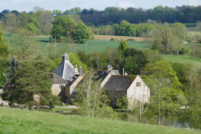
After about 550m, the crossing field boundary is met, cross this via a bridge about 20m to the right of the corner. In the next field, look for the gap in the boundary 100m straight-ahead, cutting off a small corner of the field to the left (temporary fences may slightly alter the line here). Cross the next field aiming for a steel gate between two old oak trees. Turn right here and cross a small track to cross the next field, with the boundary fence initially to the right, but err left towards a gap in the hedge ahead. Turn left here to cross another boundary, and then turn slightly right to cross the next field diagonally. There is a ditch (which has the appearance of a hedge) crossing the field about three-quarters of the way across, and after crossing a bridge, stay on the same line to a gap in the hedge. Pass through this, and stay on the same line to a gap in the corner of the next field, which is right by the River Dickler. The river bends away to the right, but the path keeps on straight to a small stone bridge crossing a stream. Over this, bear right slightly towards Hyde Mill.
Pass by the homestead and buildings and cross a bridge over the mill-pond. Don’t go straight ahead, but bear left and go through two hand gates and cross the field diagonally to another hand gate and climb steps onto a dyke, where turn left to go past a large stable and exercise yard. Pass through Netherswell Farm, and walk up through fields and a number of gates to a copse. Entering the copse, bear right and exit onto a path that develops into a hard track. Continue on this towards, and then past, houses and emerge onto the busy A429.
Turn left and look to cross the road at a point where there is an island refuge in the centre. Having walked past the cemetery on the right, take the first right turn down the road Back Walls. Walk 200m to pass a small Methodist Church and graveyard, and take the enclosed footpath left just beyond this. Walk to Sheep Street, and cross this to another small alley (Talbot Ture) and walk through this to the town square.
Alternatives
Stow is an interesting Cotswold town (although it would be much improved by eliminating parking in the town square area) with all amenities. However, if the walker is minded to crack on, then there are many options to by-pass the town. Gerry Stewart suggests turning at Hyde Mill, and taking footpaths to first Lower Swell and from there to Upper Swell, where the main route is rejoined. A GPX for this route is available below.
GPX downloads
This section joins the two picturesque towns of Stow-on-the-Wold and Winchcombe, crossing splendid upland country. There are some sections at the start which involve road-walking, although mostly this is on quieter roads. There are fine views, firstly of the big Cotswold skies, and then, coming into Winchcombe, of the surrounding hills and vales.
There are few amenities along the way, with the exception being the Plough Inn at Ford.
Travelling by public transport between the start and end is not easy, and necessitates a visit to Cheltenham, but buses do run in both directions throughout the day. See Traveline for more information. The Gloucestershire and Warwickshire Railway runs close by the route, and this option might be explored.
This section of the route requires the OS map of the 1:25000 series:
- OL45 – The Cotswolds
Maps will appear on this site when we have sorted the copyright and logistical issues. In the meantime GPX files for the section are available below.
The route
Leave Stow Market Square by the High Street, and walk to the busy A429 (Fosseway) and cross this (advisedly at the pelican crossing a few paces away). Then turn first down the A424 and, almost immediately after, left down the B4077 Tewkesbury Road. Stay on the left side, walking on the verge downhill for about 1.1km. Past the entrance to Abbotswood House turn left into a field through a kissing gate and follow the left hand fence line down to cross the River Dickler by a stone bridge. Walk up the enclosed field edge path beyond, and turn right into the field at the kissing gate. Loop across the field, initially walking diagonally towards the river, and exit via a kissing gate to the road. Turn left up the hill through the hamlet of Upper Swell, remaining cautious of traffic.
Having turned a sharp corner right, at a fork in the road, take the right fork signposted to Donnington Brewery. Walk along this road for about 1km, crossing the Dickler again, and climbing past the entrance to Donnington Brewery.
At a T-junction, turn left towards Condicote, now walking parallel to the river over on the left. After a further 2km, take the right turn signposted to Condicote and walk into the village.
After 400m at a T-junction turn left. Shortly, take the right fork in front of the village green, to pass the church of St Nicholas on the right, and then turn sharp right. Walk through the village for about 500m, to reach a fork where a track bears off the road to the left. Follow this for about 1.4km, passing large farm buildings about half-way along. At a T-junction with a minor road, turn right and after 150m turn left into a tree lined bridleway. Emerging into open fields after about 350m, fork left to follow the bridleway along a field boundary (the map shows the route to the right of the boundary, but on the ground this may be to its left). After about 450m, look out for the bridleway angling right to cut the corner of the field towards a gap in the boundary running across the path. Follow this line through the gap and across the next field towards a coppice of mixed woodland. Don’t pass through the coppice, but instead fork left onto a track beside a wall on the right. After about 1.2km at a wayside stone, the track bends slightly left. After about 400m the route deviates slightly into and then out of Ford Hill Farm before resuming the same line for another 600m to reach a road.
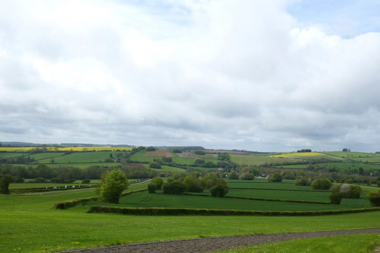
Fine Cotswold views of rolling hills with the occasional farm or homestead. Big skies and big colours: yellow, green and brown fields, blue skies.
Cross this road and using the large pedestrian gate enter the racehorse training establishment of Jackdaw’s Castle. Walk ahead on the sealed road for about 800m to signs where the footpath is directed over the gallops. With extreme caution, turn right to cross the gallops and then turn left on the sealed road to continue walking downhill for another 1.1km to the road at Ford and possibly a detour to the Plough Inn.
The Gloucestershire Way turns right at this busy road, passing a red post-box and phone booth and going down the hill to cross the infant River Windrush. Go round the bend and walk up to the road junction and turn left towards Temple Guiting. (Before this there are Permissive Paths on the left side of the road that use the verge, and if these are available, take them for preference.) Within a few metres of the road junction, there is a footpath going right, up the hill, with a hedgerow on the left. At the crest of the hill, pass left through a gap in the field boundary, continuing in the same direction, now with a low wall on the right and beyond that a quarry. Stay on the path beneath trees that eventually becomes fenced on either side, and leads past buildings at Slade Farm to a lane.
Turn left, and follow this narrow winding lane for about 1.9km, passing a road to the right signed to Farmcote, and then a road to the left by Lynes Barn Farm. Just after this, leave the road through a gate on the right, and turn left to follow the track that contours round the hillside past a large old barn. Beyond this, pass through a field boundary and about 100m further on fork left into woodland through a steel gate. Exit the woodland through a kissing gate into a large field, where continue to follow the track contouring round the hillside towards Little Farmcote Farm. After 700m pass through a gate, and here angle right slightly towards the corner of the fence going round the farm compound. Here follow the fence on the left to reach a kissing gate, where enter the farm compound and shortly turn right towards the main entrance gates. Pass through the pedestrian gate and take the left-most track that inclines slightly up hill to cross the old Saltway (here a minor road).
From the lane, contour across two fields to a gate on the skyline and turn left up to a stile into a small copse. Fine views to the right, Cotswold Scarp, Gloucestershire and Warwickshire Railway, Dumbleton Hill and beyond Bredon Hill. Flatlands of the Avon plane heading north.
Exit the copse and go down hill through scrubby woodland and descend to a kissing gate, where the slope becomes less steep. Continue on the path, keeping the field boundary on the right nearby. Looking up and ahead, sight Langley Hill, which provides some orientation: this is where you are heading. Look out for the gate in the right boundary fence, and pass through this and then turn half-left, and look for a gap into the trees. Here the path steepens again and becomes muddy and slippery under the trees. After emerging from the woods, Winchcombe comes into view. As the path descends, the field narrows and look for a gate about equidistant from both corners of the field. Maintaining the same line, cross two more small fields with kissing gates, eventually exiting onto Stancombe Lane. Cross this slightly to the right and enter a large field.
The farmer here has helpfully installed extremely large signs to mark the path. Walk across the field towards a gate (and 1m2 sign) in the opposite boundary. Here turn half-right, walking between a line of ancient oat-trees to diagonally cross the field to exit just to the left of farm buildings. Pass through the kissing gate and turn half-right again, to walk directly down the now gentle slope and exit via a kissing gate onto a lane. Turn left and after about 50m turn right into a field, which cross diagonally to the far corner. Exit through the kissing gate into a narrow passage between houses, and after 40m reach the road where turn right. Cross the River Isbourne and walk up the short steep hill into Winchcombe.
GPX downloads
This final stretch of the Gloucestershire Way links the small town of Winchcombe in the Cotswolds with the larger urban centre of Tewkesbury, and its magnificent Abbey. There is fine walking to Oxenton with Splendid panoramic views. Thereafter the route passes back into the flatlands of the Severn and Avon, although these are not without merit. The walker has the option to skip this last section, and instead head down the Cotswold escarpment over Nottingham Hill, Cleeve Hill and beyond. However, that would mean missing out on the sense of accomplishment of completing the route, and the attractions of Tewkesbury.
The route does not pass by any amenities, although the walker could divert into Gotherington, where there is a shop, a pub and a regular bus service.
Travelling by public transport between the start and end is not easy, and necessitates a visit to Cheltenham, but buses do run in both directions throughout the day. See Traveline for more information. The Gloucestershire and Warwickshire Railway runs close by to the route, and this option might be explored.
Somewhat annoyingly, this section of the route requires three OS maps of the 1:25000 series:
- OL45 – The Cotswolds
- Explorer179 – Gloucester, Cheltenham & Stroud
- Explorer190 – Malvern Hills & Bredon Hill
Maps will appear on this site when we have sorted the copyright and logistical issues. In the meantime GPX files for the section and various alternatives are at the end of this section.
Of the variant route options listed, only the minor one between Dixton and Oxenton is recommended, thereby avoiding ploughed in fields.
The route
Leave the town via Gloucester Street (B4632) passing the massive 15th Century Church of St Peter’s with its splendid gargoyles to your right. At the Corner Cupboard Inn turn right into Malthouse Lane and, after a short distance, at the mini-roundabout turn left into Langley Road. Take the first right into Harveys Lane and walk about 650m up the ever-steepening road out of town. Having passed Enfield Farm and its entrance road, look out for a kissing gate on the right side of the road and pass through this and cross the field diagonally, going steeply up Langley Hill towards the far-corner. Pass through a kissing gate in the fence crossing the hill, and continue climbing the hill in same direction towards the top-most corner and exit through a kissing gate. In the next small field, maintain the same line, again diagonally crossing to a gate and kissing gate which have a wall to the right. Shortly after passing through this gate, a farm track joins from the left. Turn right along the track, and after about 70m reach a junction of tracks. The right-of-way passes through the right-hand gate, then immediately turns sharp left and, after 20m, sharp left again through a kissing gate. The Gloucestershire Way continues along the track ahead, contouring around the hillside.
Fine views here. G&W railway easier to hear than see.
Walk about 500m around the hillside, following the track on the ground, erring towards the higher slopes close to the mature woodlands on the left. Nearing the ruins of an old farm pass through the field-gate and continue to walk round the hillside, with the woods to the left for another 350m where, with heavy brush ahead, look for a wooden hand-gate in the wall in the top left corner of the field. The path then bears left, again staying at about the same height. After 600m the path joins a bridleway from the left and then turns right to descend steeply to a small plateau and crosstrack. Using a gate on the left, cross the plateau to the right of a barn and shortly turn into a holloway which follow for 350m down to the hamlet of Far Stanley. Pass through the bridlegate, turn right through a stableyard and follow the lane down hill, under a railway to a junction. Turn left and (with care) walk along the busy road for a short-distance to the bend, and leave the road through a bridlegate straight ahead.
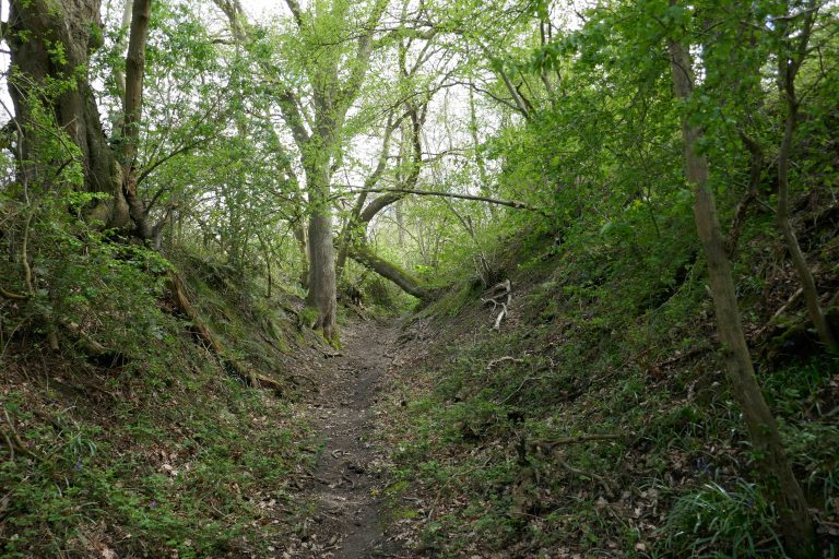
The bridleway passes over the shoulder of Dixton Hill and descends past the manor, joining a small road. At a T-junction, turn left and after 70 metres turn right into a bridleway. Cross the field to a gate, pass through this and cross the second larger field, where a small stream about halfway is crossed with a little bridge. Exit this field through a gap in the hedge with a gate. There are two paths here (the GW route veers slightly left, whereas the recommended ALTERNATIVE1 continues straight on – see below), the Gloucestershire Way veers slightly to the left here, contouring round the hill. These fields are often found ploughed over or with crops. The following instructions may help with finding the line of the path.
As a line of telegraph poles comes into view, target the one to the right which is at the gap in the hedge. Pass through this, and walk along the line of the telegraph wires to a pole in the next hedge. Here, orientate slightly to the right of the wires, passing about 10m to the right of the pole in the middle of the field and meeting a gap in the field-boundary about 20m to the right of the pole in the hedge. Here turn leftwards to walk to the telegraph pole in the middle of the field, then cross diagonally across the field to the bottom left corner where there is a gap onto a track.
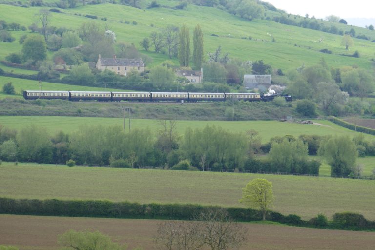
360 panorama – behind Dixton Hill, Langley Hill, Nottingham Hill, Christ Church in Cheltenham, Line of Cotswolds, Churchdown Hill, Robinswood Hill, Gloucester Cathedral (right light needed), line of hills on other side of Severn, May Hill, Woolstone Hill (close by). Racecourse.
The ALTERNATIVE2 route to Oxenton starts here. This was designed to avoid muddy fields on Crane Hill, but this appears no longer to be a problem and this variant is not recommended. See below for description.~
For the main route, at the track turn right and pass 200m through the farm yard, looking out for the concrete lane leaving the farm to the left (where the alternative1 route from Dixton rejoins). Walk about 250m along this lane to a footpath on the right at Crane Hill Farm. This climbs steeply, initially close to a hedge, but as it nears the top circles right over the shoulder of the hill to a stile. Cross over the next field, meeting the fence slanting in from the left, by some pollarded Ash trees. Cross the stile and continue, keeping the fence on the left close by, reaching a gate into a coppice. Pass through the coppice and at the exit kissing-gate turn left to join a four-wheel-drive track curving downhill. Where the track runs out, look out for a gate on the left with the church below. Take this to a green kissing gate in the left corner and exit onto the road at Oxenton.
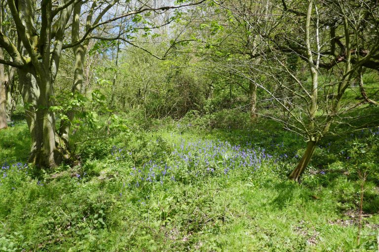
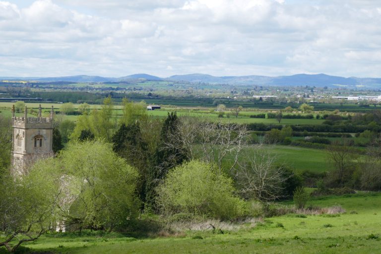
Splendid views from the hill to Malverns, May Hill, Hay Bluff etc.
When the track meets the road, continue down the village street past the church of St John the Baptist on the right. (This repays a visit: it is a fine old church, dating in parts from the twelfth century and with interesting frescos.) Continue to follow this minor road (where shortly the alternative2 route from Woolstone Hill Farm rejoins) for about 800m, leaving the village to cross the A435 Cheltenham – Evesham Road. Take the footpath, slightly to the right, continuing in the same direction along the stony track, with a hedge on the right. After 750m, at a field boundary, the hedge ends abruptly. Continue walking in the same direction, crossing the field to a stile in the hedge (orientate about 50m left of the farm buildings) and then cross a smaller field, with large green farm-buildings to your right, to a gate onto a green lane.
Cross slightly left to a stile, and cross the next field remaining about 15m from the hedge and ditch on the left. Pass through the gate at the field boundary and, after a short section of enclosed track, pass through (or round) a second gate and then continue on the track to the kissing gate at an elbow in a small road by Claydon Farm. Walk about 100m along the road to a bridge and kissing gate on the right.
The ALTERNATIVE3 route, which avoids a railway crossing continues straight along the road, see below. This variant is not recommended.
The main route continues over the bridge, following the hedge to the right, to a cross hedge and follow this left for about 20m, then cross the open field diagonally right to a footbridge (just to the left of the far corner of the field, orientate towards the Malverns’ second peak from the right) over the Tirle Brook.
Over the bridge, the path turns right along the hedge and from the corner continues on the same line across the wide field to a stile in the distant hedge. An alternative line, which avoids crossing the muddy field, is to turn left after the bridge and follow the field boundary to the left, which shortly performs a U-turn to continue in the same NW direction. When this meets a crossing hedge, pass through a gap and continue following the edge of the next field.
Both the marked footpath and the alternative gradually converge with the hedge on the left to join a surfaced track from a house. Follow this right for 180m to a lane and turn left and then cross the railway with extreme care. (If diverting to Ashchurch train station, on reaching the lane, proceed into the footpath ahead.)
Continue along the track, passing a business park on the left, to join a busy road and continue straight on for 100m until the road bends left, where carry straight on passing a post box, onto an enclosed bridleway. Follow the bridleway, bearing slightly left then right by The Homedowns, continuing for about 900m, passing over access roads into a housing estate, to cross the M5 motorway via a footbridge. (At the time of writing significant house-building is on-going in this area. This does not appear to affect the line of the route, but check Cicerone website for any updates.)
Over the motorway, go through two old gateways, turning right after the second, following the field edge for 150m to a small pond with willows, where turn left to continue following the field boundary, with a hedge to the right. After 350m, having passed through the field boundary enter an enclosed track which leads past homesteads to a minor road at Walton Cardiff.
At the road turn right and walk round a sharp bend to a junction, where take the left fork which curves left round a pond. After 40m, at the apex of the bend (where the alternative3 route rejoins), look out for a footpath on the right which follows the line of a brook on the right. Keep to the field edge. After 100m, there is a meeting of footpaths, but stay with the brook on the right, angling slightly left to a bridge over a water course (which often floods the path!). Over this, follow the hedge on the right for 110m to a gap with a stile and cross this. Cross the next wide field diagonally towards the far left corner. Walk around the corner of the hedge to a hand-gate which gives onto a surfaced path which leads past houses before slanting right down to a cycleway. Turn right and follow this beneath the A38 road and then continue along the hard path, with the Tirle Brook on the right, to a narrow lane. Here turn right to cross the red-brick footbridge, then immediately turn left, to resume following the brook, which is now on the left. When the path reaches Link Road, cross over, and pass through the children’s playground towards Tewkesbury Hospital which is on Howells Road. Turn left, to walk along Howells Road, which becomes Swilgate Road. Follow this to a T-junction and cross Gander Lane into the small car-park and from here enter the grounds of Tewkesbury Abbey.
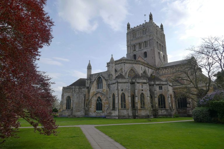
Alternatives
1. Dixton – Woolstone. Recommended. The official route passes through fields that are often ploughed in or heavily cropped. This minor variant crosses the fields a little higher, using a bridleway that is often easier. Having passed through the gap in the field-boundary, take the right-most of the two paths, which continues straight-ahead, rising up the hill. Pass through the gap in the hedge and maintain the same line through the next smaller field, to another gap in the hedge. The next field has a grass verge on the left side, walk along this to the far side where there is a four-wheel-drive track angling down the hill to the farm. Take this and walk through Woolstone Hill Farm, turning right in front of a large green barn, and rejoin the main route. (To pick up the second alternative route between here and Oxenton, turn left, pass through a wide gate-way and then turn right and left round a cow-barn, passing through another wide gateway. The alternative route starts on the right of this gateway, over a small wooden bridge.) [ Return to: before alternative / end of alternative. ]
2. Woolstone Hill Farm – Oxenton. NOT recommended. This route was included in the original guides as a means of avoiding Crane Hill, and heavily churned pastures there. This problem appears to have abated. In the marshalling yard (strewn with large debris) instead of passing through the wide gateway into Woolstone Hill Farm, pass to its left to a small bridge over a stream. Take the path up the hill to a kissing gate, cross the next field on the brow of the small escarpment, to a second kissing gate (views to Nottingham Hill and Cotswold escarpment). Here angle slightly left to walk down the hill towards a third kissing gate, here turn left and cross a bridge over a small stream, where turn right to follow the stream and field boundary on the right. Walk along the edge of two fields for about 400m until reaching a wooden kissing gate into young woodland, where proceed straight ahead. Exit the woodland onto a road, and turn right over a bridge, pass a farm entrance and look for the kissing gate on the left into fields. Follow the line of the farm boundary on the left and then the hard-track next to a fence (this is different to the line of paths shown on OS maps) proceeding along the base of the slope. Pass through the right of two gates and here, angle slightly right and as the tower of Oxenton Church comes into view aim slightly to the right of that (views to Bredon Hill ahead). Pass through a kissing gate and follow the same line to a second kissing gate, and then angle slightly left to walk alongside a fence on the right to a stile with a preceding sleeper bridge. Now follow the field boundary on the left, to pass Field Farm. Take the gate in the corner of the field, and turn right on the driveway which shortly reaches the road at Oxenton and turn left to continue on the main route. [ Return to: before alternative / end of alternative. ]
3. Claydon – Walton Cardiff. NOT recommended. This alternative avoids a railway crossing. Although there are fast-trains here, they are infrequent and the sight-lines are excellent, so crossing should not be hazardous. Continue on the road, which after 850m crosses the railway line, and after a further 350m reaches a T-junction. Here take the bridleway straight ahead, and where this meets a road, turn right. After 400m, cross the M5, and continue for another 600m to a small homestead on the right and take the restricted bridleway to the left. After about 300m this reaches a minor road where turn right, and at the hard right bend in the road, turn left onto the footpath, which is the main route. [ Return to: before alternative / end of alternative. ]
GPX downloads
Direction Tewkesbury – Chepstow
Downloads:
Click on highlighted section to download file.
Notes on the way
This is an ad hoc section to record route issues. Overtime it may expand into a full real-time route guide. Right now, I’ll record here any noted issues or observations. I’ll try to order these according to the line of the route, starting in Chepstow and ending in Tewkesbury.
Signage
25 January 2023. The signage along the route is variable, with the yellow confirmation markers being more prolific in some parts than others. The plan is to review the whole route and install additional markers as necessary. The intention is to avoid over-signing the route. Markers will be installed at obvious boundaries and at any point where there might be uncertainty about which is the direction. But the intention is to not over-clutter the countryside with signage.
Gloucestershire Way finger posts were installed at the road-sides when the route was first designed. Most of these remain, being sturdy cast-metal affairs. However, there is no signage that directs the walker along the road, that is, the footpath may be signed, but on reaching a road, usually the direction is not indicated. It is hoped this will be rectified in the coming period.
Some other Recreational Paths in the area have been very heavily signed, with stickers affixed to any street furniture, gate, stile or pre-existing local-authority sign. A walker of the Gloucestershire Way should not expect this level of hand-holding. The expectation is that you have a route guide, and the signs will aid you use this. Generally the rule is, if there isn’t a marker, you carry straight-on. But even more importantly, you use your common sense.
Severn River
A this time a deviation is recommended (see downloads, above) from the section which follows the River Severn around Gloucester from SO 82448 19046 (end of foot bridge crossing Severn into Gloucester) to SO 82866 20875 (the point where the path emerges onto Sandhurst Lane – just past the former pub building). The path is heavily overgrown.
This section is also prone to flooding, and can be impassable at times of heavy rainfall and/or high-tides.
The Severn Bore is a spectacular phenomenon, which is at its greatest at the high-tides close to the equinoxes. There are plenty of web-sites that advise on times and places to witness this. You don’t want to be observing (or participating in!) a bore from this location!
A417 Birdlip Roundabout
After years of delay, spades are now in the ground to upgrade the A417 at Birdlip. We’ll try to keep a note of developments here, but walkers should anticipate possible diversions between Crickley Hill and Coldwell Bottom (section 5). There may also be times when it would be advisable to avoid driving around these roads. (Additionally, the “old” Cheltenham-Cirencester Road (A435) is closed between Seven Springs and Cheltenham due to subsidence.) Information on this project, and its progress can be found here: https://nationalhighways.co.uk/our-roads/south-west/a417-missing-link/ . Impact on Footpaths and public rights of way can be found here: Temporary closures – Highways (gloucestershire.gov.uk) In the meantime, possibly the unachievable has been achieved: that is, this road-crossing has been made even more hazardous for pedestrians!!! Take great care.
Lower Slaughter – Stow-on-the-Wold – Condicote
The section of the path that leads into Stow is shared with several other Recreational Routes. Some of these have been very heavily signed, possibly to facilitate multi-participant walks. The walker of the Gloucestershire Way should anticipate fewer signs more judiciously placed.
The road walking between Stow-on-the-Wold and Condicote is not well signed, and it is hoped this will be remedied in time. The walker will need to have a clear idea of the route to be followed along the quiet roads hereabouts.