
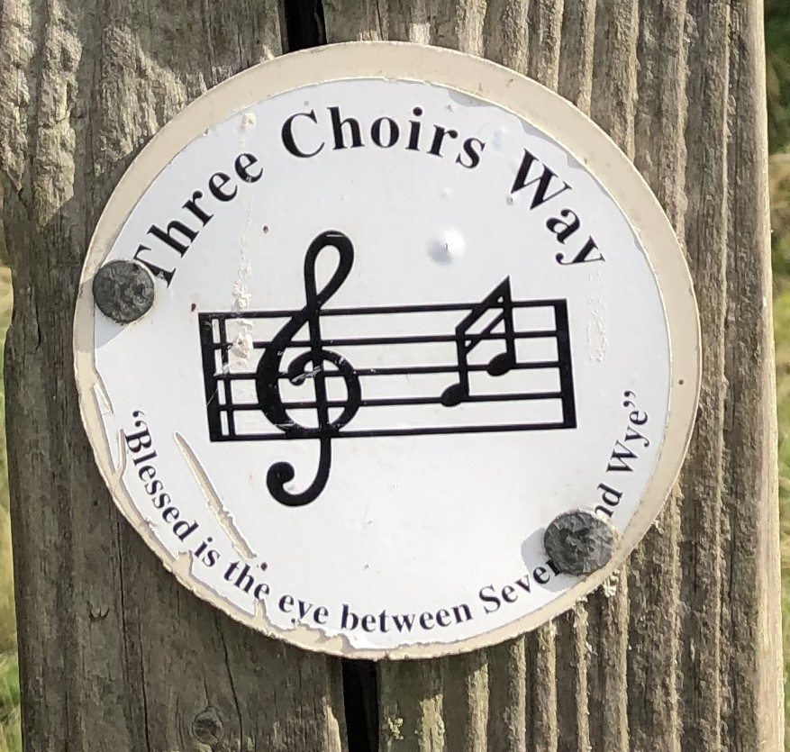
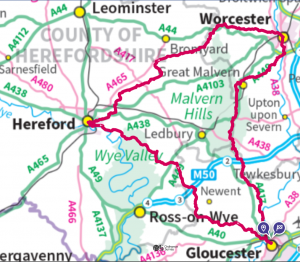
A footpath way between Gloucester, Hereford and Worcester, with a theme linking the walk and the music festival celebrated at the three cathedrals for over 300 years.
The Three Choirs Festival arose, partly, from the proximity of the three cities which has resulted in close cultural ties between them. The Three Choirs Way serves to strengthen and promote those links, by providing a glorious walk of 100 miles through the attractive and varied countryside of the three counties, evoked in the old adage, “blessed is the eye between Severn and Wye”.
The guidebook, last updated by Gerry Stewart in 2009, can still be obtained. For more information, see here.
There is a page devoted to the walk on the Long Distance Walkers’ Association Website.
See also the route guide, below.
A consortium of Gloucestershire, Herefordshire and Worcestershire walkers is looking to engage with various local agencies to promote the walk better and to ensure this fine route is properly celebrated and lasts into the future. Although it is largely in a good state (see below), the signage could be improved over much of its length. Currently the walker will need to depend on maps (see below for GPX) and guidebooks.
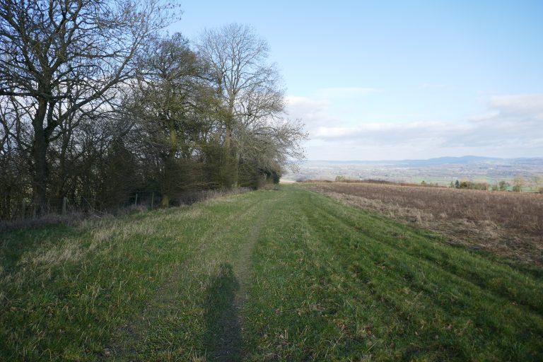
Being a circular walk, the Three Choirs Way can be started at any point, and undertaken in either direction. However, following the precedent of the guide-book, the presumption is that the walk is undertaken clockwise, starting and ending in Gloucester, its most southerly point.
A full route survey was undertaken during the summer of 2022. The highlights of this were:
- By-and-large the route follows that described in Gerry Stewart’s guidebook and the line shown on OS maps (see below for GPX).
- The significant developments around Carrington Road Bridge, south of Worcester, has altered the route somewhat (see below). The entry to Access Land is relatively straight-forward, but could be improved.
- There was some difficulty around Bannersbrook Farm (SO 74336 56473) but this has been resolved.
Route Guide
Disclaimer: The route descriptions and associated GPX are provided in good-faith after considerable checking and review. However, they are a guide only, and any walker needs to check the route for him or herself using appropriate maps. The walker also needs to assess and manage for him/herself the hazards that this kind of route presents.
Acknowledgements: This route was originally devised and described by Gerry Stewart. His guide is still available (see link above) and is recommended. The text here borrows heavily (with permission) from the original guide, although it has been updated to reflect changes in the route. Sadly, Gerry died in summer 2024. He was an inspiration for anyone who enjoys the countryside, and he’ll be much missed. There are some 250 miles of long-distance paths shown on maps that result from his endeavours: a memorial any Rambler would be proud of.
Having recently walked the routes, any errors in the text, maps or GPX are mine alone. Observations will be gratefully received. The guide here is largely confined to route directions, For more colour and interest, buy Gerry Stewart’s book! The guide below adopts the second (2009) edition of Gerry’s book, dividing the route into ten roughly equal sections. However, the walker should not be constrained by these. There may be good reason to reduce or extend a section slightly, particularly if seeking accommodation or transport links. The walker may well wish to delay in any or all of the three cathedral cities.
An ecclesiastical extravaganza!
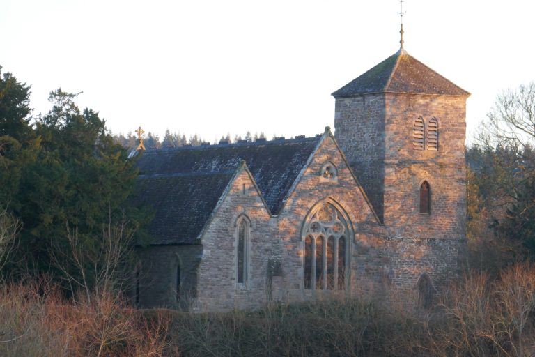
A walker with even the most passing interest in the history and architecture of churches and cathedrals is in for a treat on this walk, passing as it does through a succession of villages and parishes. Clearly there are the highlights of the three cathedrals to be visited, but the many parish churches passed are also of considerable interest and invariably are worth a short interlude for exploration.
Hereford and Gloucester Canal
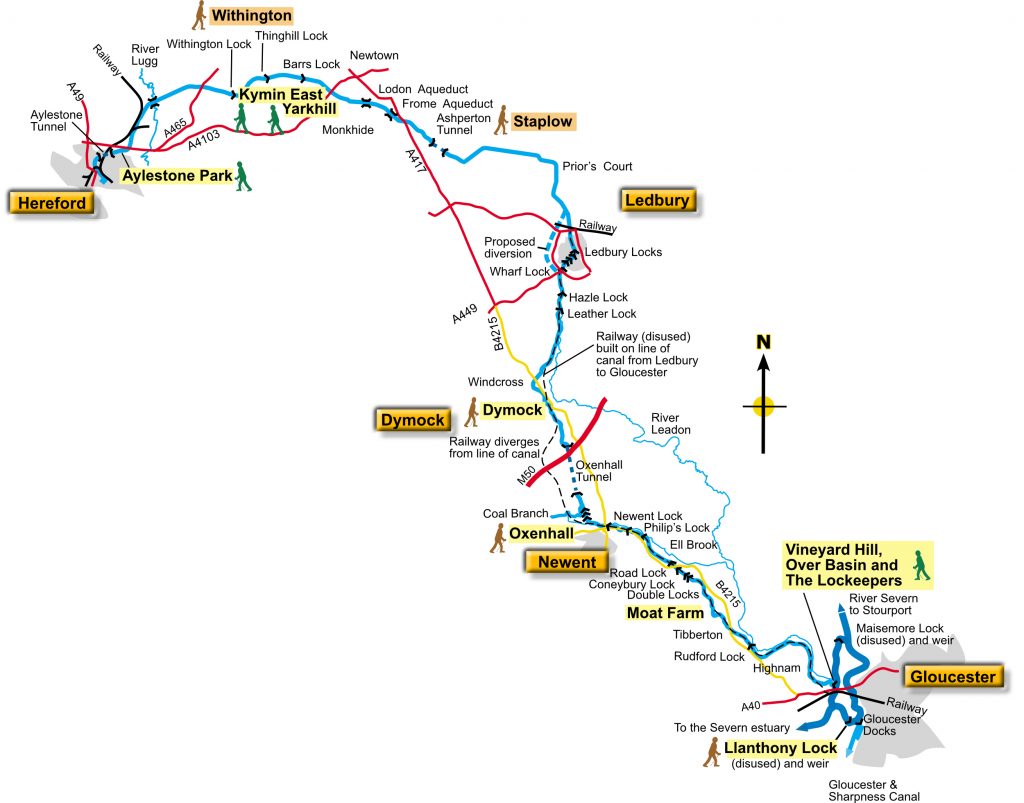
The route criss-crosses the old line of the Hereford and Gloucester canal in the sections between those two towns (including in the first part after leaving Hereford for Worcester. Much more information available here.
Map reproduced by kind permission of the Herefordshire and Gloucestershire Canal Trust
Clockwise direction
Introduction
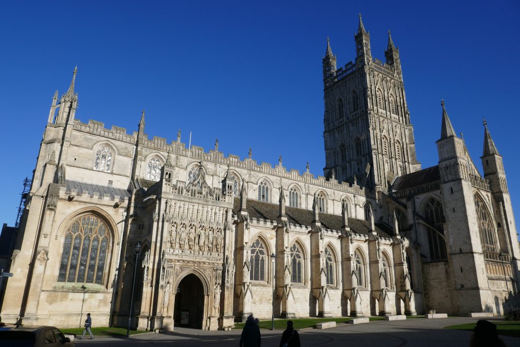
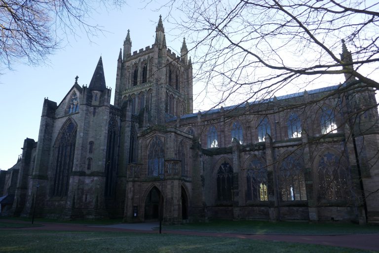
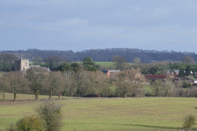
Until the building of the Severn bridges, Gloucester was for centuries the major crossing point of the Severn. An ancient frontier and centre for trade. Gloucester cathedral lies at the heart of the city and continues to play a significant role in its life. If starting the Three Choirs Way from here, be sure to allow a good few hours to explore this magnificent building.
Gloucester has all the amenities of a large city, including large bus and train stations. There are regular bus services between Gloucester and Newent, and continuing into Newent (eg from Briery Hill) at the end of the day’s walk is not difficult (although adds distance). Two buses a day run between Kilcot (a few kilometres further on) and Gloucester. See https://www.stagecoachbus.com/ . There is accommodation in Newent and there is an Inn at Kilcot.
There are few amenities en route, notwithstanding the way passing through a series of villages.
This section of the route requires the OS map of the 1:25000 series:
- OL14 – Wye Valley & Forest of Dean
The Route
The short walk from Gloucester Cathedral to the Severn involves negotiating the busy gyratory A417 and there is no ideal course. The official route, which is not recommended, involves leaving the Cathedral yard by the main gate opposite to reach Westgate Street, where turn right. When the pedestrian area ends, stay on the right hand pavement, which eventually curves round in front of a surface car-park. Find a pedestrian bridge over the busy road and take this onto a large island with big shops. Cross this between a modern building on the right and an older stone building on the left to the far side. Unfortunately here, the walker needs to scamper – unaided and unprotected – over one lane of the gyratory road. Cars are only coming from the left, but they may be moving fast. A few metres ahead is the pedestrian bridge over the river.
A safer alternative is to turn left at the end of Westgate Street (by Castlemeads Court) and walk about 150m and cross Quay Street to traffic lights. Here now cross over the The Quay to the River Severn and turn right. Now walk about 450m to where a footpath forks off left. Take this footpath to rejoin the official route, turning right under the road bridge to reach the pedestrian bridge over the Severn. However, if preferring the wet-weather alternative, remain on the roadside pavement and continue ahead (see ALTERNATIVE ROUTE, below).
Take the pedestrian bridge over the River Severn, and at its western exit turn right to pass under the road bridge and then bear left. Walk parallel to the main road on the left, and look out for a footpath on the left, forking away from Westend Terrace, that emerges onto the busy A417 gyratory road. Continue until reaching a side street, Westend Parade, which cross with care, and then take the path into parkland. The path bears right, passing through a gate into trees, and becomes an unsealed track. A railway line, carried by red-brick arches appears ahead.
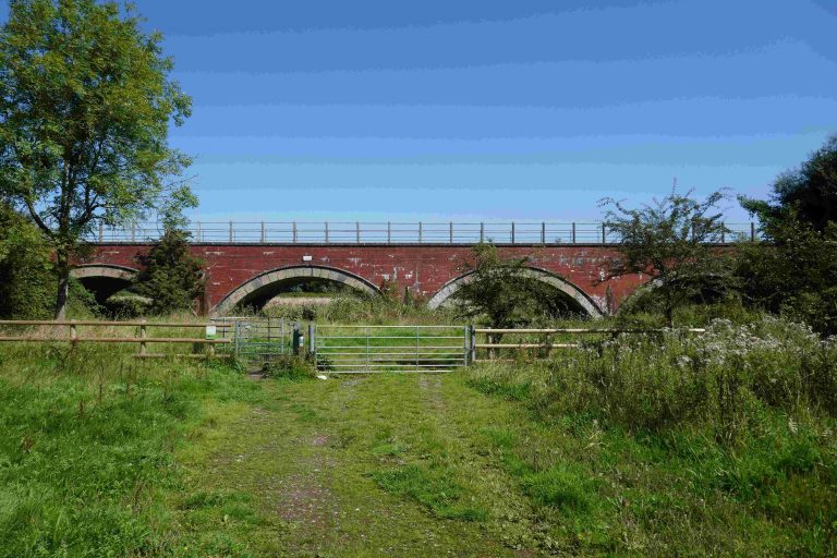
Pass through a kissing gate, ornamented to celebrate the millennium, and then go under the leftmost railway arch and turn left. With the railway line on the left, walk across the field and then pass under a high road-bridge. Continue in the same direction into scrub, and after 250m emerge onto a metalled path, where turn right and then after 20m turn left onto the ramp up onto the now-pedestrian Over Bridge (“Telford’s Bridge”).
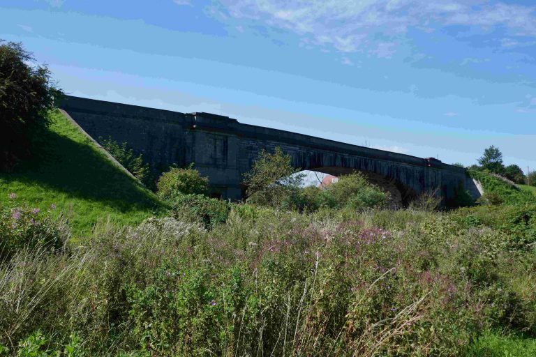
ALTERNATIVE ROUTE FROM WESTGATE PEDESTRIAN BRIDGE TO OVER. Alney Island is prone to flooding after heavy rainfall. To avoid this, instead of crossing the Westgate pedestrian bridge, turn left, pass under the west-travelling road bridge and turn left to walk up to the pavement. Here turn left again and now walk along the A417 (grim but good pavement) for 1.2km crossing first the railway and then the Severn. To the left is Over Bridge (“Telford’s Bridge”) where the Three Choirs Way is rejoined.
Having joined the A40 pavement after leaving Telford’s Bridge, turn right, and immediately look for a path angling down towards the river. Take this, turn left at the bottom to walk under the road bridge where turn left again to emerge onto the north side of the A40. Pass the Toby Inn and then the Over Farm shop and turn right into Lassington Lane, now a cycle route. After 900m at the apex of a left-hand bend, take a kissing gate on the right, cross over a farm track and enter Lassington Wood. There are several ways through the wood, the easiest is to follow the path running about 10m inside the right hand boundary and after about 400m look for steps on the left to reach the top of the hill. Exit over a stile, and continue straight on the ridge to cut off the left corner of the field. At the end of the field, take the left stile to emerge onto a verge by a roadway. Turn right, staying on the verge and looking out on the right for where the path enters trees and shortly turns down the slope to reach a hand-gate into a narrow field. Walk down the field to a stile on the right, cross this and a second stile to a track and follow this to a lane, where turn right.
Walk towards Lassington Church (worth a short detour) and then turn left between farm buildings, and after passing Nissen huts, go through the gate into a field. May Hill appears clear in the distance ahead. Cross the field to reach the woodland on the far side, turn left, and follow this for a while along the field edge, then to find a path angling downhill that continues through the woods next to the old railway line, eventually reaching a field gate.
The path curves round the field converging with the B4215 in the far corner. Here turn right and shortly take a stile on the left, to proceed along the path of the old railway, running parallel to the road on the left. About 330m after the stile, cross over a water course, and about 50m further on find a stile in the hedge on the left. Take this, and continue in the same direction, now with the hedge on the right to reach the lane at Rudford Cross. For a worthwhile visit to the church, cross the bridge. But otherwise cross directly to the kissing gate, and descend to the embankment to the track bed.
 May Hill
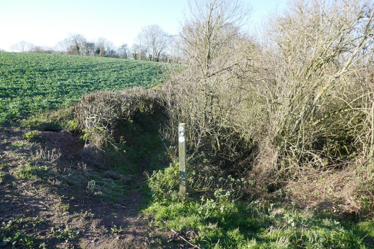 Footpath
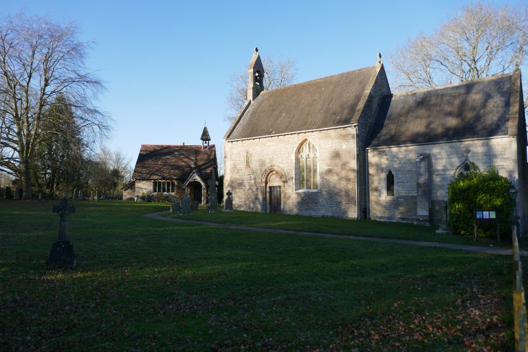 Rudford Church
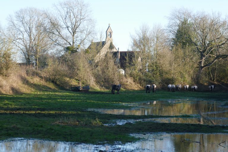 Church from the railway line
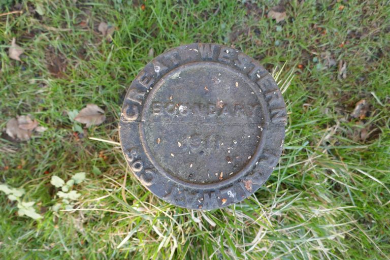 Boundary marker
 Old station
Walk along the old line for 880m, reaching the B4215 which cross slightly right and go up steps to Barbers Bridge. Walk up to the bridge to gain a view of the old station, now converted to a residence. Otherwise, the Three Choirs Way turns left and immediately right onto a cinder road towards Bovone Farm. Nearing the farm, take the right hand fork to pass between buildings beyond which turn half-left to find a path into a field going down hill. The path crosses the field diagonally down hill (although if cropped or ploughed it may be easier to turn right and walk round the boundary). In the bottom left corner of the field cross a ditch – Barbarous Bridge – from a Civil War action. In the next field, turn left but then diverge from the left boundary to cross diagonally towards houses. Cross a footbridge and then follow the path round houses to reach Orchard Rise, where turn right and walk down to the main road through Tibberton.
Here turn right and then left around the duck pond into Huntley Road. Walk about 300m to find on the right a footpath along a track, just prior to Tibberton Church. Presently the vista opens up to reveal May Hill ahead and left and the Malverns to the hard right. Proceed down a small decline to a junction of paths. Turn half-left into a field and cross this diagonally (May Hill is directly ahead) and, over the crown, the hand-gate in the corner becomes visible, ahead. Cross the water course and turn a quarter left looking to spot a gap in the far hedge about 80m left of the brook. Cross the double stile and maintain the same line in the next field, converging with the brook where shortly the footbridge becomes apparent. Cross this into parkland. To the left is a large house and ahead is the drive leading to it. Spot the stile ahead onto the drive and aim for this, cross the drive and the stile on the far side and, holding the same line, continue over the parkland to the right of a telegraph pole towards the corner of the field by a large oak.
Through the hedge turn half-right to cross the shoulder of the hill ahead, well to the right of a circle of oaks on the top. Obtaining the crest, look ahead to see two large homesteads and in the foreground, a gap in the hedge ahead. Aim for this, cross the water course, and head across the field (an interim target is the telegraph pole with lines leading away in three directions) to the right of the left-most homestead, which is the rectory and church. Exit the field hard in the corner and turn towards the lane, where turn right towards the red-brick reading room.
Look for the path on the left, just past the reading room, and cross the field diagonally towards Drews Farm. Pass by the farm and then a marshalling yard on the right, and exit through a gate, where turn left to follow the hedge on the left to a stile. Over this, maintain the same line, passing through a porous field boundary towards The Hill Farm buildings. The route is not that shown on the OS map, but in fact enter the farm yard just to the left of a shed protruding into the field. Pass into the yard, and walk to the right of the red-brick house between it and a barn. Exiting the yard, bear right along a track which becomes a green lane. Avoid entering fields on the right, but bear left to keep a hedge on the right and eventually enter into an open field. About 450m after leaving The Hill, reach a cross roads of paths by Cole’s Barn, where look for the stile on the right and cross this into a large field.
 How now?
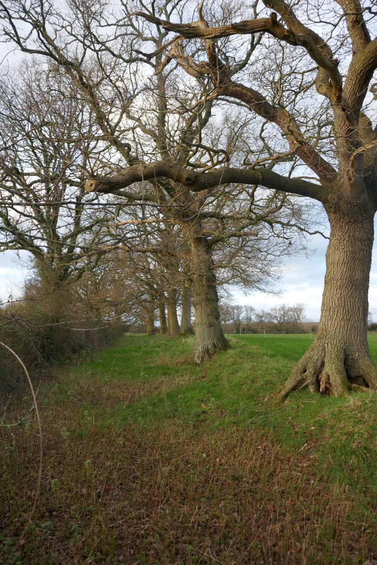 Old greenway, past Hill Farm
Proceed ahead, down the hill towards a gap in the trees by a watercourse. Ploddy House can be distinguished behind trees, ahead. Having crossed the stream turn slightly left and walk up the incline, staying about 50m from the trees on the right. When the brow of the rise is reached, spot the roadside footpath sign, and aim for that. On reaching the road, turn right, and walk 190m through Little Cugley to find a footpath on the left, opposite the driveway to Ploddy House. Turn half-right over the ridge to a stile, which cross and in the next field converge with the left-hand boundary hedge in the far corner, where cross the stile so the hedge is now on the right. Continue up the hill to another stile about 20m to the left of a right angle in the boundary. Cross this, and again with a hedge on the right, crest the hill and walk down, now with electricity lines nearly overhead. Find the next stile under a holly tree and cross this and descend steps to an undulating field. Cross this, staying between the power-lines, erring towards the left-hand lines. Towards the end of the field, (avoid the footpath going straight on and) be sure to turn left before the stream, to find a footpath entering a small clump of trees. Follow the hedge on the right up the hill, to find a stile beyond which is a pond, follow this round anti-clockwise. Pick up a wooden fence on the right and follow this round to exit onto a track, where go ahead towards a grey building, which pass on the right eventually to reach a lane where turn left.
Walk along the lane for 650m, where take the right-most fork uphill. After 180m, at a crossing lane, keep straight-on onto a rough driveway. (A walker with a mind to climb May Hill, at 296m the highest point in Gloucestershire to the west of the Severn, should divert towards it somewhere roundabout here). After the last cottage on the track, cross a stile on the right, and angle uphill towards a red-tiled cottage. Pause at the gate for a moment and, trying to ignore the forest of pylons, take in the wide panorama over the vale. If weather is reasonable, or even sunny, Gloucester cathedral will be clear in the distance. The Cotswold scarp is beyond.
Alternatives
Alternative routes between Gloucester cathedral and Over (“Telford’s”) bridge are discussed in the text. Consider avoiding the paths on Alney Island after heavy rains.
To walk to Newent for public transport links (and supplies), follow the GeoPark Way or continue into the next section 2, and look for the path leaving Briery Hill. This will be an additional 4km.
To continue to Kilcot, see the next section. This will be an additional 2.2km.
Downloads
Introduction
A fine mixed section, with forest, flatlands and the magnificent finale of Marcle Hill.
There are few amenities en route until Much Marcle where there are three pubs, one of which The Royal Oak, provides accommodation. Plans for a shop, have yet to reach fruition. There are some public transport links at Much Marcle, see: Daffodil line; Nick Maddy Coaches.
There is a pub at Woolhope (3km further on – downhill all the way) which provides accommodation.
This section of the route requires the OS map of the 1:25000 series:
- OL14 – Wye Valley & Forest of Dean
- OS Explorer 189 – Hereford & Ross-on-Wye
The Route
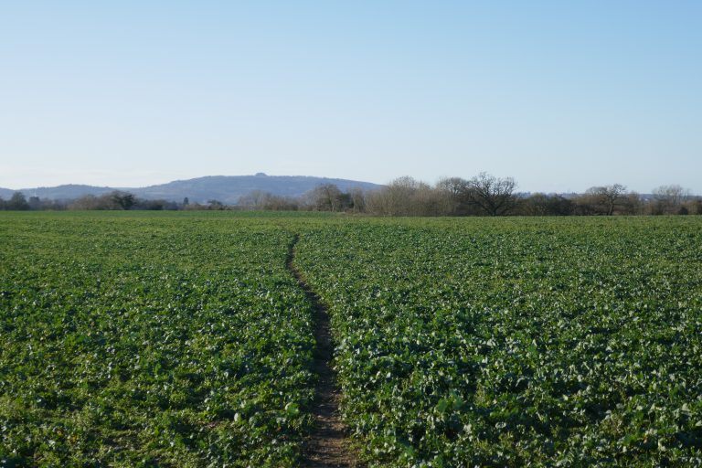
Exit through the gate (at SO 69756 25455) and proceed up the lane ahead. Where this takes a sharp right, continue straight on through a kissing gate and cross paddocks. The view, improved by the lack of pylons, is now west and north to Mayhill and Herefordshire, with the Marcle ridge dominated by its tall mast. In the distance the Suckley hills beyond the long ridge of the Malverns.
 Ravenshill
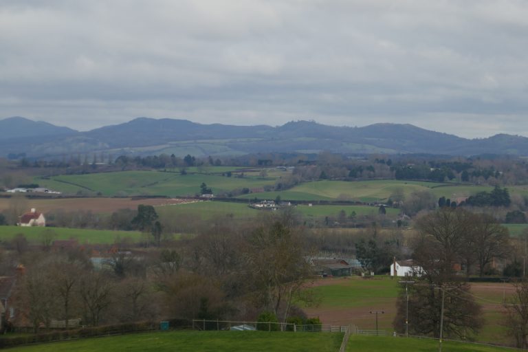 West from Ravenshill
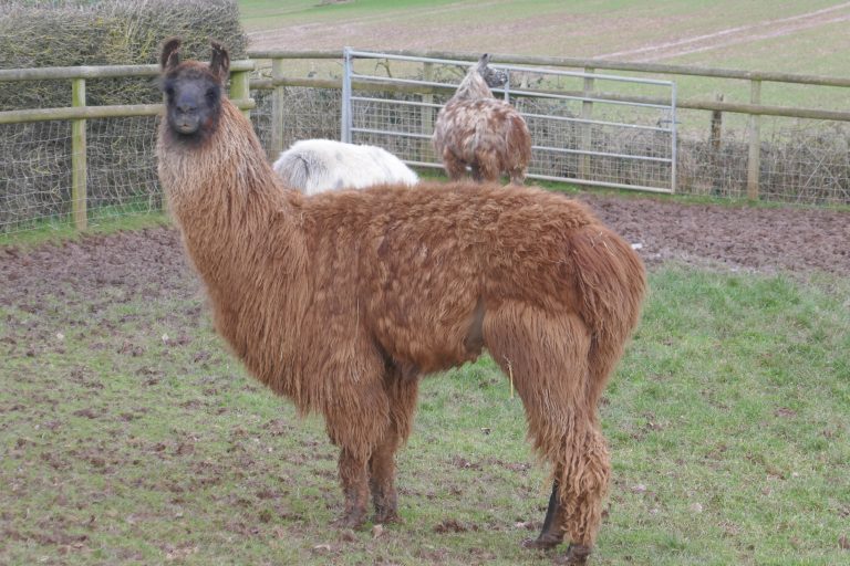 Llama at Briery Hill
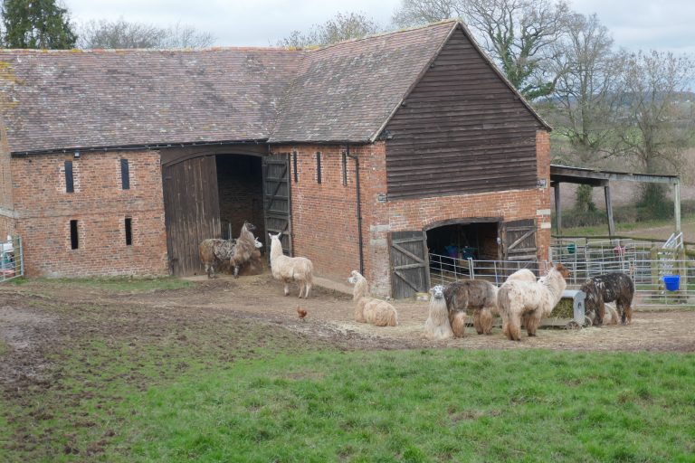 Briery Hill
Pass through a kissing gate into a long field and turn right and cross the field to converge with the far hedge, which leads to another kissing gate. Exit through this onto a track where turn right. Follow this until it reaches the homestead at Ravenshill, where turn left to follow the hedge downhill. After 150m stay alert for the kissing gate in the hedge, which pass through and continue downhill, now with the hedge on the left. Join the track that goes down the hill to the right of Briery Hill farmhouse and which turns left in front of handsome barns, where llamas congregate. (If deviating to Newent, find the alternative path just before the barns.) Follow the track for 670m, and having passed several houses, look for the footpath angling away on the left which is opposite the entrance to Oakleigh Farm. Take this, through trees to the B4221, which, WITH CAUTION cross into Kilcot Lane.
Walk up Kilcot Lane and at the crossing road turn right and shortly look for a footpath left. Walk down the field, keeping the right hedge close by, to a gate onto Kews Lane. Turn right and after a few metres left into a field, where walk down, erring right to a stile in the corner. Continue on a similar line towards a protruding right-angle in the hedge ahead and then to the stream where there is a stile up to a dirt track. Turn left, cross the stream, then turn right through a gate into a field, where initially walk parallel with the stream on the right, but err towards the left hand boundary as it bends left and follow this to a footbridge. This is actually a culvert of 1790, which carried the branch canal over Brockmorehead Brook, which the canal then followed towards Oxenhall. In the next field keep by the left hand boundary, behind which is a stream, and after 200m reach a lane. There is information here about the Newent Colliery.
Turn left and after 180m, before the lane turns hard left, pass through a wooden gate on the right, into fields. Cross the field away from the road, staying near the right boundary, behind which is a stream. After 150m pass over a crossing boundary and continue up the hill, now with the hedge on the left. After 400m cross the stile on the left, close by the field gate. Cross towards a kissing gate in the fence ahead, and through this turn slightly right to meet with the right boundary about 50m ahead, where pass through another kissing gate. Now look up the hill to see a cottage with a surrounding hedge, and aim just to the right of the cottage. Exit through a field gate to reach a lane, where turn right and walk 100m to track on the left entering Greenaway’s Woods. Walk directly ahead and after about 130m, pick up a small stream on the left, which the path now follows for another 180m to a small footbridge. Cross into an open field, and follow the right-hand field boundary uphill to where it meets Betty Daw’s wood. Don’t enter the wood, but turn left and track the wood boundary for 500m, curving rightwards, to reach a lane by Four Oaks.
Turn left, and shortly turn right over the M50 motorway and walk a further 160m to find a track on the left into Dymock Wood. The Three Choirs Way now runs coincident with the Daffodil Way, which may be better signed. Follow the track for 260m and at a fork, take the stronger right track (travelling about WSW). After a further 310m at another fork, again take the right fork along the stronger path (now heading N and then NW). After a further 310m leave the woods through a wooden kissing gate, and walk down the field to the bridge ahead and then up towards buildings. Pass through gates on to an old track, bounded on the left by a row of old Perry trees and on the right by wide views to the Malvern ridge. Cross over the rise, staying to the left of the barns, and descend to a kissing gate by a gnarled old oak, and continue now upwards towards redbrick houses ahead staying close to the right-hand boundary. Exit between houses onto a track where turn left and immediately right onto a lane through Kempley Green.
Pass the red-brick chapel on the left, and shortly the Daffodil Way is signed off the road, but don’t take this, continuing through the village for 250m to the old post-office, where fork right into a green lane (avoid the hard-right footpath nearby). (The Three Choirs Way now travels north or north-north-west for the next 4km, along the shallow valley bottom.) Continue along the green lane, crossing a track, through a galvanised steel gate and into a field, which walk across staying close to the left-hand boundary. After 280m, with a copse ahead, pass through a gate in the left boundary, and continue in the same direction, now with the hedge on the right. Continue 400m, over a stile in a crossing hedge, to reach a lane, where turn left.
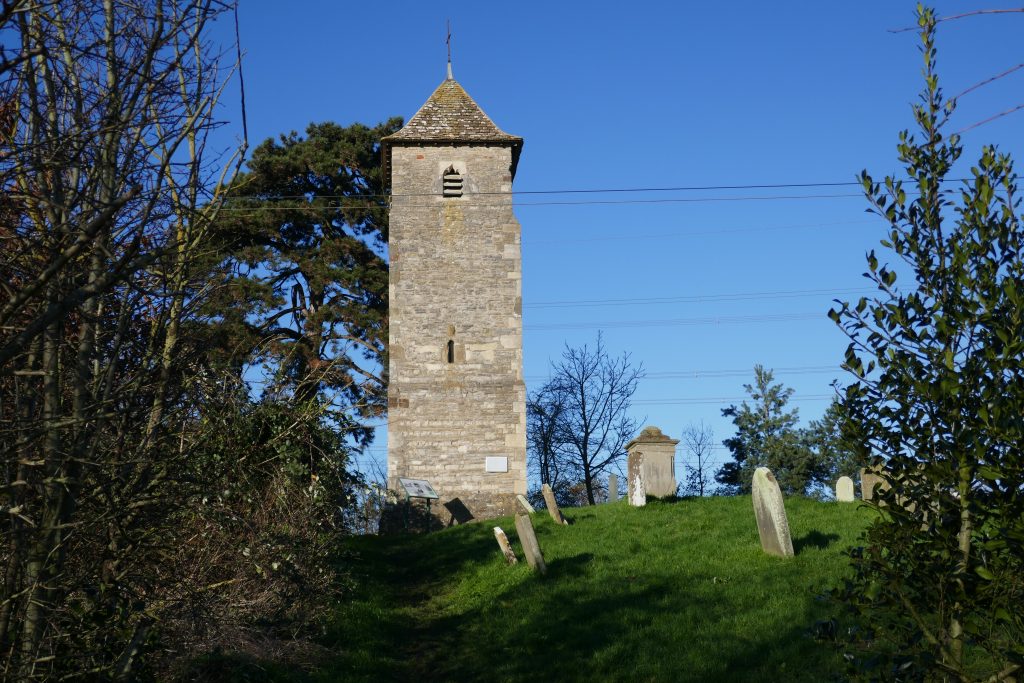
Kempley has two churches. St Edwards, built in 1903, can be visited by a footpath to the left – prior to reaching the lane – climbing the field. It has several modern sculptures and was described by John Betjeman as ‘a minature cathedral of the Arts and Crafts movement’.
Walk 120m to a footpath on the right into fields, and take this, staying close to the boundary with a narrow water course for the next 840m to a field boundary. Here bear right, to stay by the water course for another 300m to pass to the right of large farm buildings at Kempley Court. Go over a crossing track and round the buildings to spot St Mary’s church and a footbridge before it, and aim for this.
St Mary’s church contains frescos painted as long ago as 1130. The building is managed by English Heritage. It is usually found open, but check ahead if a visit is planned.
Exit the churchyard onto a lane, turn left, and after about 20m, turn right over a stile into a field. Although the instructions for the next 1.4km are a little complex, the direction of travel (NNW) is clear and constant. Follow the right hand field boundary, passing a pond, for 100m to a footbridge on the right. Over this, follow the left hand boundary for about 70m until it turns sharp left, here continue on over the field to another little footbridge ahead. Over this, continue on the same line, cutting off a small extension of field on the right, shortly to pick up a hedge on the right. After 130m, look for a gap in the hedge on the right with a footbridge, take this, and turn immediately left to pass through a steel gate and continue, now with the hedge on the left. Cross this narrow paddock and the next, with Friar’s Court large on the right. Through a porous boundary to a large field, often with an arable crop. Continue on the same line, rising up an incline, where a kissing gate in the far boundary becomes visible, if not hidden by the crop. Through the kissing gate, to cross a narrow field to a wooden footbridge over a ditch, into another field with a stile on the far side. Stay on the same line towards a gap ahead, where there is a double stile, onto a road.
Turn left and walk 780m round a bend, to a track entering St Bartholemew’s churchyard. (Alternatively, continue into the village centre where there is are pubs.) Enter the churchyard through a yew lychgate and pass an ancient cross to the famed and impressive Marcle Yew in front of the church entrance. Continue on, to exit the churchyard under another yew arch and cross a lane to a stile into meadows. Descend diagonally right to far right corner to emerge cautiously! onto the busy A449. Cross the road and take the left forking path towards an electricity pole in the middle of the field and on cresting the slight rise, spot the footbridge on the far side. Continue on the same line, now rising, towards a metal handgate. Through this, continue up the large field, now with a hedge on the left. Eventually reach a lane.
Cross the lane slightly left to a stile. Turn a quarter right, crossing the right shoulder of the ridge, and on gaining the ridgeline, spot the metal gate in the far corner, through which exit to a lane. Cross this onto a track, now with the mast looming large ahead. After 400m, pass a modernist house, The Point, cross a stile and turn left to follow the left field boundary for 100m to a stile in the crossing hedge. Over this, turn right, and follow the right boundary as it turns around the field for 300m until it reaches a driveway. Turn right and shortly emerge onto a lane where turn left, up hill. At a T-junction of lanes, continue ahead onto a strong track. After 330m, just after cresting the ridge, look for steps and a stile on the right. Take these, following the ridge line (there are paths both sides of the hedge), to pass the large mast, and reach the trig point after 1km.
Spectacular panorama. Ledbury, nestling under the Malverns to the east. Cotswold escarpment in the far distance. May Hill to the south. Hay Bluff to the west.
Continue another 880m from the trig point, along the ridge top, and descend down steps to the lane. Take a hard left, past a small car-park, and descend down the lane for 500m, passing Sleaves Oak homestead.
Alternatives
Options to end early at Much Marcle or continue on to Woolhope to obtain accommodation. Both lie on the main route.
Downloads
Introduction
Starting on the high point of Marcle Hill, this section winds its way into Hereford. For those interested in the city and its amenities and museums, there is the obvious attraction of walking all the way to the cathedral. However, some may tire of the extent of road-walking this entails – with a similar amount needed to exit the city. Two alternatives are offered.
There are pubs at
There is a pub at Woolhope and at Mordiford. Transport links into Hereford are available from nearby Mordiford (a kilometre south – not a pleasant walk! – along the B4224).
This section of the route requires the OS map of the 1:25000 series:
- OS Explorer 189 – Hereford & Ross-on-Wye
The route
From the small car-park on the top of Ridge Hill, descend down the lane for 500m, passing Sleaves Oak homestead. Find the path on the right at a point where the lane turns left, and walk down the steep hillside to a large green farm building in the valley below. Pass through two farm gates in succession to reach a track, and follow this, shortly to turn left to follow a watercourse. After 200m, reach Hyde Farm, and pass through this, staying on the track as it bears rightwards, passing the farmhouse, to reach the lane, where continue.

After 670m, after a left bend, take a stile on the right, and walk away from the road towards a footbridge visible in the fence ahead. Over the bridge, turn a quarter right and pass through the apple orchard to a stile. Over this, turn left and cross another stile, where turn right to walk diagonally right up the ridge, towards the middle of three wooden electricity poles. Beyond the pole, having reached the ridge line, look slightly right and walk to the gap in the hedge to the right of houses. Walk through this, pick up a garden boundary on the left, and shortly reach a stile onto a lane.
Turn left and walk into Woolhope, where there is a pub. Continue the walk through St George’s churchyard, passing to the left of the tower and out onto a track. This turns left behind houses, and shortly reaches a lane. Turn right and walk a few metres to a footpath on the left into a field. Cross the field to the right of a great oak, erring slightly left as it is passed to a wooden kissing gate in the far corner.
Through this, turn left and then right to follow the edge of woods for 120m to a wooden kissing gate on the left. Pass through this, and cross the stream to rise on the bank beyond. Turn right, to walk up the small valley, now with the stream and trees on the right. Pass through a wooden kissing gate to a field, and continue on the same line, passing a pond on the right to reach a gate onto a lane. Turn right, to reach Broadmoor Common, and after 550m a road junction by Haughwood Gate, where turn left.
Pass the intriguing Haughwood Gate cottage on the left. Shortly, take a track on the right into woods. Pass a wooden vehicle barrier and bear left at the fork. After only 30m fork right, away from the stronger path ahead, onto a path going up into a pine plantation (NW). The track rises steadily into deciduous woodland. After 400m, cresting the hill, pass over a strong forestry road, continuing in the same direction. At the next crossing track, 350m further, having passed through a muddy dip, again keep straight. At the third crossing (200m on), again keep straight, now going downhill on a compacted forestry road, with a vista to the west visible through trees. After another 200m (about 1.3km after entering the wood), the track is crossed by a footpath, here turn left and then immediately right down steps into a holloway. Walk down this mysterious enclosed path to reach a paddock ahead, and walk round this, with the boundary fence on the left, to reach a plank bridge and kissing gate. This gives onto a hard track, where turn right, and walk 540m to reach the Woodhope – Mordiford Road.
WITH CAUTION, turn right and walk 250m (probably best on the left side) reaching Iron House with a track to the left before. Take this down to a lane where turn left (there is an alternative to take the footpath ahead) and presently at a crossroads, turn right up a lane.
From here to Hereford, with only minor divergences, the Three Choirs Way is co-incident with the Wye Valley Walk, which is often better signed. Variances between the routes will be noted.
After passing Bagpipe cottage on the left, fork right onto a metalled lane and shortly fork again onto a track going down hill. Enter an orchard, and stay with the left-hand hedge, going downhill. Cross a trestle bridge and through a kissing gate and turn half left to follow the contouring watercourse on the left. Pass through a gate and a bridge over a culvert, and then follow the track passing right of farm buildings and then the old mill to reach the B4224.
There is an option to turn right (particularly if visiting the pub!) but the route goes directly over the road to a track. After 160m, at a T-junction, turn right to reach the B4224 with Holyrood church ahead. Turn left, to cross the River Lug WITH CAUTION for the incessant traffic. Immediately after the last span, turn right into fields, and bear up onto the flood-bank, which now follow for 1.64km. At a point about 1.5km from the bridge, the ALTERNATIVE route to Lugwardine (see below) bears off to the right along a floodbank hard by the river. Otherwise bear left to diverge away from the river towards a junction of tracks. Here, there is an option to turn left (which is the way taken by the Wye Valley Walk), to walk along roads. But the Three Choirs Way continues ahead, towards the large farm, The Court, which is 700m ahead. Cross the next small field on the same line towards gates ahead. Through these, enter a large field, and walk directly across this to gates on the far side. Through these, pick up a hedge on the right, and cross the field to a gate onto a metalled driveway. Turn left and with ornate ironwork gates ahead, look for the pedestrian gate on the left (here rejoining the Wye Valley Walk).
In the lane, turn right and walk 170m round the corner, to a footpath on the right, by an oak, which passes between garden fences into a paddock. Cross this, initially with a hedge to the left, to a gate in the hedge ahead, which gives onto the B4224. Turn right, and walk 100m to a footpath on the left, which rises onto a flood-bank. Turn right, and walk 400m along the dyke and on reaching a crossing fence, drop down to the left of the dyke, cross a ditch via a footbridge and look for the path directly ahead going to the river (on the OS, the public right of way – green dashes – is shown crossing the field at a much gentler angle: this path is not now present on the ground). On reaching the River Wye, turn right and walk 1.3km. As housing appears ahead, follow the path away from the river, through a kissing gate and now cross a quiet road in the housing estate beyond which pass through a small grass area to reach the main B4224 road into Hereford.
For the ALTERNATIVE route to Tupsley (see below) turn right.
Otherwise, cross over, turn left, and walk 1.57km, passing a past-residence of Edward Elgar, and noting the distant Lord Hereford’s Knob, visible when crossing a rise. Passing under a railway bridge, a choice of routes is available:
- The Wye Valley Way (recommended route) turns left into Outfall Works Road, but almost immediately turns right into Crozen Lane, and when this reaches a crossroads, turns left to walk along Park Street for 430m. Turn right at the end.
- The Three Choirs Way also turns into Outfall Works Road, but continues along this, until it draws level with the striking pedestrian bridge over the River Wye, where a path drops down on the right into fields. Walk away from the river, towards a gate in the far corner. Through this, turn half-right to follow the boundary fence on the right and electricity lines above. Reach Green Street and turn right, shortly passing Park Street where the Wye Valley Way rejoins.
Turn left into Vicarage Road, at the end of which, continue down an urban path to reach the river, where turn right. Shortly, the elegant pedestrian Victoria Bridge comes into view. Here bear away from the river to steps going up to Castle Green. Stay on the path looking over the river, to reach a building and walk past this on its right, go down the slope to Quay Street, which follow up to its junction with Castle Street, where turn left into the Cathedral Grounds.
Alternatives
ALTERNATIVE route to Lugwardine. [The walker will need to assess the feasibility of this route: at times of high rainfall, it may not be passable.] About 1500m after Mordiford bridge, after a steel gate, look for the path that continues along a flood-bank along the riverside. After 400m, pass through two gates and then take the further of two low bridges over the stream. Turn left, and walk on to the brick-built arched bridge over the River Lug. Bear left and initially follow the river, but look for a strong path over the water-meadows that at times has Lugwardine Church ahead in the distance. Tidnor Mill initially is dead ahead, but the path bears away to the right from this towards a kissing gate. Through this, and orientate towards a stile onto a lane, close by the left hand fence. Over this, take the lane ahead for 1.42km to Lugwardine Church, where cross into the road ahead, walk another 240m and look for the narrow path between gardens on the right, where the Three Choirs Way is rejoined.
ALTERNATIVE route to Tupsley. After leaving the River Wye, and on reaching the B4224, turn right and walk (east) 200m to a bridleway on the left, and follow Holywell Gutter Lane for 1.1km. At a road junction, with a school ahead, turn right and after 240m reach the A438 by the Cock of Tupsley pub, where proceed into the old road ahead and bear right.
Downloads
Introduction
This section leaves the city of Hereford for the more tranquil countryside beyond, ending at the tiny village of Ocle Pychard. From a cathedral to a tiny parish church.
There are pubs and other amenities through Hereford. There is a pub on the route at Lugwardine and small deviations can find shops in Withington and a slightly longer diversion will reach a shop in Bartestree.
After Withington there are few public transport services until past Ocle Pychard.
This section of the route requires the OS map of the 1:25000 series:
- OS Explorer 189 – Hereford & Ross-on-Wye
- OS Explorer 202 – Leominster & Bromyard
The route
With the cathedral entrance behind, turn right and follow the paths through the eastern entrance – the same way the grounds were entered – into Castle Street. Walk to the end and bear left into St Ethelbert Street. At the junction with Cantilupe Street, turn left to reach the busy St Owen’s Street, where turn right. Presently, reach traffic lights at the junction with Bath Street – the A438. Cross over the A438, and walk up in front of a red-brick terrace on Daw’s Road. At the end of the terrace, turn right, continuing on Daw’s Road, and then cross to a metalled path passing through a small green, with a children’s play area on the right. Reaching Central Avenue, turn right and cross directly over a roundabout and cross to the left side of the road. Reaching the Ledbury Road (the A438 again) turn left.
One option now is to stay on the A438 (not wholly unpleasant) for the next 3.5km, ignoring the small deviations discussed below.
Alternatively, continue on the A438 for nearly 700m, passing through a roundabout, after which cross to the right side, and look for Quarry Road, with a chip-shop on the corner. Walk up the hill, passing Dormington Drive on the left and turn into a path, which shortly reaches parkland. Stay close to the wooden fences on the left, and leave the parkland, via a narrow urban path between houses, to reach Church Street. Cross over, turn right and then immediately left into Winchester Avenue, which merges into Salisbury Avenue before rejoining the A438, where turn right. Cross over, when safe to do so, and walk 370m to pass The Cock of Tupsley (where the ALTERNATIVE Highfield – Tupsley route rejoins), and turn left into the old road. Which shortly rejoins the A438 to cross flood meadows to reach Lugwardine Bridge. (There are entrances into the meadows, which is Access Land, at either end of the causeway, but unless walking following an extended drought, this route cannot be recommended.)
WITH CAUTION cross Lugwardine Bridge, where there is no pavement. About 380m after leaving the bridge, turn left into Cotts Lane.
The official route passes down the road to take advantage of the Crown and Anchor public house, and continues round a right bend at the end. Pass Court Close, and find a footpath on the right, which take. When this reaches an estate road, turn left, into the cul-de-sac.
A more direct route is, before the pub, on the apex of the bend, to take the footpath on the right between houses to Traherne Close. Here continue in the same direction, and curve right into the cul-de-sac. Look right
Identify a kissing gate to the right of house number 6. Walk to the right of the associated garage to reach the gate, and then bear round a small paddock, cross a bridge over a ditch, and then bear rightwards towards a hard track that leads to a drive, with elegant houses beyond.
At the drive turn right, shortly to reach Lumber Lane, where turn right. Go down the hill, and after 110m, take the footpath on the left by a garden (where the ALTERNATIVE Hampton – Lugwardine route rejoins). Shortly pass through a kissing gate into fields. Where the garden boundary on the right ends, cross a stile on the right, and the continue in the same direction along a farm track, now with the boundary hedge on the left. After 480m the track reaches a large open field, which cross directly, following the line of wooden poles and wires overhead.
At the far side, turn left before the kissing gate and walk along the boundary on the right. Good views to the left of Sugar Loaf and Hay Bluff. At the end of the field, exit through a wooden kissing gate, through which turn left, to continue in the same direction, now with a hedge on the left. Pass over a stile into a paddock, and then a second stile by a cottage and go down the drive to a lane. Turn left passing a house, The Hyett, and turn right into the forecourt. Cross this left to an archway, through which enter fields, erring towards the left-hand hedge. When the hedge gives out, turn right to cross the field to the right boundary, and then turn left to follow this towards a pond at the bottom. Cross a footbridge over a ditch into a small field with a model railway. Over this, reach a (standard-gauge) single-track railway. CROSS WITH CAUTION. In the large field ahead, often cropped or ploughed, a hand-gate may be seen directly ahead, and cross to this. Through the gate walk down an enclosed path to the busy A4103. Turn right, passing a car-dealership and walk 300m, and take a stile into fields, just before the first house on the left.
Walk directly away from the road, and at the top of the rise, look for the stile at the top right of the field. Over this, on the unsealed lane turn left and where this bears left after 50m, look for a gap in the hedge on the right. In the field it is possible to turn left to walk round the boundary, but the path actually angles across the field towards a kink in the hedge-line, cutting off the left corner. Reaching this hedge, turn right to walk up the field to reach an unsealed lane, which cross slightly left to a stile into a field sloping down. Follow the right hedge to the end, where turn right through the boundary and immediately left, down steps to a lane. Where turn right to pass between houses. After 270m, the road turns sharp right, but here keep on straight crossing a paddock and erring right as it narrows and leads to a stile by a school. Cross this and turn left on the lane and walk 1.21km, passing over the line of the Hereford & Gloucester Canal.
After passing The Barns, turn right into a farm road to Thinghill Court, and walk 560m. After passing between two large modern barns, with a much older barn ahead, turn left into a track and after 120m, turn right with the track into a green lane. After 170m, enter a field and continue on the same line, with a hedge to the left.
Pass through a porous field boundary, and continue, now with a hedge on the right. Pass through a crossing boundary, and continue again with a hedge on the left, behind which is a reservoir. Nearing the end of the field, bear left towards the large farmhouse, to a field gate, by which exit and turn right towards the reservoirs. Shortly turn left towards a bund and walk onto the top of this and continue, passing the smaller reservoir. Drop off the bund at its end and cross the ditch ahead via a footbridge.
The line of the path goes upto the boundary around Howberry Barn, and then “bounces” back towards a gate near to the ditch just crossed. As the field is usually just grass, there should be little objection to crossing the footbridge and turning left towards the gate in the boundary, about 50m right of the ditch. Through this pass through the next field staying close to the right boundary. After 310m, pass through the crossing boundary and continue for another 640m to a stile which gives into a farm yard and then a stony lane. Follow this out to the metalled lane, where turn left.
Walk round a sharp right bend beneath large oak trees, and at the next bend, join a footpath on the right angling up the field to its top left corner. Over the stile is the small village green of Ocle Pychard.
Alternatives
The alternative routes (ALTERNATIVE Hampton – Lugwardine; and, ALTERNATIVE Highfield – Tupsley) that avoid Hereford are discussed in the previous section (Sleaves Oak – Hereford).
Downloads
Introduction
This is a lovely section through the Herefordshire countryside, which inspired the works of Edward Elgar. Although there are sections of road-walking, these are pleasant country lanes which feel very much a part of this old farming landscape.
There are no amenities along the route. There is a public transport service to Munderfield Stocks (drmbus.com).
This section of the route requires the OS map of the 1:25000 series:
- OS Explorer 202 – Leominster & Bromyard
- OS Explorer 204 – Worcester & Droitwich Spa
The route
From the green turn right, passing a Victorian postbox, and walk 980m to the busy A417. WITH CAUTION, turn right and walk 100m, and there turn left onto the metalled driveway to Cowarne Court. Walk the 1km to the farm buildings, but in the yard with the redbrick farmhouse on the right, turn left to walk round large barns. Go round the buildings, and look for the track passing a small pond on the left and look ahead to a hedge-end in the field, and walk to that. Reaching the hedge, maintain the same line, crossing to the far corner of the field, with the village in view ahead. Go through a kissing gate, through a young wood, and cross a ditch via a sleeper bridge, and turn left towards a gate into St Mary’s churchyard under yew trees.
Pass to the right of the church, and exit by the main entrance, where turn left and walk down the lane which bears right with houses and farm buildings around. Just before the track gives onto a metalled lane, bear left to stay on the track now running parallel with the lane to a crossroads. Here continue ahead, passing recently constructed houses and after 380m, take a footpath on the left into a field. Walk to the isolated beech tree ahead, and there turn half-right towards two oaks and thereafter to the bridge crossing the River Loden. Continue on the same line with the hedge on the right to a porous boundary through which continue to the next boundary, where pass through the gate. In the next field, diverge leftwards away from the boundary to gain the shoulder of a rise, and reaching this, aim for the gate ahead beyond which is the redbrick Hope’s Rough Farm.
The line of path shown on the OS map can still be followed, but much easier is to walk to the left of the farmhouse around the boundary of the buildings, and having done so, angle right towards a steel gate by a large barn next to the drive. Reaching this, turn left and walk out to the lane. Here turn left. After 420m turn left at a T-junction, and 280m later take the road to the right. Now walk 1.42km zig-zagging through an orchard and eventually emerging to pass Lower Hopton Farm and, after a sharp left turn, reaching Hopton Court.
Turn right onto the track going uphill. Reaching a gate at the top of the track, continue on the same line, with a hedge on the right over the plateau. Across the next boundary, take the right forking path, which follows the field boundary on the right to a large gap ahead. The communications mast is visible ahead. Reach a track and turn right to pass Hopton Corner cottage and stay on the track as it bears left and shortly right around a ploughed field (the OS shows the path going through the field, but staying on the track is easier) still with the mast ahead. Follow the track round till it reaches Stoke Lane.
Turn right, and walk 1.06km to a footpath on the left, in front of the house Pembroke Lodge. Cross the field diagonally, cutting off the right hand corner, to a gate. Over this, follow the right-hand boundary across two fields for 430m to reach a track. Go up this to Munderfield Court, which pass on the left. Exit onto a driveway passing across a field to the B4214. Cross the road directly, in front of a small pumping station, and take the gate on the right. Cross the field diagonally, towards two wooden poles near the right hedge. Having reached these, follow the hedge left to find a stile just before the corner. In the next large field, the line of the path may be ploughed in. But bear leftwards away from the hedge whilst rising to the crest of the ridge. Having gained the ridge, turn half-left to walk along the ridge-line to a gap in the boundary. Through this, continue on the ridge line, aiming for the left-hand end of a hedge 350m ahead. This turns out to be a sharp corner, and now follow the hedge going in the same direction travelled, keeping this on the right. After a few metres, go over the stile in a crossing hedge, and cross two large fields, continuing along the ridge-line with the hedge on the right. With barns of Upper Venn Farm close ahead, find a handgate in the hedge on the right, through this and then turn left towards the gate into the concrete farmyard. Pass to the right of the handsome farmhouse, and pick up the sealed drive, which follow for 840m to a lane, where turn left.
Round a bend, 80m on, take a footpath on the right. Angle diagonally right across the field, towards the right end of a wooden fence crossing the field and reaching this, follow the fence as it proceeds, now in the same direction as just travelled, to reach a stile. Over this, in the next field rise up a bank on the left and then look to follow a hedge line on the right, going up the hill. At a crossing hedge, go over the stile which is hard by the hedge line behind which is a gully Continue up the hill, with Lower House visible across to the right, with a fine oast house. Reach a gate by the buildings, but don’t turn right into the farmyard, instead keep on going up hill to a handgate in the top right corner. Through this, rise up to the field on the right, and turn left to resume the same direction up the hill, now with large farm buildings of The Hawkins ahead. Aim for the right-most pole in front of buildings, reaching this, turn left towards a further pole. Pass through two gates to reach the farmyard, and continue straight on, passing the farmhouse on the right. Don’t take the driveway going left, instead turn hard right to pass in front of the farmhouse, to reach the lane at Stanford Bishop. For the church of St James, turn right, to continue on the Three Choirs Way, turn left.
Downloads
Introduction

Another rural section passing from Herefordshire into Worcestershire. The route crosses Ankerdene Hill, which affords fine views of the flat country of the West Midlands.
The Cross Keys pub at Suckley is on the route as is The Talbot at Knightwick ( https://the-talbot.co.uk/ ). Some sustenance might be purchased at Knightwick Butchers ( https://knightwickbutchers.com/ ).
The 423 bus route runs between Worcester and Suckley (see https://lmstravel.co.uk/ ). The 420 bus route runs along the A44 between Worcester and Bromyard (see https://www.firstbus.co.uk/worcestershire )
This section of the route requires the OS map of the 1:25000 series:
- OS Explorer 202 – Leominster & Bromyard
- OS Explorer 204 – Worcester & Droitwich Spa
The route
Having passed through the Hawkins and reaching the lane, turn left. If starting from Standford Bishop church of St James, at the end of the driveway, turn right and walk 140m to the entrance to the Hawkins, where continue. Walk 880m to the B4220, where turn right. Walk 170m, passing a homestead, and take a footpath on the left into a field. After 250m, look to drop into a green lane on the right, continuing in the same direction to a lane. Turn left and walk 170m to a footpath on the right, through a gate, into a field.

Stay, by the left boundary to reach a stile in the crossing fence, over a greenway, and then a handgate into the next field. Cross this, maintaining much the same line, to an inconspicuous stile about 70m to the right of the left corner. Continue on the same line, but now with a hedge on the left with ponds behind. Reaching a crossing fence, turn left passing through a gap over the line of the ponds’ egress. In the next field, turn half-right and rise up to reach the top right corner, where reach several gates. Go through the one in the boundary sloping down to the stream, and continue so as to keep the hedge on the left and the stream below the slope on the right, thus cross the long side of a narrow field, eventually dropping down at the end to a footbridge. Over this, continue up the hill (the indistinct field boundary is on the left which is not as shown on the OS) for 100m to a crossroad of paths, where turn left into the copse and look for a handgate at the top of the hill.
Through this, the view ahead now opens up. Turn left to a stile and in the next field, cross along the top and at the corner turn right, to walk down the hill, with trees on the left. On reaching a crossing track, with the Old Yearsett farmstead to the left, cross left over the ditch, and then enter the green lane on the right to continue in the same direction of travel. Continue on the lane for 440m to a gate into a field. Err to the right of a line of trees going away ahead, and go up the steep slope to a stile to the left of a steel gate at Upper House.
Over the stile cross the hard ground and shortly turn left into a track opposite a corrugated steel barn. After 180m, with a gate (beyond which is a lovely homestead) turn right through a holly arch and over a stile. Turn left to round the field ahead, but after 50m find a stile on the left and cross this into a paddock. Cross this, close by the right-hand boundary, and after a gate, continue on the same line up a steep hill towards farm sheds. Look for the track through the buildings on much the same line, which shortly gives onto the lane at Suckley Green, where the Cross Keys pub is 10 steps to the left.

Avoid the path directly across the road, taking a few paces to the left to find a path opposite the pub. Angle left down the field, shortly to pick up a boundary hedge on the left. In the far left corner pass through a gate, and bear slightly right to cross to the far right corner of the next field. Cross through the boundary, and then stay by the right boundary for 70m to reach a stile on the right, which cross, and follow the path diagonally towards a red-brick house on the lane at Suckley Row.
Turn left, and walk 530m along the road, crossing the line of the old railway (remants of the old station can be seen in a garden on the right). Turn right before a large red-brick house, and walk 170m further, to find kissing gate into a footpath on the left. The path diverges slowly from the road towards The Old House, here the line of the path varies slightly from that shown on the OS, in that it passes to the left of the leftmost outhouse to find a hidden stile into woodland. Initially the path contours above the coombe, then drops steeply towards the stream where it may be muddy. Having crossed the stream, rise towards the edge of the woodland, where there is a gate ahead. Don’t take this, look for the gate on the left into a field, and cross the field towards the red-brick Coronation Cottage, about 110m away.

Cross the road, and take the track on the right of the Cottage towards the large Knightwick Manor. Here turn half-right, to follow a boundary on the left. But where this turns half-left after 220m, the walker needs to turn half-right to cross the field towards a deer-proof gate in the far hedge that gives back onto the road recently crossed. Cross the road directly, turn half left to walk down to a stream, which cross by way of a concrete culvert, and then rise towards the small Knightwick Chapel of St Mary and St Andrew, directly ahead. Pass into the churchyard, and out onto the lane via the lychgate, where turn left. Walk 280m to a T-junction, which cross to a stile into a field. Turn half-right, and walk along the shallow valley, towards a right angle in the boundary, which pass to pick up a hedge on the right, to reach a crossing boundary. Through this, cross the next field to the busy A44. Turn right.

With care walk about 130m to the minor road angling off to the left in front of a farm-shop. Shortly reach the pedestrian bridge over the River Teme and over this, reach the Talbot Inn and then a shoulder on the B4197. Carry straight on, walking up the hill passing the old church and old school and beyond the point where the footway ends. About 350m from the Inn, before a house find a well-signposted track on the right into the woods. (The Worcestershire Way and GeoPark Way are both coincident with the Three Choirs Way through these woods, and are better signed.) Follow the path close to the gardens below, but where it forks after about 220m, turn right to rise more steeply up the hill. At the next switch back after a further 140m, again fork right to continue steeply up hill. Shortly pick up a garden boundary on the left, and then emerge onto a track at the ridge, where turn left.
After 220m walking along the ridge track, before Willow Cottage on the right find a footpath to the right of the cottage and take this. (Here leaving the Worcestershire Way and GeoPark Way.) The path descends, with fine views opening ahead, and widens into a track. On reaching a brick and clapboard barn, look for steps up to the left, to pass behind the barn along the hillside. Shortly, on reaching woodland, turn right through a field gate and descend the large open field towards the valley bottom. Bear rightwards as ponds in the valley come into view, to reach a gate onto a metalled driveway. Here turn left shortly reach a lay-by on the A44 by Bannersbrook Farm.
Avoid the footpath on the left going back into woods, but take the footpath a pace or two further on that goes into Bannersbrook farmyard. Pass between the farmhouse on the right and farm buildings on the left and up a ramp through a field-gate into fields with woodland on the left. Follow the left hand boundary, and when this gives out after about 200m, continue on the same line towards a hand-gate in the crossing boundary ahead. Through this hand-gate, turn half-left walking up hill towards a gate, which is a little to the left of a cream coloured house, onto Easinghope Lane.

Turn right, and shortly take the right fork walking downhill to Doddenham. After 800m, at a T-junction, turn left, but shortly find the footpath on the right. Here be sure to bear left away from the track towards farm buildings and into a field with hedge on the right towards a shallow valley. Walk up this shallow valley (which will be muddy in times of rain) to a gate, which pass through, keeping the same line to a right-angle in the hedge ahead. Here walk to the left of the angle, to have the hedge on the right. Pass through a crossing hedge and continue on the same line, under power lines to a galvanised steel gate on the far side, which gives onto a lane.
Turn right, and after 90m take the track on the left which roughly parallels power lines above. At a cross hedge continue through on the same line, now on a path with woodland on the left. When the woodland boundary turns left, stay on the same line cresting the hill and then descending via a stile to a stream, which cross over a footbridge. Rise up to a field boundary, where turn right and shortly reach another boundary, where turn left and walk to the lane at Broad Green.
Downloads
Introduction

This section passes the Elgar’s birthplace museum to reach Worcester. Many walkers will choose to pause at either or both, so this section is written in two parts: the first to Worcester, the second on to Stanbrook Abbey. The section of urban walking in Worcester is either on quiet roads or along the Severn, which is full of interest. An alternative route, avoiding Worcester, is available.
Directly on the route, there are few amenities before Worcester, although there is a cafe at The Firs, Elgar’s birthplace. Worcester has all the amenities of a city, including transport links. The footpath passes a Toby Inn, just before Carrington Bridge, and it is possible to divert into Powick after crossing the Severn. At the end of the section is Stanbrook Abbey Hotel and nearby in Callow End is the Old Bush pub.
Various buses run between Broadheath and Worcester.
There are lots of transport links within the city of Worcester, including a railway and bus station.
Bus 363 runs to Callow End.
This section of the route requires the OS map of the 1:25000 series:
- OS Explorer 204 – Worcester & Droitwich Spa
- OS Explorer 190 – Malvern Hills & Bredon Hill
The route
Part 1: Broad Green – Worcester Cathedral
Having reached the lane by the Severn Water station, cross over and proceed along the stony track that crosses the top of the green. At the lane on the far side, in front of the house, Peartree House, turn left and walk along the metalled lane, which shortly becomes a stony track. About 120m after the last house, before passing through gates on the lane, turn right to a stile into a field.
Walk across the field, away from the lane, with the boundary on the left. Meeting the crossing hedge bear right, but after 70m look for a hidden path on the left through the thick brush. Take this and hack through the boundary to reach a meadow on the far side. Turn left to walk along the left field boundary, and maintain this direction for 760m through a crossing fence (not shown on OS), then a thick hedge, then two stiles into and out of a narrow field. After the final wide field, pass through a hand-gate, and turn right down a greenway, passing to the right of the tumbledown Blackfield Cottage.

Reach a galvanised gate in a crossing boundary, but don’t pass through, instead turn left, keeping the boundary on the right to a handgate 50m away. Continue through, crossing the next field with the boundary on the right to a double set of stiles. Through these, the line of the path crosses the next large field, parallel to the hedge on the right, towards a lightening struck oak on the far side, about 300m away. (However, if the field has been ploughed in, it may be pragmatic to turn right and follow three-sides of field boundary round the field edge to the hand-gate in front of the lightening-tree 300m away.) At the far side of the field, cross a small footbridge and stile, then continue on the same line past the lightening-struck-oak towards the corner of a small copse ahead.
Pass this corner to the right to reach a field gate, through this continue over the next field, with the boundary now close by on the left. After 330m, cross a trestle-bridge and stile into the next small field, which cross on the same line to a handgate on the far side. Cross the next field staying close to the left boundary. At the corner, don’t pass through the gate ahead, instead go through the gate on the left, then turn right to a handgate and pass through that. Continue walking in the same direction as hitherto, but now with the hedge on the right. After 170m pass through a field boundary, and continue with the hedge on the right, which shortly turns half-left and after 200m reaches another boundary. Through this, now angle half-left to mount the hill ahead towards a red-brick house. Soon the fieldgate in front of the house comes into view and make for this.
Through the gate onto a lane at Broadheath, turn right. Walk 720m along the road, going over a cross-roads and passing the now closed Plough Inn and the entrance into The Firs, Elgar’s birthplace. Just past The Firs find a stony bridleway on the left, which take (unless the walker is preferring the alternative route, avoiding Worcester, in which case see ALTERNATIVE section, below).

After 700m, be sure to fork off right from the track onto metalled lanes, to pass in front of Oldbury Farm. But continue ahead in much the same direction, now with Worcester ahead, onto a partially metalled bridlepath. After a further 690m the path reaches Oldbury Road. Continue for a further 2km, entering into suburban Worcester until the busy crossing Henwick Road, is reached. Cross this to the pedestrian lane, Holywell Hill ahead, and descend this to Hylton Road, which cross and turn right to pick up the footpath by the River Severn. After 260m reach the Sabrina footbridge, which cross, turn right and continue to follow the river downstream. Walk a further 1.05km, crossing the busy A44 in front of Worcester bridge, to reach the Portway which leads up to the Cathedral. City centre amenities are hard-by the Cathedral precincts.

Part 2: Worcester Cathedral – Stanbrook
From the Portway continue to follow the River Severn downstream. After 590m, reach the entrance into the Worcester and Birmingham canal, with several locks visible to the left. Continue another 290m to reach the pedestrian bridge over Diglis dock, and take this, keeping the river on the right. After 400m, having passed the lock on the Severn, don’t take Diglis Bridge which crosses the river, but keep straight on staying on the left bank, but now moving into scrubland. After a further 510m, meeting a tributary stream, stay on the strong gravel path and deviate left slightly to a wooden footbridge over the stream, which having crossed turn right to return to the River Severn.

After a further 1.35km, having passed through a former caravan site, Carrington Road bridge looms large above. Before reaching the bridge, look to turn hard left in front of the site-office to reach a footpath going up the bank. Follow this up to the Toby Carvery, and emerge onto the A34 Worcester Road. Turn right and walk towards the roundabout, but bear round to the right towards the bridge, which cross. On the far side of the bridge, turn hard right to take the slip-road down towards the river and cross the boundary via a stepped stile. Turn right to walk under the bridge, and pass over the slip-road going back up to the A4440. Follow the fence ahead for about 10m to a field gate on the right, and pass through this into Access Land.

Look up to the Malvern Hills in the distance and orientate towards the saddle between the two peaks. Below this point, about 400m across the meadow is a gate, make for this. Through the gate, bear slightly right and walk towards the top of the field, meeting a stream on the left and nearing powerlines overhead on the right. Pass through a field gate, exiting the Access Land, and in the next long field, the easiest crossing is to turn left along the field boundary, shortly to turn right to follow the stream for about 620m (the field boundary shown on OS after about 250m is not discernable on the ground). With a pylon ahead to the right, look out on the left for a path leaving at a right-angle, and take this, shortly to cross a wooden bridge with a brick sluice gate beyond.
Enter into an enclosed track, with sewage works on the right. Emerging from the path at a crossroads of paths, turn half-right to take the wide middle path towards Kings Croft cottage, ahead. Just before the cottage, turn right over a small footbridge over the ditch, then turn left to continue in the same direction, now with the hedge on the left. Follow this round a half-left turn to a crossing hedge, which pass through and continue in the same direction, with a mobile home park away to the right. After 240m, cross the boundary, and angle slightly right towards a stile onto the busy B4424. The Way continues into the footpath ahead, which is just left of the entrance into the Stanbrook Abbey Hotel.

Alternatives
For those wanting to avoid walking through Worcester, an alternative route has been devised, which is a similar distance. A description of this route will follow, but it leaves the main route just past the Elgar Centre, The Firs, at Broadheath. It rejoins near the sewage works, south of Powick. The route is available as a GPX download, below.
Downloads
Introduction

This section walks into the charming town of Malvern and leaves via the stunning Malvern Hills. This involves a spectacular ridge walk and extended sections with views both east and west. Here is a true cathedral of light, air and landscape that leaves any heart singing in delight and wonder. Enjoy.
Bus 363 runs to Callow End. Malvern has various transport links, including a railway station. Bus 675 runs to Upper Wyche.
There are few amenities prior to Malvern. The described route through Malvern actually passes few shops or pubs, but clearly small deviations will access town centre amenities. In the Enigma Business Park (entering Malvern) pass a Colston Bakery and then the Morgan Experience Centre. And at the top of Link Common find The Nag’s Head Public House. At Wyche there is The Wyche Inn and Cafe H20. At British Camp, find The Malvern Hills Hotel and Sally’s Place, a small al fresco cafe.
This section of the route requires the OS map of the 1:25000 series:
- OS Explorer 190 – Malvern Hills & Bredon Hill
The route
Having crossed the B4424 Upton Road, take the footpath ahead, which is just to the left of the entrance to Stanbrook Abbey Hotel. Cross the field ahead, staying close to the hedge on the right (and possibly taking the opportunity to peep through it at the hotel). At the end of the field, enter an enclosed path between redbrick walls and emerge onto a lane between two octagonal lodges. Turn right. After 260m, where the lane curves left into driveways, keep straight on into an enclosed track. Keep on for 360m to where the track opens onto a stony driveway with Henwick Cottage ahead. Take the left fork, passing the cottage on the right, and after 160m, with the redbrick house, Mount Henwick ahead, take the diverted footpath on the right. Emerging from this at a stile, take the left-hand fork going downhill for 350m through paddocks. Reaching a high field gate, take the handgate to its left into Access Land.

The objective is to reach the concrete trigonometrical beacon 430m due south of the entry point. To this end, continue on much the same line, walking first to the left of a clump of gorse, and then bearing right, up hill. On reaching a more open section, look left and up hill to see a bench in front of an oak, and walk to that. Pause here to take in the fine views in several directions, then walk on, parallel to the trees on the right, shortly to spot the beacon ahead, which walk towards. Just prior to the beacon, turn hard-right downhill. About 50m on, be sure to branch right onto a lesser track into woods, still going downhill to reach a boundary fence and a handgate to the left of a couple of ancient oaks. Through the gate, walk forward for about 15m, and just past a lightening-struck tree, look left to a handgate and a path crossing an open fields to a coppice beyond.

Walk across the field, enter the coppice and follow the path through. Exit the woodland over a stile and pick up a path in the same direction, with a hedge on the left. Reach a stony track, where turn left to cross a stream via a concrete culvert, and then turn right to follow the stream on the right with fields on the left. Cross two large fields. After entering a third field, cross over a stile to place the fence to the right, between the path and the stream. Now orientate towards a solitary dying oak in the field ahead, and reaching this continue to diverge from the stream to a kissing gate on the left of the far fence, ahead.
Go through the kissing gate, and ahead onto gravel lane, and descend to pass under two small arches carrying Madresfield Estate roads. On meeting a metalled driveway, bear left, and continue, eventually meeting the road by the Lodge, with its splendid chimney. [See alternative route, below.] Cross and turn left, and after 90m take the footpath on the right. Walk away from the road, cutting off the corner on the right, and bear right round a fence through a handgate and continue, now with a hedge on the right. After 200m, pass through a crossing boundary, and continue in the same direction, and 140m further enter through a handgate into a copse. Through which, reach a lane.
ALTERNATIVE ROUTE through Madresfield. There have been persistent reports of frisky cattle along the advised route. No problems noted, but if you want to avoid these, on meeting the road turn right and after 100m take the left fork onto a minor road. Walk a further 90m passing a club house, and then go into its carpark and take the permissive path for 230m which rejoins the main route, where turn left.

Cross the lane directly to a footpath and continue crossing the stream via a buried culvert, and then go uphill to pass in turn a handgate, a kissing gate and then a stronger crossing track. Keep on to reach the busy B4208 Townsend Way which marks the edge of Malvern. With care, cross slightly left to a footpath that enters the Enigma Business Park. Walk 180m with a haulage depot to the right, to reach the crossing Betony Road. Cross this directly to a footpath, and continue for 140m, passing two large metal sided buildings. At the end of the second, where the path forks, go left and walk a further 80m to a T-junction of paths, where turn right. Walk 80m further, to reach Spring Lane, where turn left.
Walk 260m (passing a Colston Bakery on the right – the only food-shop directly on the route through Malvern) to where the road turns right, but here bear off to continue straight-on in the same direction. Shortly pass the Morgan Experience Centre, a possible stopping point for car-nuts, although it also has a cafe, and then reach Pickersleigh Avenue. Cross this and turn right and after a few paces turn left into an urban footpath between houses. Take this, walk 120m to Russell Drive, which cross and continue another 130m to Pickersleigh Road, which cross to the parkland ahead. Walk ahead, passing a circular bench round a hawthorn tree and enter into woods.

Proceeding, bear slightly left, looking to drop into an underpass that continues under a small arch carrying the Hereford-Worcester railway. Beyond the arch, the path continues more strongly and after 340m, reaches a minor road with a small car-park beyond. Follow the path leaving the left side of the car park and rising up the hill ahead, to reach a crossroads. Cross over, continuing uphill into Moorlands Road, but shortly bear off left into Bank Street, which is just left of The Nag’s Head Public House. Walk 280m to the junction with the A449 Worcester Road, where bear left and look to cross when safe to do so. Walk 260m to an entrance on the right marked for house numbers 59,61,63, turn right here, and immediately take the flight of steps going up steeply into woodland.
Gerry Stewart’s Three Choirs Way guide has this to say about the route through the Malverns:
It is difficult to describe or recommend any particular route along the switchback of the Malvern Hills in detail. The open grassy contours have many paths and tracks at different levels which allow routes to be chosen at will (p83).
Indeed, there is no marked route on the OS between Worcester Road and British Camp. This said, navigation is relatively easy. The Malverns run in a clear north-south direction, and the task is to pick up one of the many clear paths taking one in the direction desired.
A good option is to seek to attain and then hold the ridge line as best as can be achieved. This gives stunning views to both right (west) and left (east). Taking this route adds a little distance and ascent, but the rewards are immeasurable.
Go up the steep steps, and pass the communications tower on the right. Shortly reach a hard-left turn and take that. Reaching a strong crossing track and junction (at SO 77407 46416), look to take the path angling right up-hill. Reaching a T-junction with a contouring track (at SO 77342 46547), turn left. Just before reaching Ivy Scar Rock (marked with a post with grid-reference SO 7732 4637), turn hard-right to the path angling uphill. After about 360m, this path switches back a couple of times, and then turns southwards, for about 260m, eventually meeting another contouring crossing track at SO 77216 46456, with a wooden post showing various Malvern trails.
Here there is the option to turn left (and so southwards), following Lady Howard De Walden Drive, contouring to the east of North Hill (and so is shorter and has less ascent). However, the ridge route turns right, to walk 170m northwards, to find a minor path on the left going steeply up the hillside of North Hill. Take this and, as the gradient lessens, hold the ridge to reach the summit about 340m further on.

From the summit, look right to nearby Table Hill, and follow the clear path 250m to that summit. Having gained this, turn left, again following a good path 660m down to a saddle and then upwards to the top of the elongated Sugarloaf Hill. From here, drop down slightly leftwards to the confluence of tracks at circular stone plinth, where the Lady Howard De Walden Drive also arrives. The path from here to Worcestershire Beacon is unmissable. And beyond that, there is a clear path to the top of Summer Hill, some 500m on. (OS Map users will note that the line of the Shire Ditch – often observable more as a dyke – is often the best one to take in order to hold the ridge-line.) From Summer Hill, continue southwards for about 850m, and as car parks and Beacon Road become visible through trees on the right, follow the path as it drops to the road, where turn left, shortly to meet the B4232 Wyche Road.

Cross over to concrete steps which are to the left of a cast-iron Belvedere (behind which are toilets) and walk up the side of the hill to regain the ridge. Now again, orientate towards the high point of Perseverance Hill, ahead, and make for that (720m from the road). From here, simply follow the ridge 550m southwards to the minor Jubilee Hill. Here, still hold the ridge line, bearing first a little right and then adjusting left, to reach Pinnacle Hill after 450m. Stay on the ridge for another 775m to reach Black Hill. Now walk down the ridge for another 900m, to pass well-hidden houses on the right and with woodland ahead. Angle right down the path towards the B4232 just by the Malvern Hills Hotel, where turn left, shortly to reach the A449 with the British Camp car park beyond.

Alternatives
As discussed above. There are numerous alternative routes through the Malvern Hills. Navigation is relatively straight-forward, given the topography of the hills. The walker just needs to avoid taking paths that angle down off the hill prematurely. The alternative route, avoiding climbing North Hill at the start of the Malverns, is identified in the main text.
Downloads
The alternative GPX files reflect that there is no fixed route through the Malverns. However, the Malvern-British Camp route is the recommended line for this section, taking in North Hill and thereafter following the ridge-line as much as possible. The longer Malvern-Hollybush file follows the same route, but extends this for the full length of the Malverns.
Introduction

This is the tail of the Malverns, passing the mysterious and ancient British Camp atop Herefordshire Beacon. Thereafter the route enters a pleasant undulating agricultural landscape, returning to Gloucestershire. The route ends at the old Chartist Town of Staunton.
The 351 bus runs (infrequently) between Corse and Gloucester. Otherwise this section of the route is poorly served by public transport.
There are few amenities between British Camp and Staunton-Corse. At British Camp, find The Malvern Hills Hotel and Sally’s Place, a small al fresco cafe. At Corse there are various shops, a Garden Centre and a community hub.
This section of the route requires the OS map of the 1:25000 series:
- OS Explorer 190 – Malvern Hills & Bredon Hill
- OS Explorer 179 – Gloucester, Cheltenham & Stroud (only for the last kilometre)
The route
The first part of this section is through the remainder of the Malvern Hills. Unlike the earlier northern section, the Three Choirs Way route has been precisely described, and is shown on OS Maps. However, following the approach through the northern section, an alternative route is offered, that more closely follows the ridge line to Hollybush.
Original British Camp – Gullet Wood: Take the steps sign-posted to British Camp on the right of the British Camp car park. Shortly, the path forks up hill towards British Camp, but take the left fork to take the more gently rising path. Continue on this for about 1km, with the British Camp fort above, and a reservoir below. Reach Broad Down, where the path from British Camp rejoins from the right, at a stone plinth. Continue southwards along the ridge line, but shortly, bear off slightly right to pick up a path that runs just above the treeline. Follow this for about 400m until it dips through the trees to a crossing track junction of paths. Here take the right path going along the ridge line up Swinyard Hill for about 240m (don’t be misled by the OS Map which apparently shows an earlier fork right) keeping a sharp eye for a hidden path angling off to the right. Take this, which descends, diagonally crossing the gradient, eventually reaching the strong forest track shortly before the gate and handgate into Gullet Wood.
Alternative (high-route) British Camp – Gullet Wood: Take the steps sign-posted to British Camp on the right of the British Camp car park. Shortly, the path forks right up hill towards British Camp, take this, finding a metalled path all the way to the summit. Here, bear leftwards, following the good path which crosses ancient battlements to Millenium Hill. Follow the line of the hill southwards, eventually bearing off slightly left to well-constructed steps down to a circular stone plinth with signs. Here turn slightly right, and follow the ridgeline, often marked with ditch and/or dyke to the minor Hangman’s Hill. Descend this, and shortly bear right to pass through trees to a crossing track junction of paths. Here take the right path going along the ridge line up Swinyard Hill. Just past the summit, is another concrete plinth, and here take the right path (sign-posted Midsummer Hill) and in a few paces take the right forking path, to descend through woods to a forest track, where turn left to the gate and handgate into Gullet Wood.
The routes rejoin at Gullet Wood.

Follow the strong track for 590m to emerge from the woods at a cross roads of tracks. Go straight ahead, rising up hill. After 600m pass Castle Copse Cottage, where continue straight on the now metalled lane. After a further 700m reach the A438, where cross and turn left, walk 240m down the hill to a driveway on the right (just before an old phone box) marked to the Old Post Office, UnderThe and Rag Stone cottage, and take this, shortly to ascend steeply. After 150m, where the driveway turns right into the final house, bear off left onto the strong footpath contouring the hillside through woods. After 360m, look out for a path on the left angling downhill to a handgate, through which continue to a second handgate and into an open field, which cross diagonally towards a clump of trees by a crossing track. At the track turn right and after 150m enter mature woods. Continue on this contouring track for a further 1.11km to a track on the left entering a field, on the far side of which are old farm buildings. Cross the field keeping close by the right hand boundary (notwithstanding the line of path shown on OS map), walk to the left of the small brick building and reach the lane, Chase End Street.

Turn right and walk 400m, passing red-brick Hawthorns and a road going left. As the road bears right, turn left through a wide gap into a field. The path diverges slightly from the left-hand field boundary, but if the field is cropped or ploughed, it will be easier to follow the boundary away from the road and then for 20m further after it turns right to a gap in the hedge. Now enter a field of scrub and brush, where be sure to turn immediately right to follow the right-hand field boundary ahead (any other route quickly becomes blocked by vegetation). In the top right corner, reach a wooden bridge, which cross into a wide meadow. Look up to the higher ground ahead with a solitary oak (that marks the corner of long-disappeared field boundaries), and make for that. Gaining the high ground, find a stronger track towards the gate onto a lane.
Turn right towards the cluster of homesteads at King’s Green, and after 200m, having passed The Old Stable take the footpath on the left along a track into fields. Just before a gate at the end of the field, turn right to a stile, which cross and then follow the hedge on the right across first a small field and then a longer one. At the end of this, in a large field, observe the house ahead and just to its right a fieldgate onto a Cook’s Lane and make for this.
At the lane, turn left and walk 670m to a right turn, which take. Walk 660m to Pendock Road, where turn left, and 80m on find a footpath into a field on the right. Be sure to take the rightmost of the two diverging footpaths. Depending on whether the field is cropped or ploughed, it may be easier to turn hard-right to follow the field boundary to meet a stream (Wynd Brook) which then turn left to follow on the right. At the crossing field boundary, walk away from the stream for about 20m to a gate, through this, and then turn right back to the stream, and repeat this process in the second field, again reaching a crossing boundary and turning away from the stream to find a gate. However, here don’t pass through the gate, but continue to follow the boundary on the right (away from the stream) which turns left shortly to reach a handgate onto a footbridge. Here turn to rise up the hill, with the boundary on the left, and shortly reaching the hill crest, turn right to walk along the minor ridge with the hedge on the left.
Walk through the field and the next, directly towards the redbrick Dobbshill Farm, and emerge onto a lane, where turn right. After a few steps, turn left into the farmyard, and pick up the separated footpath on the right of the track. Follow this path as it bears right and continues along the ridge, eventually opening into a large field. Continue along the ridge with the hedge on the right, and cross two large fields. At end of the second, pass through a handgate, and in the open field ahead, turn left, dropping off the ridgeline, to follow the left hand boundary to the far left corner. Pass through the right of two fieldgates. Continue ahead with the field boundary on the right.
Cross directly over a lane into the field beyond, and continue in the same direction, now with the boundary on the left. Pass through a handgate onto a stony driveway, where turn left and after 20m, turn right into paddocks. Take the rightmost path, running parallel with the woods to the right up the hill to a gate on the high ground. Through this, continue on the same line to a gate just to the left of the woods, and through this, pick up the track running with woods on the right. When the woods end, cross right over a stile into the next field, then turn to resume walking in the same direction as hitherto with the hedge now on the left. Reach a lane, where turn right, passing the entrance to a house and straight-on into a grassy lane. This swiftly narrows to a path, but soon emerges onto a field, where turn left on a bridleway into an enclosed track.
On reaching Moat Lane, turn right and shortly arrive at the busy A417 Gloucester – Ledbury Road, at Staunton.
Turn left but after 70m, just past a minor junction on the right, find the entrance into an enclosed footpath over a bridge. Follow this, to emerge at the end of the cul-de-sac of Cullingham Close, and follow the road to a T-junction with Chartist Way, where turn left. Follow this to its T-junction with Prince Crescent, where turn left again to meet the A417 Gloucester-Ledbury Road.
Alternatives
The alternative ridge-line route through the Malverns (over British Camp) is discussed in the text and is recommended.
Downloads
Introduction

The home-stretch for the clockwise walker. The walk is through rural Gloucestershire along old footpaths and bye-ways. Eventually the route joins with the great Severn River in its tidal reaches. Walkers will need to determine which is the best alternative route, based on how wet is the land. Walk along the river, if possible!
The 351 bus runs (infrequently) between Corse, Ashleworth, Maisemore and Gloucester. There are many transport links in Gloucester, including a railway station.
At Corse there are various shops, a Garden Centre and a community hub. At Ashleworth there is a community hub, which serves meals and snacks. There is a pub – The White Hart Inn at Maisemore. Gloucester has the shops and amenities of a city.
This section of the route requires the OS map of the 1:25000 series:
- OS Explorer 179 – Gloucester, Cheltenham & Stroud.
The route
At the A417, turn right, walk 150m, and turn left into School Crescent. Walk the 440m to the end of this lane, noting the Chartist homes along the way. Over a stile, enter a field, and walk to the far left corner, ahead (likely round the field boundary, if cropped). Pass through the boundary, and keep on the same line, with the hedge on the left, to a stile-bridge. And over this, walk to the right of the hedge ahead, and continue to a small knuckle in the boundary, over which bear slightly right, now following the hedge on the right, with a ridge ahead. The field narrows to the right of a small reservoir, and cross into the next field, which cross to the far right corner and exit onto the B4211.

Cross directly, and walk directly over the next field towards the ridge ahead, and then up the steep slope through trees, to gain the ridgeline. Turn back to take in views of the Malverns. Find the gate and stile in the top left corner, and over this, descend the ridge – now with views of the Cotswold escarpment – staying with the hedge on the right. About 90m further on, cross through the hedge, and continue to descend to Hasfield Road. Turn right, walk 110m, then turn left into Ivy Cottage, and take the path on the right of the driveway and garden. Enter a field, which cross, staying by the left boundary and turn a few steps right at the end to a stile, into a wide boundary, and a second stile. In the next field, keeping the hedge to the left, continue downhill to a steel gate, after which, following the line of electrical wires overhead, continue to another steel gate ahead. Through this, follow the garden boundary on the left to a stile onto Wickridge Street.

Turn right, and walk 150m to a wide bridleway on the left, which take. After 370m pick up a cinder track and 140m further, at a fork, bear left on the stronger track, passing the ruins of Foscombe Farm on the right. After 380m, pass through a wide gap in the field boundary, that is over a hidden culvert over a stream. Continue, but after 120m further, turn left to recross the stream, and then turn right to follow it, now on the right. Walk 500m through meadows, and then take the right forking path, crossing the stream. Ascend through a short field to a wooden kissing gate, where enter a sports field. The path runs along the right boundary and turns left at the top – but the field can be crossed diagonally to the pavilion. Just past this, be sure to take the footpath on the right, soon to reach Sawyers Rise, where turn left, and left again when this meets Nup End. Follow this to a T-junction, with Ashleworth Hub ahead.
The season of the year, and conditions underfoot will influence the choice of route from here to Gloucester. The dryest but least satisfactory is to follow the National Cycle Route 45 signage. Which involves taking the road to Hartpury, where turn left, walk a few metres along the A417 then turn left again into a minor road to Woolridge and Maisemore. Having crossed the Severn at Maisemore, pick up the metalled cycle route hard by the Severn that runs to Telford’s Bridge and thence to Gloucester.
Preferring footpaths, there are two clear alternatives. The first is the formerly designated main route. The alternative (which is recommended if feasible) is to follow the riverside to Maisemore, where rejoin the old main route. These are now described.
Former main route to Maisemore. Turn right in front of Ashleworth Hub and walk through the village, after 280m bear right, passing the cross and village green on the left; and after a further 370m, having walked through two right-angle turns, at a fork turn left into Longridge Lane. Follow this 1.15km to its end past Longridge Farm, where enter fields. Cross the first field close to the left hand boundary, and in the second, angle half right to cross diagonally to the far right corner (the landowner has erected fences here to usher the walker along the left hand fence). On reaching the riverside turn right. After leaving this field, cross two large fields, walking 930m. At the far side of the second field, turn right following a deep ditch on the left away from the river. At the top of the field, bear leftwards into a track which shortly becomes a metalled lane, and continue for 1.85km to reach the A417 at Maisemore.
ALTERNATIVE ASHLEWORTH-MAISEMORE riverside route (recommended). At the T-junction, pass to the right of Ashleworth Hub down a stony track, and take the footpath on the right at its end. Spot the Tithe Barn, about 750m away. Cross a series of small fields, and after 310m reach a crossing footpath beyond which is a homestead. Turn right towards the lane, but shortly, turn left into a footpath through a paddock. Reaching the lane, turn left, and shortly turn right at the black-and-white signpost to The Quay (also signed to the Tithe Barn). Now follow this lane 550m, passing Ashleworth Court, the Tithe Barn and eventually the now closed Boat Inn, to reach the River Severn, where turn right. Walk 3.74km along the river (coincident with the better signed Severn Way, to its division into east and west channels at the start of Alney Island (where the path turns west), and a further 650m to the lane at Maisemore. Turn left, and after 290m reach the A417, where the old main route is rejoined.

(Over Maisemore bridge, on the right, is the metalled cyclepath to Gloucester via Telford’s Bridge.)
Immediately over Maisemore bridge turn left onto a metalled driveway. Ignore the first gateway, to reach a fork, where turn right down a farm track. After 520m, find the kissing gate on the right, and follow the footpath for 470m over two fields, staying close by the watercourse on the right. At the end of the last field, with a pylon looming large ahead, turn left to follow the field boundary, now on the left. At the bottom of this field, with the River Severn just behind a thick boundary, turn right. Walk along the river, to pass under the A40 flyover. About 80m further, find a track turning right away from the river towards red-brick railway arches, and follow this (the riverside path becomes impassable beyond this point). Up a small rise to a kissing gate, beyond which, walk towards and under the red-brick railway arches.
This closes the loop of the Three Choirs Way, and this final section retraces the path out of Gloucester.
Pass through the ornamented kissing gate, and pick up the track ahead through trees. After 300m, this passes through a gate, where a metalled track bears slightly left, shortly to reach a side road which exits onto the busy gyratory A430. With care, cross the side road, and then walk along the A430 until there is a footpath forking left off, which shortly reaches a minor road. Walking parallel to the main road on the right, continue on the minor road, shortly a path bears off right, passing under the traffic to reach a pedestrian bridge over the Severn.
Over the bridge, turn right, walk under the west travelling traffic bridge, then turn left angling up to join the pavement. Turn right towards Gloucester, and walk 400m until reaching traffic lights on The Quay (Severn river is on the right, opposite is Quay Street). Cross the road here, cross Quay Street and double back down The Quay for a few metres to its junction with Westgate Street, where turn right and walk up 350m to College Street on the left, leading to Gloucester cathedral.
Alternatives
As noted in the text. The paths close by the River Severn can become waterlogged, and there are alternatives, including a road-walk (following NCR45) from Ashleworth to Gloucester. The original line of the Three Choirs Way follows a middle-way, but actually it is recommended to take the riverside route from Ashleworth to Maisemore if this is possible. From Maisemore, the NCR45 can be rejoined (now separated from traffic, but on a metalled path) which may be the best way across Alney Island in wet conditions.
Downloads
Anti-clockwise direction
Introduction
Departing from Gloucester’s magnificent cathedral, this section follows the tidal reaches of the Severn before rising away into the farmlands of the county. Depending on the conditions underfoot, the walker may choose alternatives, but the riverside walk is to be preferred.
There are many transport links in Gloucester, including a railway station. The 351 bus runs (infrequently) between Corse, Ashleworth, Maisemore and Gloucester.
Gloucester has the shops and amenities of a city. There is a pub – The White Hart Inn at Maisemore. At Ashleworth there is a community hub, which serves meals and snacks. At Corse there are various shops, a Garden Centre and a community hub.
This section of the route requires the OS map of the 1:25000 series:
- OS Explorer 179 – Gloucester, Cheltenham & Stroud.
The route
The first section out of Gloucester is co-incident with the returning route to the Railway Arches.
There are various routes from Gloucester to Ashleworth, and the walker will be influenced by the season and state of paths underfoot. The wetter the conditions, the less amenable will be paths near the Severn River.
The short walk from Gloucester Cathedral to the Severn involves negotiating the busy gyratory A417 and there is no ideal route. The former official route, which is not recommended, involves leaving the Cathedral yard by the main gate opposite to reach Westgate Street, where turn right. When the pedestrian area ends, stay on the right hand pavement, which eventually curves round in front of a surface car-park. Find a pedestrian bridge over the busy road and take this onto a large island with big shops. Cross this between a modern building on the right and an older stone building on the left to the far side. Unfortunately here, the walker needs to scamper – unaided and unprotected – over three lanes of the gyratory road. Cars are only coming from the left, but they may be moving fast. A few metres ahead is the pedestrian bridge over the river.
A safer alternative is to turn left at the end of Westgate Street (by Castlemeads Court) and walk about 150m to cross Quay Street to traffic lights. Here now cross over the The Quay to the River Severn and turn right. Now walk about 450m to where a footpath forks off left. Take this footpath to rejoin the official route, turning right under the road bridge to reach the pedestrian bridge over the Severn. However, if preferring the wet-weather alternative, remain on the roadside pavement and continue ahead (see ALTERNATIVE ROUTE, below).
Take the pedestrian bridge over the River Severn, and at its western exit turn right to pass under the road bridge and then bear left. (The Three Choirs Way is coincident with the better signed Severn Way.) Walk parallel to the main road on the left, and look out for a footpath on the left, forking away from Westend Terrace, that emerges onto the busy A417 gyratory road. Continue until reaching a side street, Westend Parade, which cross with care, and then take the path into parkland. The path bears right, passing through a gate into trees, and becomes an unsealed track. A railway line, carried by red-brick arches appears ahead. Pass through a kissing gate, ornamented to celebrate the millennium, and then go under the railway arch and carry straight on – here departing from the returning anti-clockwise route of the Three Choirs Way.
Cross a field to its top right corner, pass through a kissing gate, and bear left to pick up the Severn-side path, with the river on the right. Shortly pass under the A40 flyover, and walk 700m. Soon after passing under power lines, turn left to follow a field boundary on the right, away from the river. After 300m, with the porous crossing boundary ahead, and a pylon on the left, turn right through the boundary, and now follow the stream on the left for 470m over two fields to reach a farm track. Here turn left and walk 520m, where at a fork, turn left to join the A417.
ALTERNATIVE ROUTE FROM WESTGATE PEDESTRIAN BRIDGE TO MAISEMORE. Alney Island is prone to flooding after heavy rainfall. To avoid this, instead of crossing the Westgate pedestrian bridge, turn left, pass under the west-travelling road bridge and turn left to walk up to the pavement. Here turn left again and now walk along the A417. Pass the big left turn of the A430 and continue about 300m further, to a metalled lane on the left, usually with a barrier to stop vehicles. Take this, and 180m on, join the National Cycle Route 45. This now passes by Telford’s Bridge, under the A40 road bridge, and follows the Severn to Maisemore along a metalled path. (NCR 45 continues on to Ashleworth along relatively minor roads.)
Cross over Maisemore bridge, and take the first road on right, The Rudge, just before the White Hart public house.
In the wettest conditions, it may be preferable to road-walk to Ashleworth, following the National Cycle Route 45 signage.
Former main route to Ashleworth (slightly higher and dryer). Walk 850m to where a road turns left, but bear right, to carry straight on. After 500m the lane descends, and becomes a track, which follow for another 500m, to where it crosses a deep watercourse, where bear right to follow the stream to the River Severn and turn left. Follow the river for 1km, and after crossing a stream, with a brick farm buildings away to the left, look for a gate into the field on the left, which cross diagonally to the far corner (the land-owner may have contrived to encourage the walker to continue along the riverside for a further 130m, and then turn hard left along the far field boundary). Reaching Longridge Farm, pick up the strong farmtrack that shortly becomes a metalled lane. Continue 1.15km to reach a fork, where bear right, and continue 380m passing a green, the cross and a road to the right. Go straight on for 470m, to reach Ashleworth Hub on the right and the minor road Nup End to the left.
ALTERNATIVE MAISEMORE-ASHLEWORTH river-side route (recommended). From the A417 walk 300m along The Rudge, passing the last house in the village and crossing a stream. Turn right into a footpath, and follow the stream on the right until the path bears left along River Severn. Walk 3.14km to reach a cluster of homesteads around Ashleworth Quay and the now closed Boat Inn. Turn left into the old car-park, and follow the lane 550m passing a Tithe Barn and Ashleworth Court, to reach a T-junction with an old black-and-white sign. Turn left and after a few paces take a footpath on the right, walk up the field and over a boundary to a crossing track. Turn right and take a few paces, and then turn left onto a path that ascends the hillside through a series of small fields, and emerges onto a stony driveway, where turn left to Ashleworth Hub.
Cross over the road in front of Ashleworth Hub, and head up Nup End. Turn right into Sawyers Rise and shortly look for a footpath on the right into a recreation ground. Cross the field diagonally to a wooden kissing gate in the far corner, behind large trees. Continue down hill bearing left to a large gap in the far boundary and go through this, passing over a stream and turn left. Walk 500m through meadows, staying close to the stream, until reaching a fork, where turn left to recross the stream, and then right to proceed in the same direction as hitherto but with the stream now on the right. A further 120m, again cross the stream, but now follow the track up the rise towards the ruins of Foscombe Farm. Past this, turn right onto a cinder track for 150m, but where this bears away right, keep left and straight-on to a field gate into a fenced bridleway and a further 200m, reach Wickridge Street.
Turn right and walk 150m to a footpath on the left over a bridge-stile. Follow the garden boundary on the right, and pass through a field gate. Now follow the line of telegraph lines above to the field gate ahead, which pass through, and continue up the hill, now with the hedge to the right. Pass through a wide field boundary via two stiles, and follow the hedge on the right in the next field, to a stile into a path which is on the left of a garden and driveway. Follow this to emerge onto Hasfield Road. Turn right, walk 110m, then turn left to a footpath ascending the ridge. After 150m, where the hedge kinks left, turn right through the hedge and then continue up hill. Go over the stile on the left at the ridge top – pause to take in the views of the Malverns – and then descend directly with the hedge on the right, to a steep path through woods. Reaching fields, continue straight-on to reach the B4211.
Cross directly to a bridge-stile, and in the next field quarter-turn right to spot a stile on the far side. Over that, carry on in the same direction, passing a reservoir on the right and following the left field boundary. Pass through a crossing hedge and turn a shade left and follow the boundary on the right through three fields, in the last find the stile exiting about 40m left of the corner. Exit onto School Crescent, which runs straight-as-an-arrow for 440m, passing Chartist homes along the way, to the A417, where turn right.
Alternatives
As noted in the text. The paths close by the River Severn can become waterlogged, and there are alternatives, including following NCR45 from Gloucester to Maisemore, and potentially on to Ashleworth. The original line of the Three Choirs Way follows a middle-way, but actually it is recommended to take the riverside route from Maisemore to Ashleworth if this is possible.
Downloads
Introduction
This section continues through rural Gloucestershire before turning towards the Malverns. Here it passes the mysterious and ancient British Camp atop Herefordshire Beacon.
The 351 bus runs (infrequently) between Corse and Gloucester. Otherwise this section of the route is poorly served by public transport.
There are few amenities between Staunton and British Camp. At Staunton there are various shops, a Garden Centre and a community hub. At British Camp, find The Malvern Hills Hotel and Sally’s Place, a small al fresco cafe.
This section of the route requires the OS map of the 1:25000 series:
- OS Explorer 179 – Gloucester, Cheltenham & Stroud (only for the first kilometre)
- OS Explorer 190 – Malvern Hills & Bredon Hill
The route
From the A417 Gloucester-Ledbury Road, turn left into Prince Crescent. Take the first right into Chartist Way, and then walk for 150m to the right turn into Cullingham Close. At the cul-de-sac take the footpath left and follow this round to re-emerge onto the A417. Cross and turn left and after 70m go right into Moat Lane. After 200m, turn left into a bridleway, and follow this along an enclosed track into a field. Walk about 10 paces forwards, to find a footpath on the right, which take.
The footpath widens and meets a lane in front of a house. Continue on up the track beyond, shortly to find a footpath on the left, running by the garden. After a handgate, continue on, with a hedge on the right towards a copse; on reaching which, turn right over a stile into the field, then left to resume the same direction as hitherto, now with the copse on the left. At a crossing fence, go over the stile hard by the copse. Continue to the field gate on the far side of the paddock, and through this, to the field gate slightly left ahead, which gives onto a stony driveway. Turn left and after 20m turn right to a handgate into a field, which cross with the boundary on the right.
After 300m reach a lane, which cross directly to another field, and continue, now with the boundary on the left. Hidden in the top left corner is a gateway, which pass through and now climb diagonally up the ridge, loosely following the right boundary. Find the handgate on the ridge line. (The path now follows the ridge for 1.4km, with the Malverns ahead left and on the right Eldersfield Church and the wooded Gadbury Bank fort.)
Pass over the tops of two large fields, and then enter into a separated pathway, still running in the same direction. Follow this pathway over the next field, and then by the left-side of Dobbshill farmyard, to reach a lane, where turn right. After a few paces, turn left into a footpath, which continues along the ridgeline, crossing to a stile ahead. Over this, continue for 280m with the hedge on the right to a porous crossing boundary which don’t cross but turn left, descending the ridge with the hedge on the right. Go over the handgate-bridge-handgate in the corner.
The route taken through the next two fields may depend on whether they are cropped or ploughed. If the path is not visible (it goes ahead for 100m then turns right to run parallel with the ridgeline [right] and the stream [left] running in shallow valley ahead) then turn hard left to follow the boundary on the left, which shortly turns down hill and reaches a gateway. Don’t go through this, instead carry on following the boundary, soon to reach a stream – Wynd Brook – where turn right. Follow the stream to the crossing boundary, where turn right to walk uphill to the gateway on the left. Go through this, then turn left to return to the stream, which follow to the gateway out of the field onto the lane at Pendock.
Turn left and shortly turn right into a lane signposted Bromesberrow. Walk 660m to a T-junction, where turn left, and walk a further 670m along Cook’s Lane, passing Mayfield Cottage to footpaths on the right. Take the right-most of the two paths, walking directly away from the road to a field gate in the far hedge. Continue, with a hedge on the left, crossing first a long field and then a smaller one. Over the stile turn left on a track that runs to a lane between two homesteads at King’s Green. Turn right, and walk 200m, passing an open barn on the left, beyond which is a footpath.
Take the footpath, which angles about half-left from the line of the road towards a solitary oak (that marks the corner of long-disappeared field boundaries). Look ahead to spot the “V” end of a footbridge and walk to this (avoid taking the stronger sheep-paths that bear to the right of this!). Cross into a field of scrub and brush, which hack through by holding close to the left-hand boundary to reach a gap into an arable field. Cross this to the houses in the far right corner (it may be easier to walk round the field boundary) and exit onto a lane. Turn right, and walk 400m, passing a road going right, into Chase End Street, and beyond the handsome red-brick Hawthorns.
Pass a redbrick farm building on the left, and between this and a timbered barn, turn left into a large field. Walk the short distance back to the field edge and then walk along the edge, up the gentle slope towards the woodland at the far side. Exit the field through a wide gateway and after a few paces reach a forest track, where turn right. The track contours for 1.08km before entering an open field. Through the gate, continue a further 160m to a clump of trees, where turn half-left and walk diagonally up hill towards the top left corner of the field. Views to the right to Bredon Hill and the Cotswolds Escarpment. Go through a handgate and continue up hill (by-passing the handgate on the right) 15m or so to another handgate through which turn right to pick up another contouring forest track. Follow this 350m to where it bears left and downhill and a further 200m to reach the A438 at Hollybush.
Turn left and walk 240m to the crest of the hill, where turn right into a lane signposted to Brewer’s Cottage. Walk 700m to pass Castle Copse Cottage and keep on along the now stony track for another 600m to a junction of tracks. Go straight ahead into an enclosed track within Gullet Wood, and continue for 590m to a gate with a handgate on the right.
This now marks the start of the Malvern Hills. The original route of the Three Choirs Way walked just off the ridge line from here to British Camp, and thereafter left the walker to find his/her own route to Malvern. This guide offers the alternative of, as far as reasonably possible, following the ridge line. Both alternatives are offered between here and British Camp car park.
Original Gullet Wood – British Camp
Continue along the forest track for about 100m, keeping an eye out for a small path on the right which forks off from the track, but then runs parallel with it for some way. Take this, crossing the slope of the hill diagonally to emerge on the ridge 330m further on. Turn left to follow the path over a crossing track, and then avoid the path on the right steeply going up Hangman’s Hill, and instead keep straight-on up the gentler gradient, shortly to emerge from tree cover, with a tree line to the left and the slight rise of Hangman’s Hill on the right. About 500m on, reach a stone plinth with direction markers. Take the path ahead, which contours to the right of British Camp and follow this for 1km, soon to observe the reservoir below, to reach the car park on the A449.
Alternative (high-route) Gullet Wood – British Camp
Walk a few paces beyond the gate and look for a path on the right going steeply up the slope through trees. Take this to reach a concrete plinth on the ridge line, where turn left, shortly to reach the top of Hangman’s Hill. Continue to follow the ridge line down hill for 350m to reach another stone plinth. Here turn half-left towards steps which rise onto Millennium Hill. Follow the path as it bears right towards the higher Herefordshire Beacon and cross ancient battlements to reach British Camp. Cross the plateau at the top, to find a metalled path, and follow this all the way down to the car park on the A449.
Alternatives
An alternative (recommended) route that follows the ridge-line of the Malverns is discussed in the text.
Downloads
Introduction
This section walks the length of the stunning Malvern Hills before entering Malvern Town. This involves a spectacular ridge walk and extended sections with views both east and west. Here is a true cathedral of light, air and landscape that leaves any heart singing in delight and wonder. Enjoy.
Bus 675 runs to Upper Wyche. Malvern has various transport links, including a railway station. Bus 363 runs to Callow End.
At British Camp, find The Malvern Hills Hotel and Sally’s Place, a small al fresco cafe. At Wyche there is The Wyche Inn and Cafe H20. The described route through Malvern actually passes few shops or pubs, but clearly small deviations will access town centre amenities. It does pass, The Nag’s Head Public House at the top of Link Common; the Morgan Experience Centre in Enigma Business Park, and a few metres further, a Colston Bakery. Beyond Malvern there are no amenities until Callow End.
This section of the route requires the OS map of the 1:25000 series:
- OS Explorer 190 – Malvern Hills & Bredon Hill
The route
Gerry Stewart’s Three Choirs Way guide has this to say about the route through the Malverns:
It is difficult to describe or recommend any particular route along the switchback of the Malvern Hills in detail. The open grassy contours have many paths and tracks at different levels which allow routes to be chosen at will (p83).
Indeed, there is no marked route on the OS between British Camp and Worcester Road. This said, navigation is relatively easy. The Malverns run in a clear north-south direction, and the task is to pick up one of the many clear paths taking one in the direction desired.
A good option is to seek to attain and then hold the ridge line as best as can be achieved. This gives stunning views to both right (east) and left (west). Taking this route adds a little distance and ascent, but the rewards are immeasurable. (OS Map users will note that the line of the Shire Ditch – often observable more as a dyke – is often the best one to take in order to hold the ridge-line.)
Cross the busy A449 and take the B4232 going ahead, with the Malvern Hills Hotel to the right. Just past the entrance to the hotel car park, turn right to a stony track and keep right to ascend towards the ridge line. As the path reaches woodland, the path bears leftwards, to find the ridge and follow this for 850m to reach the first summit of Black Hill. Continue on, initially descending slightly, but staying on the ridge with views both right (east) and left (west). After 775m gain the summit of Pinnacle Hill, and continue in the same manner – following the ridge – for another 450m to Jubilee Hill. Continue here to follow the ridge for a further 550m to Perseverance Hill, where continue for another 720m, bearing off left as Wyche Road is neared and houses are visible below the path. Pass by the Belvedere and toilets, cross the B4232 Wyche Road and enter Beacon Road.
Just past the last of a terrace of houses – Summerhill Cottage – turn right onto a path angling up the hill, and regain the ridge. Now continue on the ridge line for 850m to Summer Hill and then for another 500m to Worcestershire Beacon (the highest point in the Malverns at 425m). Continue along the ridge, downhill to a stone plinth, with signage for the various paths converging there.
Short route alternative. Go ahead along Lady Howard De Walden Drive (sign-posted Great Malvern) which contours around the right North Hill ahead. After 1.32km, find a wooden post (at SO 77216 46456), with a track forking off to the right.
Ridge route: is to follow the path on the left going up Sugar Loaf Hill. Reaching the summit, follow the path as it bears half-right towards nearby Table Hill. At this summit, again follow the clear path bearing right towards the higher North Hill. At the summit of North Hill turn half-left to follow the clear path along the ridge of the hill. Ahead in the far distance is Worcester and nearer is the sharp right bend in the Malvern-Worcester rail line. At the lip of the hill, find the clear but narrow path through bracken, that descends steeply. After about 100m, reach a wide track contouring the hillside, and turn right. After 170m, by a wooden post (at SO 77216 46456) signing various trails, turn hard-left, down hill.
The alternative route, via Lady Howard De Walden Drive also rejoins here.
After about 260m this route turns southwards (downhill now on the left) and 360m further reaches a post at Ivy Scar Rock (marked with a post with grid-reference SO 7732 4637), where turn left downhill. After 200m turn right, and a further 160m cross over a contouring track to find a path left down hill. Continue towards a hidden communications tower, which pass on the left to steps. Descend these to a driveway and emerge on the A449 Worcester Road.
Turn left. Look to cross as soon as it is safe to do so, and after 340m bear off right onto Bank Street. Walk down 280m passing The Nag’s Head Public House on the left to reach Moorlands Road, where turn right to reach a cross roads. Cross left to parkland and bear half left walking downhill to a small dog-walkers’ carpark. Here, cross the minor road, and take the path following the line of a small overgrown watercourse, which after 340m passes under the Hereford-Worcester railway. Immediately after, take the middle of three paths ahead, running diagonally up the embankment on the left. Once in trees aim to maintain the same line, avoiding drifting to the left, soon to sight Pickersleigh Road ahead. Orientate towards a circular bench around a hawthorn tree.
Cross Pickersleigh Road infront of the circular bench, and take the urban footpath ahead between houses. After 130m cross Russell Drive, and continue on the footpath for another 120m to reach Pickersleigh Avenue. Cross slightly right and go ahead into Spring Lane. Shortly pass on the right the Morgan Experience Centre, a possible stopping point for car-nuts, although it also has a cafe, and reaching the shoulder of a bend, carry straight on. Walk on 260m (passing a Colston Bakery on the left – the only food-shop directly on the route through Malvern) to reach the cul-de-sac with an electrical sub-station directly ahead. Turn right into a footpath, and after 80m take the footpath off to the left. Shortly reach the corner of a large metal industrial building, and here turn right to walk alongside the building on the left. After 140m reach Betony Road, which cross slightly right and continue into the footpath, where walk a further 180m with a haulage depot now on the left. Reach the busy B4208 Townsend Way, which cross with care to the footpath ahead.
Go straight on, crossing a stony track to a kissing gate, from which walk downhill through a handgate, over a buried culvert crossing a stream, and on to a kissing gate which gives onto a lane. Cross this directly, to a footpath through a copse, which shortly reaches a kissing gate into a field. Continue 140m with the field boundary on the left, pass through a handgate in the crossing boundary, and continue up a green lane. [An alternative route is discussed below.] Continue 200m to a junction of tracks. Here, go through the handgate ahead to enter a field, where turn half-left to spot a gate in the far left-corner, which is to the left of a redbrick house. At the lane through Madresfield, turn left, crossing the road when it is safe to do so.
Pass the private drive into Madresfield Court, and immediately after the mock-Tudor Lodge, turn right into a footpath along metalled driveway. After 280m, fork right and shortly descend slightly to pass under two small arches carrying Madresfield Estate roads. Proceed for 270m to reach a kissing gate ahead, into a field.
ALTERNATIVE ROUTE through Madresfield. There have been persistent reports of frisky cattle along the advised route. No problems noted, but if you want to avoid these, after 110m along the green lane look on the right for a hand-gate and field-gate side by side. Go through the hand-gate and walk down the permissive path, through the club carpark to a road, where turn right. Walk on meeting the road turn right and after 100m take the left fork onto a minor road. Walk a further 90m passing a club house, and then go into its carpark and take the permissive path for 230m which rejoins the main route, where turn left. Walk to the drive into Madresfield Court, where rejoin the main route.
Orientate towards a solitary dying oak in the field ahead, and reaching this, aim for the far left corner, which is hard by a stream on the left. Cross the stile, now to continue with a fence on the right and the stream on the left. Cross two large fields to reach a stony track, where turn left to cross the stream via a concrete culvert and then turn right to follow a boundary hedge on the right for 170m, after which recross the stream via a culvert and then turn left to a stile into woodland. Through the coppice reach a trestle bridge and stile and emerge into a large field, which cross directly ahead towards a lightning-struck oak on the far side.
Exit through a handgate and turn right, shortly to reach a handgate into Access Land. Take the right of the two paths going ahead into woods and up the hill. Emerging into more open land, keep going upwards, eventually to reach the concrete trigonometrical beacon at (near!) the summit. Here turn sharp left to walk along the ridge of the hill, with fine views all around, and woodland close by on the left. Pass an oak with a bench before, after which there is a small decline, and here look to bear right to find a footpath going through the undergrowth beyond which are a steel gate and handgate, with a small stable in the field behind. Pass through the handgate, exiting the Access Land, to pass uphill between paddocks.
After the path curves round to the left, take the stile into a more enclosed footpath that passes the redbrick Mount Henwick on the right, and soon after emerges onto the driveway. Follow this downhill, soon to reach the pretty Henwick Cottage on the left. Here, keep going straight-on into an enclosed footpath, which follow downhill until reaching a kissing gate which gives onto a metalled lane, where continue. Just before the lane reaches the B4424 Upton Road through Stanbrook, turn left into a footpath between two octagonal lodges which proceeds between brick walls, soon to emerge into a field. Continue straight-on, with the hedge on the left, behind which is Stanbrook Abbey Hotel, which can be viewed (and visited) through gaps. At the end of the field, again meet the B4424 Upton Road, which cross directly.
Alternatives
As discussed above. There are numerous alternative routes through the Malvern Hills. Navigation is relatively straight-forward, given the topography of the hills. The walker just needs to avoid taking paths that angle down off the hill prematurely. The alternative route, avoiding climbing North Hill at the end of the Malverns, is identified in the main text.
Downloads
The alternative GPX files reflect that there is no fixed route through the Malverns. However, the British Camp-Malvern route is the recommended line for this section, following the ridge-line and taking in North Hill. The longer Hollybush-Malvern file follows the same route, but extends this for the full length of the Malverns.
Introduction
This section passes through Worcester and thereafter The Elgar Birthplace museum. Many walkers will choose to pause at either or both, so this section is written in two parts: the first to Worcester, the second on to Broad Green. The section of urban walking in Worcester is either on quiet roads or along the Severn, which is full of interest. An alternative route, avoiding Worcester, is available.
At the start of the section is Stanbrook Abbey Hotel and nearby in Callow End is the Old Bush pub. Shortly thereafter it is possible to divert into Powick, and across Carrington Bridge is a Toby Inn. Worcester has all the amenities of a city, including transport links. Coming into Broadheath there is a cafe at The Firs, Elgar’s birthplace.
Bus 363 runs to Callow End.
There are lots of transport links within the city of Worcester, including a railway and bus station.
Various buses run between Broadheath and Worcester.
This section of the route requires the OS map of the 1:25000 series:
- OS Explorer 190 – Malvern Hills & Bredon Hill
- OS Explorer 204 – Worcester & Droitwich Spa
The route
PART 1: Stanbrook – Worcester Cathedral
Having emerged onto the B4424, cross the busy road to the stile and footpath ahead. After 430m at a fork of paths, after a crossing boundary, take the right fork to stay close by the right-hand field boundary. After a further 120m, keep a sharp eye out for a small trestle bridge on the right which take, and then turn left to continue in the same direction, but now with the hedge on the left. After 130m, at a crossroad of paths, take the middle path, which enters into an enclosed track ahead. Follow this for 420m, passing sewage works on the left, to reach a wooden bridge into a field, where turn right (unless the walker is preferring the ALTERNATIVE route, avoiding Worcester – see below for details of this). Follow the stream on the right for 620m to a gate, which pass through into Access Land. In the following field, initially walk roughly parallel to the right-hand boundary, but keep the same line as the hedge bears away right, towards a gate in the far hedge. Through this, orientate towards the middle arch of the Carrington Bridge ahead, and as the field is crossed, a gate in the far boundary becomes discernable, which walk towards.

Reach the galvanised steel gate close by Carrington Road bridge, pass through and turn left to first cross the slip road and then pass under the bridge. Turn left to a stepped stile and walk up the northern side slip road to the busy A4440. Turn left and cross the bridge. Bear left at the roundabout and walk along the A34 towards the Toby Carvery. Go past the footpath signposted to Kempsey and look for a second path on the left that passes right by the side of the pub buildings, and then turns left to steps down the bank towards the Severn. Reaching the river, turn right to walk upstream.
After 1km, reaching a small tributary stream, stay on the gravel path and walk away from the Severn to reach a wooden bridge, which cross and then turn leftwards back towards the main river. A further 800m on, continue past the Diglis footbridge on the left and, after a further 400m, having passed the Severn lock, reach the pedestrian bridge over the entrance to Diglis dock. Cross this, and continue 290m to pass the entrance into the Worcester and Birmingham Canal, with several locks visible on the right. After another 590m, reach the Portway which leads up to the Cathedral. City centre amenities are hard-by the Cathedral precincts.
PART 2: Worcester Cathedral – Broad Green
From the Portway, continue upstream along the riverbank for 1.05km, crossing the busy A44, to reach the Sabrina footbridge, which cross and turn right. After 240m, take the left fork in the path, shortly to reach the busy Hylton Road, which cross directly to the pedestrian lane, Holywell Hill. Go up this and at the top, cross Henwick Road to enter Oldbury Road. Walk 2km, passing the last house, and then playing fields. Where the stronger lane forks off right, instead take the left fork, which is a parallel bridleway. After 600m, pass Oldbury Farm and then Oldbury Farm Barn and go straight onto a metalled drive towards Oldbury Grange, which shortly bear off right through a gate into a bridleway. Continue for 700m to reach Crown East Lane, at Broadheath.
Turn right, and shortly pass The Firs Elgar’s birthplace and immediately after the closed Plough Inn. Walk 590m and pass over a crossroads and then another 130m to find a footpath on the left through a gate into fields. The path diverges about half-left from the line of the road, going downhill towards the field corner and a handgate. Through this, follow the left hand field boundary round to the next crossing boundary, which pass through and continue across the next field. Reaching a handgate, trestle-bridge, handgate, pass through these, and then turn immediately left to pass through a field gate, where turn right and continue in the same direction as hitherto, but now with the hedge on the right. Cross this field, keeping close to the hedge and in the next narrow field maintain the same line to a trestle-bridge and stile in the far boundary. Over this, in the following field follow the right-hand boundary to reach a field gate to the right of a small copse. Further right is Maple Cross Farm.
Through the gate continue on the same line, initially with the copse on the left, but when this gives out, continue towards a stile which is just beyond a lightening-struck oak tree. Over the stile and trestle bridge, continue across the next larger field on much the same line parallel to the left-hand hedge, eventually spotting the stile into a copse some 300m away. (However, if the field has been ploughed in, it may be pragmatic to turn left and follow three-sides of field boundary round the field edge to the stile into the copse.) Through the copse, cross the next field with the boundary on the left, and after 270m pass through a handgate, here walk about 20m to the crossing boundary, and then bear right towards the tumbledown Blackfield Cottage.
Aim to walk along the greenway to the left of the ruins, and shortly after passing the cottage, keep a sharp eye on the left for the path through the hedge to a handgate. Now walk 760m with the hedge on the right, crossing first a wide field, then a narrow strip, then two further wide fields the second of which has a fence across it unmarked on OS maps. At the far corner of the field, look out in the dense boundary on the right for a gap and hack through the dense brush to emerge into a field beyond. Here turn right to follow the field boundary on the right, which shortly turns leftwards. Stay with this to a stile onto a stony lane.
Turn left and walk 120m to reach houses. In front of the house, Peartree House, turn right to a stony track that crosses the green to reach a lane beyond which is a small Severn Water station.
Alternatives
For those wanting to avoid walking through Worcester, an alternative route has been devised, which is a similar distance. A description of this route will follow, but it leaves the main route just past the sewage works, south of Powick. It rejoins near the Elgar Centre, The Firs, at Broadheath. The route is available as a GPX download, below.
Downloads
Introduction
The Talbot at Knightwick ( https://the-talbot.co.uk/ ) is on the route as is The Cross Keys pub at Suckley. Some sustenance might be purchased at Knightwick Butchers ( https://knightwickbutchers.com/ ).
The 423 bus route runs between Worcester and Suckley (see https://lmstravel.co.uk/ ). The 420 bus route runs along the A44 between Worcester and Bromyard (see https://www.firstbus.co.uk/worcestershire )
This section of the route requires the OS map of the 1:25000 series:
- OS Explorer 202 – Leominster & Bromyard
- OS Explorer 204 – Worcester & Droitwich Spa
The route
Having crossed the green at Broad Green, look for the path to the left of a small water pumping station, and take this. Follow the field boundary on the left to reach a crossing boundary, where turn right, and shortly bear off left to cross a bridge over a small stream. Cross a stile into a field and orientate to walk directly up towards a double wooden pylon. Having crested the rise, maintain the same line to pick up a boundary on the right with woods beyond. Pass through a gate and pick up a stronger track that more-or-less follows the line of overhead cables to reach a lane. Turn right and walk 90m to find a footpath on the left.
Cross the field to a gate in the far boundary, through which maintain the same line, now with a hedge on the left. Where this gives out, continue straight on, now in a shallow valley with intermittent spring flowing downhill. Stay in this valley, crossing a boundary hedge until reaching a hedge angling right uphill, and follow this to reach the lane at Doddenham. At the lane turn left and almost immediately take the right fork up hill. Walk 800m, and pass a lane off to the right, where bear left. Shortly find a footpath entering fields on the left.
Through the gate, turn half-right and walk to converge with the right-hand boundary about 180m downhill. Find the hand-gate here, and through this again bear a little to the right, still going downhill, towards the corner of woods ahead, to pick up a boundary on the right, where a track develops. Go downhill, with the boundary to the righ,t to a gate. Through this go through a short stretch of woods and enter the farmyard at Bannersbrook. Pass through this, with the farmhouse on the left and out-buildings on the right to reach a lay-by on the A44.
Turn right. Avoid the footpath on the right going back into woods, but take the metalled driveway on the right a few paces further on. After 230m look for a gate on the right into a field and walk up the steep hill towards the far top corner by woodland. Here look to enter a track, and then turn left towards a brick and clapboard barn. Reaching this, descend steps and turn right and bear round right to find the track that continues to ascend the steep hill. As it reaches the top, the track narrows to a path, passing a garden of Willow Cottage to emerge onto the ridge track. Turn left: the Three Choirs Way now runs coincident with the Worcestershire Way and the GeoPark Way, both of which are better signed through these woods.
Walk 200m along the track, passing the driveway into a homestead and then turn right to walk downhill with the garden boundary on the right. Soon after the end of the boundary fence the path forks, and take the left fork which descends more steeply. After 140m, reaching a T-junction of paths, turn left and continue downhill to the B4197, where turn left. Walk down the hill to a right-angled bend, where carry straight-on onto a minor road in front of the Talbot Inn. Pass this, and cross the River Teme via the pedestrian bridge. Continue along the minor road (shortly parting with the Worcestershire Way and GeoPark Way) passing in front of a farm-shop to reach the A44. Turn right, and with care walk 130m to where a footpath on the left of the road enters fields.
Cross the field to a gate and in the next field pick up a boundary on the left, and follow this. When the boundary fence turns away, carry straight on towards a field gate in the hedge about 200m ahead. However, having covered about half the distance, look to the hedge on the left, for an inconspicuous stile that gives onto the lane. Over the stile, cross the road to the lane ahead, and follow this for 280m, where enter a churchyard via a lychgate. Pass the Chapel of St Mary and St Andrew, to a stile and walk downhill to a concrete culvert over a small stream, continue on the same line up the hill on the other side to reach a stile onto a road. Cross the road to a deer-proof gate and pass through to walk towards the buildings of Knightwick Manor ahead. Pass through a gate in front of the buildings and then turn slightly left to pass through a similar gate with a track beyond, running across the field to the small red-brick Coronation Cottage on the far side of the field by the road.
Cross the road, and enter the field ahead, which cross, keeping the left-hand boundary close by. Enter woods and immediately bear right to walk parallel with a stream on the left. The path bears down to cross the stream and rises the other side. Shortly the path forks, and take the right fork to continue walking parallel to the stream, which is now on the right. Continue on the strong path through the woods, to emerge by the attractive Old House, where the line of the path varies slightly to that shown on the OS, in that it passes to the right of the rightmost outhouse to a stile into a field. Walk ahead, to round some scrub on the right and then bear rightwards towards the far corner of the field where a kissing gate gives onto a lane. Turn right along the lane, and at a T-junction by a large red-brick house, turn left and walk 530m along the road, crossing the line of the old railway (remants of the old station can be seen in a garden on the left).
Opposite a house called The Norchards on the left, spot a footpath on the right into fields. Bear slightly left towards a stile in the far corner. Over this, turn left and walk up the hill, initially with the boundary on the left. After 70m reach a crossing boundary, and through this bear rightwards towards the leftmost gateway in the far boundary ahead. Through this, follow the boundary fence on the right up the hill, but as the pub comes into view, bear away from the boundary towards a stile just in front of the pub. Emerge onto the lane at Suckley Knowl.
Look for the track just left of the Cross Keys pub, signposted to Knowle Farm, and take this. Go through the yard and enter the paddock where bear left to pick up the left-hand field boundary to a steel gate, through which continue, keeping the hedge on the left. Reach a stile over which turn right, rounding the corner of a field to reach another stile beneath holly. Over this, reach a track where turn left. After 180m reach Upper House, where turn right. Through the kissing gate, go directly ahead, but keeping a receding line of mature trees on the right. Reach a gate at the bottom and through this, cross the stream to a green lane.
After 440m, reach a track with Old Yearsett farmstead up to the right. Continue on the same line, for 240m to reach a ponds, which round and continue on, but ensuring the copse field boundary is on the right. At the top of the field bear left along the top boundary to a stile over which look to the right for a handgate into woods. Angle left down the slope into the woods and after 120m, when the woods open up a little, at a crossroad of paths, turn right following a line of woods on the right. Continue down the hill for 100m to reach a wooden footbridge, which cross. In the narrow field beyond, pick up the hedge on the right and follow this up hill, running parallel with a stream 80m away on the left. After 350m reach a gate, and through this, in the next field, angle half-left towards the furthest corner, which is a track over a culvert. To the right are ponds. Bear right round the ponds to pick up the right-hand boundary, which follow. Over the stile in a crossing hedge, keep on the same line across a wide field, with a homestead ahead. Pass through a handgate, over a track and stile, and in the next field continue on the same line, picking up a hedge on the right, with the house behind. Exit through a gate onto a lane where turn left.
Walk 170m to a track on the right by the house, Hunter’s Moon. Take the track, which shortly gives onto the field, which cross with the boundary on the left. At the B4220, turn right and walk 170m to a lane on the left, which take. After 880m reach the entrance to The Hawkins, where turn right. Or alternatively continue on the lane for another 140m, to the driveway into the church of St James.
Downloads
Introduction
This is a lovely section through the Herefordshire countryside, which inspired the works of Edward Elgar. Although there are sections of road-walking, these are pleasant country lanes which feel very much a part of this old farming landscape.
There are no amenities along the route. There is a public transport service to Munderfield Stocks (drmbus.com).
This section of the route requires the OS map of the 1:25000 series:
- OS Explorer 204 – Worcester & Droitwich Spa
- OS Explorer 202 – Leominster & Bromyard
The route
The entrance into The Hawkins is 860m from the B4220 on the right, or if coming from the church of St James, it is 160m from the end of the driveway, on the left. Take the path that passes in front of the farmhouse, and after 130m turn left into the farmyard. Pass straight through to reach a series of gates that give onto a field. Walk by the fence on the left to a telegraph pole and then continue on much the same line, with Lower House ahead, looking for the handgate just off the field edge.
Through this, continue to a gate to the right of farm buildings and pass through this. Now continue down hill, with the hedge line and gully to the left. At a crossing hedge, go over the stile, and continue downhill in the same direction, keeping the hedge line on the left until it gives out, when the stile ahead should be visible. Over this, in a flat and often muddy field, follow the line of the wooden fence going into the field, and when this turns right, maintain the same line to a gate ahead onto a lane.
Turn left, and round a corner, after 80m, take the driveway on the right to Upper Venn Farm. Walk 840m, where enter the farmyard. Turn left in front of the first barn, onto a concrete track with a gate and hill ahead (don’t make the mistake of taking the north-south footpath, that crosses here). Through the gate, turn right towards a handgate in the hedge and, through this, turn left to go up the hill, with the hedge on the left. Follow the hedge for 750m, across two fields, and when it gives out, continue in the same direction, more-or-less holding the ridge line for another 260m to reach a crossing fence. Through this, stay on the ridgeline for another 150m, but with a wooden paddock coming into view, turn half-right and drop down the hill, to find a stile close by where the paddock fence meets another at a corner. The stile is just to the right of this corner. Over this, cross the next field diagonally right towards a small brick pumping station, by which there is a stile onto the B4214 at Munderfield.
Cross the road directly to a driveway to Munderfield Court, and walk 430m to the left of buildings and beyond these, pick up the stony track continuing away in the same direction. This track shortly gives into fields, where maintain the same direction, keeping the boundary hedge close by on the left. Five-hundred and eighty metres after leaving Munderfield Court, at a final stile look half-left to the lane with a redbrick house, and make for the stile here. Turn right, and walk 1.06km, passing a communications mast.
Having passed the mast, the lane turns sharp right, but here turn left onto a track. Follow the track for 480m (don’t enter the field on the left as shown on the OS – the track is easier). Pass Hopton Corner cottage and enter a field through a large gap, which cross staying close to the left hand boundary. Cross a stile into the next field, and bear slightly left, keeping the boundary close by. Cross the plateau to a gate through which reach a track going downhill. Pass Hopton Court to reach a lane where turn left. Now walk 1.42km, zig-zagging through an orchard. At a T-junction, turn left, and 280m later take a lane to the right. After 420m, the lane bears left, and just after, turn right into the concrete driveway to Hope’s Rough Farm. After 140m, after passing a large barn, pass through the galvanised gate on the right, and orientate towards the corner of the boundary fence of the farm ahead. Reaching this, turn left and walk to the gate in the far boundary, about 50m to the right of a stream. (The line shown in the OS through the farm can still be followed, but the route just described is easier.)
Through this, bear slightly left, over the shoulder of a rise, converging with the stream and copse on the left to a gate. Continue over the next two fields, keeping the left-hand boundary close by, to reach a bridge over the River Loden. Rise up the far side to two oak trees, and from these continue to a solitary beech, where turn left towards a gap in the hedge onto a lane. Turn right and walk 380m to a crossroads, where take the track on the right, continuing in the same direction. Stay with the track as it bears right and then left to reach St Mary’s church, where go through the main churchyard entrance. Pass to the left of the church, exiting by another gate under yews.
Go down the field, bearing slightly right to a sleeper bridge over a ditch, which cross into a young wood, through which reach a kissing gate into a field. Here go across the field towards the end of the hedge ahead (a couple of large barns in the far distance provide a reasonable orientation). On reaching the end of the hedge, a stronger path is visible, going directly towards Cowarne Court, ahead. Reaching the large buildings turn right and round these on the left and then pass through the farmyard towards the redbrick farmhouse, but before this, turn right into the metalled driveway. Walk 1km to the busy A417. WITH CAUTION, turn right and walk 100m to a left-turn sign-posted to Ocle Pychard. Walk 980m to Ocle Pychard, where pass the red postbox to reach the village green.
Introduction
This section leaves the tiny village of Ocle Pychard and makes for the historic city of Hereford. From a tiny parish church to a cathedral. Hereford is worthy of an extended visit. However, the route of the Three Choirs Way does involve extensive road-walking through the city. If the walker wants to leave the attractions of the city for another day, there are plenty of alternatives that by-pass the centre and two are offered at the end of this chapter.
There are pubs and other amenities through Hereford. Small deviations can find shops in Withington and a slightly longer diversion will reach a shop in Bartestree. There is a pub on the route at Lugwardine.
From Withington there are public transport services.
This section of the route requires the OS map of the 1:25000 series:
- OS Explorer 202 – Leominster & Bromyard
- OS Explorer 189 – Hereford & Ross-on-Wye
The route
On the green at Ocle Pychard, look left to a stile and cross this. Cross the field beyond diagonally to its far corner, and exit onto a lane, where turn left. Walk round a sharp left bend, and 120m further, opposite Upper Castleton, take the track on the right. Follow this past farm buildings to a stile, which cross and bear left to pick up the left-hand boundary. Continue for 950m through two large fields to reach a gate. Through this spot the footbridge directly ahead, and if the field is just grass, aim for that. (The OS shows the path going upto the buildings and then “bouncing” back to the bridge, but there should be little objection to the more direct route, unless there is a crop.)
The narrow end of a bund is ahead. Climb up this, and continue on the bund, passing a house and old barns, where descend and take the track on the right. A few metres along the track, go through the metal gate on the left into a field, and cross this field, shortly converging with the left-hand boundary. Continue into the next field, keeping the left boundary close by. Pass through a porous crossing boundary, and continue on the same line, picking up a hedge on the right and follow this into a green lane. At a crossing track turn left, and reaching an old barn on the left with a metalled driveway going right, take the driveway, passing between two large modern farm buildings. Walk 560m to the lane.
Turn left on the lane and walk 1.21km, passing over the line of the Hereford & Gloucester Canal. After passing the aptly named Stonehouse Farm, and before reaching a primary school, turn right into a footpath through fields. Cross directly away from the road, to reach a lane on the far side. Turn right, and walk between houses to the corner, where the lane bears away right. Here take steps up into the field, where turn right, pass through the boundary, and then turn left to continue uphill in the same direction as before, now with the hedge to the left. At the top of the field, exit onto an unsealed track, cross the track leftwards and enter a field, now with a hedge on the right. It is possible to stay on the field edge, but actually the footpath leaves the boundary after 170m, at a point where the boundary kinks right. Here bear off half-left towards the far corner. Exit through a hedge onto an unsealed lane, where turn left and after 50m take a stile on the right into a field. Walk to the right of houses and towards a red-brick house on the far side of the road. As the crest is crossed, the stile ahead comes into view.
At the A4103, turn right, walk 300m passing a car-dealership and a homestead to a footpath on the left, which take. Pass a handgate into a large field, often cropped or ploughed and cross this straight, to information signs by the single-track railway. CROSS WITH CAUTION. Bear left over the model railway beyond to a footbridge, and over this, bear left to follow the left hand field boundary. Where the field narrows, now with a hedge on the right, cross to this hedge, and follow it towards the red-brick homestead ahead. Find the archway and pass through this, and then out through the forecourt to the lane. Turn left to pass the house, and then right, up a drive to a stile into a paddock which cross to a further stile. Over this, continue, now with a hedge on the right. After 190m, turn right through a wooden kissing gate, but turn left to maintain the same direction, now with the hedge on the left. Reaching a kissing gate in the left hedge, with a line of poles heading away right, with lines overhead, follow these across the large field to a gap in the hedge.
Through this, pick up a track with a hedge on the right and continue, eventually to pass through a gateway with houses ahead. Pass over the stile on the right and then continue in the same direction, now with a garden boundary on the left and pass into an enclosed path through which presently reach Lumber Lane. (The ALTERNATIVE route to Hampton turns left here.)
Otherwise turn right, up the hill, and after 110m fork off the road onto a driveway. Where this reaches handsome timbered houses, turn into a footpath on the left, which crosses a watercourse and then bears right and left round a small paddock. This leads to a kissing gate, where turn left, to walk round a garage into a cul-de-sac.
The official route takes the footpath on the right, at the apex of the first bend. Follow this to Cotts Lane, where turn left, where follow the lane round to the left, passing in front of the Crown and Anchor public house.
A more direct route is, to stay on Traherne Close left round the first bend left and at the second bend left, find the path between houses 9 and 8. At the minor road, turn right for the pub, or left to reach the main road.
About 380m after leaving Cotts Lane, WITH CAUTION cross Lugwardine Bridge, where there is no pavement.
One option now is to stay on the A438 (not wholly unpleasant) for the next 3.2km, ignoring the small deviations discussed below.
Alternatively, continue on the A438 for 1km, and at the end of the causeway, with the road ahead rising, turn into the old road on the right, which bows out towards the flood meadows before shortly rejoining the A438. (There are entrances into the meadows, which is Access Land, at either end of the causeway, but unless walking following an extended drought, this route cannot be recommended.) The ALTERNATIVE route to Highfield (see below) starts by the Cock of Tupsley pub.
Otherwise, having resumed walking along the A438, by the Cock of Tupsley, cross to the left side when safe to do so, and after 380m turn left into Salisbury Avenue and bear right as this turns into Winchester Avenue. After 260m, reach Church Street, which cross and turn right and immediately turn left into an urban footpath. When this opens into parkland, keep to the wooden fence on the right, which eventually turns into a path, which gives onto Quarry Road. Turn right, and go down the hill to rejoin the A438, where turn left. Walk along the A438 for 650m.
Cross the A438 when it is safe to do so to its right side. After passing under a railway bridge, bear right onto the high bank into Central Avenue. Cross directly over the roundabout, and then take a metalled path angling left over a small green, with a children’s play area on the left. Turn right into Daw’s Road, and before the busy A438, curve round to the left in front of a terrace of houses and go down to the traffic lights. Cross over the road, and turn right into St Owen’s Street, towards the City Centre. After 150m turn left into St Ethelbert Street, shortly forking right (to avoid Cantilupe Street). Continue to the turn right, where the road becomes Castle Street, and follow this to the entrance into the cathedral grounds.
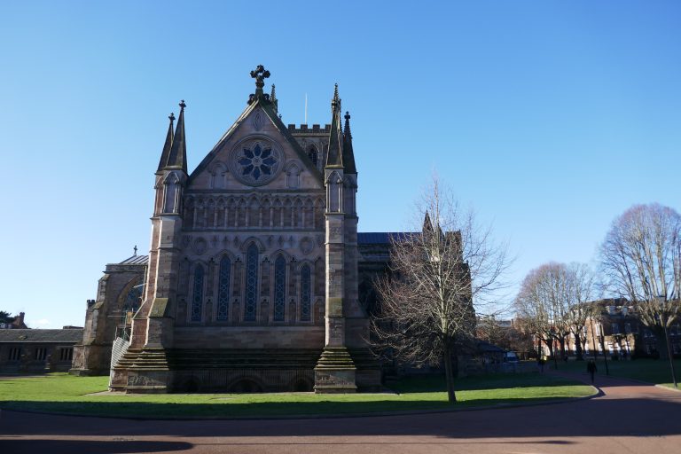
Alternatives
ALTERNATIVE route to Lugwardine – Hampton. This starts in the previous section (Ocle Pychard – Hereford). [The walker will need to assess the feasibility of this route: at times of high rainfall, it may not be passable.] At Lumber Lane, turn left and walk 240m to a crossroads with the A438, by the church. Cross over to Rhystone Lane, and walk 1.42km to a T-junction. Carry on ahead, over a stile into fields, and orientate slightly left towards a kissing gate 270m away. Through this, again bear slightly left towards two double wooden electrical pylons near the river. Reaching these, turn left to walk along the river to an arched brick bridge, which cross. Turn left and walk towards a bridge crossing a side arm of the river, which also cross and then continue in the same direction to rise onto the flood bank. Turn left, and walk 400m to rejoin the Three Choirs Way where this bank meets a larger bank – with Mordiford now visible in the distance.
ALTERNATIVE route Tupsley – Highfield. This starts in the previous section (Ocle Pychard – Hereford). Having risen up from the water-meadows and rejoined the A438 closeby The Cock of Tupsley pub, cross over and walk Hampton Dene Road. Pass by a school on the right, and 240m after leaving the A438 take the left turn into Hollywell Gutter Lane. This shortly becomes a bridleway, which now follow for 1.1km to reach the B4224. Turn right and walk 200m (if you reach Sudbury Avenue on the right – you’ve gone too far!) to where there is a green space on the left beyond which is an estate road. Take this and rejoin the main route.
Downloads
Introduction
This section takes as its starting point Hereford cathedral, and walks out of town across the river flatlands and finishes at the top of Marcle Hill. For walkers completing multiple sections of the Three Choirs Way, but who don’t want to visit Hereford, two alternatives are available that start in the previous section. Hereford cathedral and city are well worth a visit, and the road-walking is not unbearable, but those going at a clip may choose to save these treats for another day.
There are pubs at
There is a pub at Mordiford and at Woolhope. Transport links into Hereford are available from nearby Mordiford (a kilometre south – not a pleasant walk! – along the B4224).
This section of the route requires the OS map of the 1:25000 series:
- OS Explorer 189 – Hereford & Ross-on-Wye
The route
With the cathedral entrance behind, turn right and follow the paths through the eastern entrance into Castle Street. After a few metres, turn right into Quay Street and after 100m bear left into Castle Green. Follow the metalled path up towards the building on the right and continue on the right-hand path overlooking the river. Descend steps in front of the elegant Victoria Bridge, but bear to the left of this, along the riverside path.
From here to Hope Springs (beyond Mordiford), with only minor divergences, the Three Choirs Way is co-incident with the Wye Valley Walk, which is often better signed. Variances between the routes will be noted.
After 190m, reaching a kissing gate, turn left rising away from the river. Emerge onto Vicarage Road and continue to its end, where turn right. A choice of routes is now available:
- The Wye Valley Way (recommended route) turns left into Park Street, which follow for 430m, when turn right into Crozen Lane and shortly left at Outfall Works Road.
- The Three Choirs Way continues straight along Green Street, where a path enters fields, which follow with a boundary on the left and overhead lines above. After 250m, turn half-left through the boundary, to sight the pedestrian suspension bridge over the River Wye directly ahead. Make for this, but reach Outfall Works Road just prior to the bridge, turn left and follow this round.
Turn right, and pass under the railway bridge, and now follow the B4224 for 1.57km, passing a past-residence of Edward Elgar.
After crossing Sudbury Avenue, leading away left, cross over the B4224 to a small green space (the ALTERNATIVE route from Tupsley rejoins here), beyond which is a small road within a housing estate, which also cross onto a strong earth track with a green electrical substation ahead. Pass through the kissing gate to its right, and then turn right towards the river. Now walk 1.3km by the river (reaching a large willow to the left of the path). The path is not that shown on the map, in that the left turn in the path back towards the road occurs only when the gate up on the ramp is nearly opposite the river path (it’s clear on the ground). Walk back over fields to a footbridge and then onto the dyke, where turn right and walk 400m to pass through a kissing gate, after which bear left down steps to the road. Cross over, turn right, and walk 100m to a footpath on the left. Cross a paddock directly away from the road, to reach a small path between houses that gives onto a lane, where turn left.
Walk 170m rounding a right bend, and reaching ornate iron gates into The Court. There is an option here (which is the way taken by the Wye Valley Walk) to continue straight on down the road for 640m and at a sharp right turn of the road, turn left onto a track up to the dyke. The Three Choirs Way, however, turns left into The Court via a pedestrian gate, and after 100m, turns right to cross a field next to a hedge on the left and, reaching a kissing gate, crosses the next large field directly to a gate on the far side. Through this cross a smaller field on the same line, to reach a hard stock-yard, which cross to find a handgate to the right of farm gates, which pass through to go up onto the flood-bank. (The ALTERNATIVE route from Lugwardine rejoins here.) Now follow the flood-bank for 1.5km curving right to reach Mordiford Bridge. Leave the bank on the right, go up onto the road, and WITH CAUTION cross the bridge. It is possible to stay on the busy road through the village (particularly if visiting the pub!), but the route crosses the road after passing the church, and passes onto a drive to the right of the old post-office. Follow this track over a culvert, and then turn left and walk 160m to again meet the B4224, which cross over directly, into the old mill.
(If the walker is emerging from the pub – and why not? – rejoin the B4224 where it bends hard right, cross over the stream, and turn left into the old mill.)
Pass the old mill, and continue beyond the buildings, crossing a culvert. Follow the small mill-feed waterway (contouring the field) on the right to reach a wooden kissing gate, and here angle right to pass diagonally through an orchard, with a hedge to the right. At the top of the orchard, find a gate into a track by houses, enter this, and follow the track which becomes a lane. About 130m along the lane, there is an option to take a footpath on the left, but the Three Choirs Way route continues ahead for another 160m to reach a crossroads, where turn left. After about 100m, fork right, up the hill, reaching the Mordiford – Woodhope road after 100m. Turn right, and WITH CAUTION, walk along the road for 250m, to a strong track on the left going into the woods.
Follow this for 500m, passing houses on the right, and ahead of the last wooden house, look for the kissing gate and plank bridge on the left. Through these, follow the paddock boundary on the right and, rounding the end of this, enter a holloway going up the hill. After 200m, at an apparent fork, bear left and shortly reach steps up to a strong forest path. Turn left and immediately right, now on a strong forest road going uphill. Two-hundred metres on, continue straight at a crossing track. After another 200m, continue straight at a crossing track, now leaving the firm road for a green walkway which becomes muddy going down and up through a dip. After 350m, go ahead over a crossing track now on a path through pleasant deciduous woodland, which starts to descend. After 400m, as the bottom is reached and buildings come into view ahead, bear left to reach a hard track where turn right to pass a wooden barrier onto the road. Here turn left.
Immediately pass the picturesque Haughwood Gate House, and shortly at a fork in the road, turn right into Broadmoor Common. Walk 550m, after passing the last house, with the mast on Marcle Hill visible ahead as well as May Hill to its right, take a footpath on the left into a field. Walk to the right of the pond, ahead, to a wooden kissing gate into woods. Keep the woods and stream on the left, and walk down the small valley. After passing a pond, turn left to cross the stream (the second gap is less muddy, and to be preferred!) and follow the footpath to another kissing gate into a field. Turn right to walk along the field edge, with woods on the right. Nearing the crossing boundary, err slightly left to another wooden kissing gate. Through this, cross the field to the left of a great oak, towards metal gates onto a lane, where turn right. Immediately take a hard-track on the left to St George’s church car-park, where turn right to enter the church-yard. Cross this and exit through the lychgate into Woolhope. Pub on the right.
From the church, turn left, and shortly at a junction, carry straight on, passing Woolhope Manor on the right. After passing handsome barns, take a footpath over a stile on the right. Walk away from the road with orchard on the right and, continue on the same line to a gap in the porous boundary fence ahead. Through this, rise up the ridge to a wooden pole ahead. Gaining the ridge, angle left downhill towards the far corner, where there is a stile, which cross, turn hard right and cross a second stile to enter an orchard. Turn half-left and walk through the orchard towards its furthest corner. Look for the gap in the hedge with a bridge to the left of the corner, and emerge into a field, with the mast again visible ahead. Walk uphill across the field towards its furthest corner, where cross a stile onto a lane and turn left.
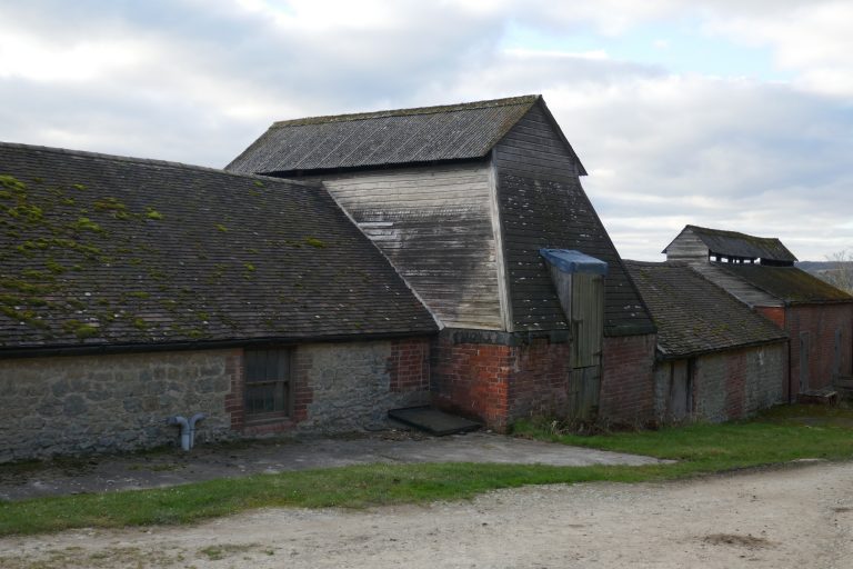
Walk 670m to Hyde Farm where stay on the track through the farm yard. Don’t take the path angling uphill, continue through the farmyard, passing large open barns on the right. Stay with the track as it bears left and follow the watercourse for 200m to reach a large green building, where turn right through two successive gates into a large field. Cross this, going uphill, angling slightly right, towards an oak in the far boundary which is about 150m to the right of Sleave Oak homestead. Exit over a stile onto a lane, where turn left, and walk uphill for 500m. Just over the crest with fine views to the east emerging turn up steps into a footpath on the right, which proceeds along the crest, and after 880m reaches the trig point.
Alternatives
The alternative routes (ALTERNATIVE Lugwardine – Hampton; and, ALTERNATIVE Tupsley – Highfield) that avoid Hereford are discussed in the previous section (Ocle Pychard – Hereford).
Downloads
Introduction
A fine mixed section, starting at the top of Marcle Hill and walking into the Forest of Dean.
There are few amenities en route after Much Marcle where there are three pubs, one of which The Royal Oak, provides accommodation. Plans for a shop, have yet to reach fruition. There are some public transport links at Much Marcle, see: Daffodil line; Nick Maddy Coaches.
Towards the end of the section, it may be easier to divert to Newent if wanting either transport or accommodation. There are regular bus services between Newent and Gloucester. Two buses a day run between Kilcot and Gloucester. See https://www.stagecoachbus.com/ . There is accommodation in Newent and there is an Inn at Kilcot.
This section of the route requires the OS map of the 1:25000 series:
- OS Explorer 189 – Hereford & Ross-on-Wye
- OL14 – Wye Valley & Forest of Dean
The Route
From the car-park at Sleaves Oak turn right, and just over the crest with fine views to the east emerging turn up steps into a footpath on the right, which proceeds along the crest, and after 880m reaches the trig point on Marcle Hill.
Continue towards the mast (there is a path both sides of the hedge), which pass and continue, to reach steps and a stile down onto a track. Turn left, and pass over the crest before starting to descend.
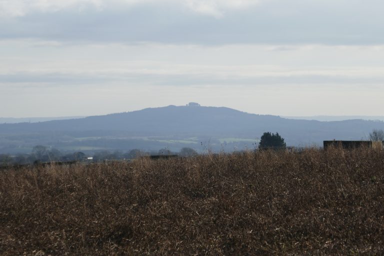
At a crossing lane, continue straight on the lane ahead for about 250m, where after passing homesteads and an old-fashioned street-lamp, turn right down a track. Just before the gate to Little Puckmore, bear left off the track onto a footpath, which reaches a field via a stile. Turn left, and follow the hedge on the left as it bears round the field to the far corner. Cross the stile here, and continue 100m down the field edge, with the hedge on the right. Look for the stile in the boundary, and cross this onto a track, with a modernist house, The Point, on the right. Continue on the track for 400m to a lane, which cross directly to a metal gate.
Turn a quarter left, to cross the shoulder to the left of the crown and on gaining the ridge, spot the stile in the gap in the hedge ahead, and aim for that. Cross the lane slightly left into a large field, and continue down hill close by a hedge on the right. When the hedge gives out, continue on the same line to reach a footbridge. Over this, maintain the same line to the hedge gap ahead onto with caution the busy A449. Cross the road directly, and orientate towards the church ahead. Cross the lane and enter the churchyard through the yew arch, where turn right and walk round the church, passing the famed and impressive Marcle Yew and an ancient cross. Exit through another yew lychgate and in the driveway beyond, turn left and then right down to the road. Here turn right (or left if wanting to experience the delights of Much Marcle).
After 90m take the left fork, and walk a futher 690m along the road, passing Great Moorcourt Farm, and look for a double stile in the right hand hedge. Although the instructions for the next 1.4km are a little complex, the direction of travel (SSE) is clear and constant. Cross the first field directly to a wooden stile (avoiding the metal farm gate to its left). Cross the next field on the same line, and the next very narrow field similarly. Now enter a large field often either ploughed or cropped. Continue on the same line, now with unmistakable May Hill visible and directly ahead in the far distance! Descend the decline to a gap in the boundary and carry on into a paddock, now with Friar’s Court large on the left. Cross another cross hedge and now follow the right hand boundary to a galvanised steel gate which pass through and immediately turn right over a small bridge and then left to resume the SSE direction of travel, with the hedge now on the left. Continue on the same line, now with St Mary’s church in view, to a crossing hedge with a small footbridge, over which, turn slightly right to cross the field to a boundary track, which now follow towards the church. In the corner of this field, a final footbridge on the right, over which turn left and follow the boundary on the left to the lane, where turn left and then right into St Mary’s church.
St Mary’s church contains frescos painted as long ago as 1130. The building is managed by English Heritage. It is usually found open, but check ahead if a visit is planned.
Walk through the churchyard to a handgate into a field and pass over a footbridge. Turn half-left to orientate to the left of the large farm buildings of Kempley Court. Reach these, and round the buildings and pass through a gate, cross a track, and through the gate beyond. There is a water course on the left, and now follow this for 300m to a crossing hedge (where don’t cross the water, but keep on), and then for a further 840m to reach a lane. Turn left and walk 120m uphill to find a footpath on the right. Take this.
Kempley has two churches. St Edwards, built in 1903, can be visited by a footpath forking right after 160m, climbing the field. It has several modern sculptures and was described by John Betjeman as ‘a minature cathedral of the Arts and Crafts movement’.
The main route, however, continues straight with the hedge on the left. After 340m reach a crossing hedge and 80m beyond this pass through a galvanised steel gate in the left hedge, and then continue in the same direction, now with the hedge on the right. At the end of this field, carry straight-on through a gate into a green-lane. Follow this, over a crossing track, to reach the lane through Kempley Green. After 250m, having passed the red-brick chapel on the right and a further house beyond, take the track on the left angling back. However, almost immediately, take the green footpath on the right of this track, passing between two red-brick houses to a field. The Three Choirs Way now runs coincident with the Daffodil Way, which may be better signed.
Cross the field, close to the left-hand boundary, descending to a kissing gate by a gnarled old oak. Through this rise up to farm buildings, which pass on the left and reach the track ahead, bounded on the right by a row of old Perry trees and on the left by wide views to the Malvern ridge. Pass through gates, and continue to a bridge over a stream, where turn a quarter left to the wooden gate into Dymock Wood. Go straight ahead, and the path becomes stronger going up hill (SE), it passes over a crossing track and then descends slightly before turning left (ENE). Exit the woods on the strong track to reach a lane, where turn right and walk 160m to cross the M50 motorway (don’t attempt to find the path shown on the OS which runs through the woods to the motorway edge).
Over the motorway, at the T-junction, turn left, and before reaching houses at Four Oaks, take the footpath on the right into fields. Track the boundary of the woods on the left for 500m, passing through one porous boundary, a reach a crossing hedge with a kissing gate. Don’t take this, instead turn right and follow the hedge on the left downhill, to a footbridge. Cross this, and enter Greenaway’s Wood. About 10m in, be sure to take the right forking path, which has to its right a small stream. Follow this into the woods, but after 160m, keep the track as it bears leftwards away from the stream. On reaching a road, turn right, and walk 100m, to a footpath on the left just before a cottage. Follow the hedge on the right, and when this turns away, continue on the same line (again with May Hill dead ahead) shortly to spot a kissing gate, ahead. Through this, turn hard left to another kissing gate and beyond this, turn slightly left again, towards a stile to the right of a galvanised steel gate, over this, turn right to walk down the field, close by the right-hand boundary hedge. After 370m reach a stile by a spring, and over this continue on the same line, now with a stream on the left, to a wooden gate which gives onto a lane.
Turn left and after 180m, pass a pond and then enter fields on the right through a gate. Just inside the field is an information board about the Newent Colliery. Follow the stream on the right and the line of wires ahead, to reach a footbridge. This is actually a culvert of 1790, which carried the branch canal over Brockmorehead Brook, which the canal then followed towards Oxenhall. Keep close to the right-hand boundary, and follow the field round to the right, but on nearing the stream on the left, stay with this as the boundary moves away and aim for the gate onto the farm track, ahead. Through this on the track turn left, cross the stream, and then take the steps down on the right into a field. Follow the river round a curve, and then bear away left to the protruding right-angle in the hedge ahead. From here, look up the hill to a stile at the top. Over this, stay on the same line up the hill to a pair of steel gates, next to which is a stile. Over this, turn right on Kews Lane, and after 40m turn left into a field with allotments. Bear left up the hill, to pick up the left field boundary, and exit via a short green lane onto a crossing lane in Kilcot village. Turn right here, and shortly turn left into Kilcot Lane and soon reach the B4222.
Cross with care to the footpath opposite. Take this through trees and curve left to meet a lane, where turn right and walk 670m to Briery Hill farm. Pass between the barns with llamas and the house and follow the track as it turns right uphill. Where the track turns right into the forecourt, continue straight-on through a kissing gate into a paddock which cross to another kissing gate into another field. Follow the hedge on the right uphill, and after 170m stay alert for the kissing gate in the hedge, which pass through and continue uphill, now with the hedge on the left. Pass Ravenshill to a track where turn right and shortly left. After 150m look for a kissing gate on the left into a long field. Aim first for the protuberance in the right hand hedge and from there for the kissing gate in the top left corner.
- Ravenshill
- West from Ravenshill
- Llama at Briery Hill
- Briery Hill
Through the gate take the left path through the paddock to pass a horse-exercising patch and reach a kissing gate onto a lane, where continue in the same direction. After 150m where the road turns right, continue straight on over a gate into a field. Pause at the gate for a moment and, trying to ignore the forest of pylons, take in the wide panorama over the vale. If weather is reasonable, or even sunny, Gloucestershire cathedral will be clear in the distance. The Cotswold scarp is beyond.
Alternatives
Option to continue on to Much Marcle (downhill all the way!) for accommodation or some transport links.
Downloads
Introduction
There are few amenities along the route, notwithstanding the way passing through a series of villages. To reach the start by public transport, the walker will be best off going to Newent (good services) or Kilcot (two buses a day) and walking to the start, probably via paths on the previous section (see https://www.stagecoachbus.com/). After the old station at Rudford, the Way is close by the B4215 where some services may be available. There are amenities at Lassington (just off the route) and Over (on the A40). Gloucester has all the amenities of a large city, including large bus and train stations. There is accommodation in Newent and there is an Inn at Kilcot.
This section of the route requires the OS map of the 1:25000 series:
- OL14 – Wye Valley & Forest of Dean
The route
This section starts where the last ends, at a gate on a bend in the road on the hill above Clifford’s Mesne (Grid Reference SO 69933 23550). Pause at the gate for a moment and, trying to ignore the forest of pylons, take in the wide panorama over the vale. If weather is reasonable, or even sunny, Gloucestershire cathedral will be clear in the distance. The Cotswold scarp is beyond. Err rightwards across the field, to find the stile onto the track to the right of the first house. On the track turn left, downhill. At a crossing road continue straight over onto a lane going down hill. (A walker with a mind to climb May Hill, at 296m the highest point in Gloucestershire to the west of the Severn, should divert towards it somewhere roundabout here). After 180m turn left and proceed for another 650m along the lane, leaving where it turns hard left.
Take the path along the track into Woodgate Farm passing through the yard and out. At an apparent fork, with homesteads to left and right continue straight-ahead to a gate, and through this turn left to follow a wooden fence and continue round ponds to reach a stile. Cross this and turn hard-left downhill. Avoid the farm gates into fields, rather aiming for trees at the bottom of the hill where there is an inconspicuous culvert over the stream. Over this go up the rise towards the nearby pylon and then cross the undulating field between the power lines but erring towards the right hand lines. Find the stile up four steps in the far hedge immediately below the power lines (and to the right of a field gate, which avoid). Cross this and continue up the hill with the hedge on the left. Just beyond the hill crest, cross over a stile and now turn slightly left to converge with the hedge on the left going downhill. Look for a stile close by a wooden electricity pole and cross this and continue down hill on the same line to a stile in the crossing hedge in the small valley. Through this, cross the next field erring leftwards whilst walking up the small rise. Having gained this, spot the gap onto the lane on the left below, and aim for this. Turn right and walk 190m through Little Cugley. After a gentle right curve, look for a footpath on the left. Take this and walk directly up the hill, away from the road. As height is gained, a gap in the line of trees along the watercourse ahead becomes visible, and make for this. On reaching the gap, cross the water course, and continue on much the same line aiming for the highest point on the ridge ahead. At the ridge, cross the boundary verge to a stile, nearby Cole’s Barn, and then turn left to follow the left hand field boundary which becomes more conspicuously a green lane and then a hard track towards The Hill farm.
- How now?
- Old greenway, past Hill Farm
Enter into The Hill farmyard, and pass between the farmhouse on the right and outbuildings to the left (this is not the route shown on the OS map). Exit the farm through a gate into fields and walk across the field towards a gap in the porous field boundary, ahead. Through this, continue on much the same line along the centre of the field, to find the inconspicuous stile in the hedge ahead. Through this into a paddock stay close by the right boundary to reach the hard track which turns right into Drews Farm. Pass by the marshalling yard and farmhouse to the left, and having crossed a stream enter into a field on the right and cross it diagonally uphill to the redbrick Taynton Parish reading room and emerge onto the lane.
Turn right, and walk a few metres to the driveway to the Rectory, which enter and then take steps on the left into the field. Turn right to walk directly away from the road. Look for the gap in the hedge on the far side of the field (an interim target is the telegraph pole with lines leading away in three directions). On reaching the stile, cross into the next field, and turn half-left, to cross over the shoulder of the ridge, well to the left of a circle of oaks on the top. Obtaining the ridge, look to walk to the far left corner of the field, where the stile is only apparent when it is close by.
Cross into the parkland, and looking between the two trees nearby, identify the stile onto the driveway and aim for that. Cross this, the driveway and the stile on the other side, and continue on the same line, looking for a footbridge about 50m to the right of the far corner. Cross this, and turn hard left but diverge from the course of the river towards a double stile. Cross this, and maintain the same line heading towards the far field boundary, where there is hand gate and water course crossing. Turn a quarter-right, aiming towards a clump of trees in the far corner of the field. On reaching this corner, there is a cross roads of paths and take the one going ahead up the incline towards the church tower. The track becomes stronger and passes between houses and after 520m reaches Huntley Lane, where turn left. Walk about 300m to the main road through Tibberton, where turn right to pass the duck pond.
Shortly, look for Orchard Rise on the left and walk up this for 170m to find a footpath on the left between houses. Take this behind the gardens to reach a footbridge, over this, orientate to cross the field diagonally, to meet the right hedge about 250m ahead. This hedge turns right and a bridge – Barbarous Bridge – from a Civil War action – becomes visible over the ditch. Walk diagonally across the next field – often cropped – to the top left corner, which is close by Bovone Farm. Pick up the cinder track that passes into the farm yard, with a large barn to the left. Continue out of the farm, and follow the track across the next field. The old station, now converted to a residence, can be seen through the fence just before the track curves right to meet Barbers Bridge. Turn left towards the bridge but within a few metres find the path on the right going down steps to the B4215. Cross this slightly rightwards, being sure to take the rightmost of the two footpaths ahead.
- Old station
- Church from the railway line
- Rudford Church
- Boundary marker
- Footpath
- May Hill
Follow the line of the old railway for 880m, rising up the right embankment just before the bridge at Rudford Cross. For a worthwhile visit to the church, cross the bridge. But otherwise cross directly into fields. Walk about 330m through three fields, keeping the hedge close by on the left. Then look for a stile through the hedge, which take, and then continue in the same direction, now with the hedge on the right. About 400m further, after a stile in a crossing fence, turn right and walk up towards the road, but before reaching the road, turn left and curve round the field towards far woods. Avoid taking the right forking path half-way through the field to a visible stile, instead curving left as the field narrows and the entrance to woods is close by the old railway line. Go through this, and continue ahead, initially with the old railway line nearby on the left, but soon the path angles up the embankment to emerge into a field. Stay with the strong path by the field edge, which dips back into the edge of the woods. Eventually the path crosses the field towards the red-brick farmhouse on the far side. Walk through the farmyard and just before the old tower of Lassington Church, turn right. The entrance to the church is a little way along the lane.

About 220m along the road, pass a large double fronted farm-building and beyond take the cinder track to the left, signposted The Elms. At a fork in paths, just in front of a house, take the right fork – crossing two stiles into a narrow field. Walk down this to the far end, and exit via a hand-gate in the left corner into trees. Go up the rise, bearing leftwards and continue through trees to emerge onto a verge with a road and housing estate on the right. As the road curves right, bear off left to a stile into a field. Here turn right and walk to the copse, ahead. Enter the woods over a stile. Take the strongest path, which shortly descends via wooden steps and then runs parallel to the left side of the woods, with flat fields beyond. Exit the woods via a stile and cross field-edge track to a kissing gate. Through this, turn left and follow Lassington Lane (a cycle track) for 900m to Over Farm shop.
Reaching the busy A40, turn left and walk 420m, cross the driveway into Over estate, and take the path angling left down to the Severn river. Cross under the road bridge, turn right and walk back up to the southern side of the A40.
ALTERNATIVE ROUTE INTO GLOUCESTER. Alney Island is prone to flooding after heavy rainfall. To avoid this, now turn right and follow the road (effectively turning right at the roundabout) for 940m to where the A430 intersects from the right. Here stay on the A417, continuing for another 720m, until reaching traffic lights on The Quay (Severn river is on the right, opposite is Quay Street). Cross the road here, cross Quay Street and double back down The Quay for a few metres to its junction with Westgate Street, where turn right and walk up 350m to College Street on the left, leading to Gloucester cathedral.
Main route. Turn left having re-emerged onto the A40 and in a few metres, turn left through the fence and climb up onto the old Over Bridge (“Telford’s Bridge”). Cross this, and having descended on the far side to reach a T-junction of paths, turn right. After about 20m, the Gloucestershire Way (now running co-incident with the Three Choirs Way) is sign-posted left, through scrub, soon picking up the railway line on the right. After 250m pass under the busy road-bridge, and shortly pass through a kissing gate into fields. After another 200m, there are red-brick arches carrying the railway, and pass under the first of these, shortly to reach a kissing gate, ornamented to celebrate the millennium. Go through this, and pick up the track ahead through trees. After 300m, this passes through a gate, where a metalled track bears slightly left, shortly to reach a side road which exits onto the busy gyratory A430. With care, cross the side road, and then walk along the A430 until there is a footpath forking left off, which shortly reaches a minor road. Walking parallel to the main road to the right, continue on the minor road, shortly a path bears off right, passing under the traffic to reach a pedestrian bridge over the Severn, take this.
The safer route, having crossed the Severn pedestrian bridge, is to turn right, walk under the west travelling traffic bridge, then turn left angling up to join the pavement. Turn right towards Gloucester, and walk 400m until reaching traffic lights on The Quay (Severn river is on the right, opposite is Quay Street). Cross the road here, cross Quay Street and double back down The Quay for a few metres to its junction with Westgate Street, where turn right and walk up 350m to College Street on the left, leading to Gloucester cathedral.
(The most direct route, having just crossed the Severn pedestrian bridge, which cannot be recommended, involves walking directly ahead shortly to reach the busy gyratory A417. Fast traffic is coming from the right, and the task is to reach the safety of The (traffic) Island beyond. Having done so, walk between buildings to the far side, and cross the pedestrian bridge, at the far end of which turn right to reach Westgate Street. Walk 350m to College Street on the left, leading to Gloucester cathedral.)

Alternatives
Alternative routes between Over (“Telford’s”) bridge and Gloucester cathedral are discussed in the text. Consider avoiding the paths on Alney Island after heavy rains. Traffic hazards are somewhat mitigated by a suggested alternative route.
If starting from Newent (where there are good transport links), the walker may pick up some of the paths in the previous section.
Downloads
Downloads
Click on the highlighted section to download the file.
Notes on the way
This is an ad hoc section to record route issues. Overtime it may expand into a full real-time route guide. Right now, I’ll record here any noted issues or observations. I’ll try to order these according to the line of the route, presuming clockwise progress starting and ending in Gloucester.
Bannersbrook Farm
The problems of passing through Bannersbrook Farm (SO 74336 56473) and the fields to Eastinghope Lane (SO 74811 56834) have been resolved.
Carrington Bridge
Carrington Bridge lies to the south of Worcester and is the means by which the Severn is crossed on the final leg towards Gloucester. There has been considerable upgrade work there, which has impacted on the line of the route on both sides of the bridge. Assuming the walker is approaching the bridge from Worcester, walking along the Severn:
- Before reaching the bridge, before leaving the former caravan park, turn (150 degree) left through the caravan park, past the site office up the footpath to the Toby Carvery on the Worcester road, and there turn right towards the bridge.
- Aim to stay on the northern pavement over the bridge and cross.
- Having crossed the bridge, turn (150 degree) right down the slip-road towards the river, and pass under the bridge. EITHER walk to the riverside and pick up the PROW there and follow that for a ways south until meeting the path going westwards; OR enter the access land at SO 85061 51572 and follow the existing route.
Malvern Hills
It has been noted that on the Ordnance Survey map there is a break in the line of the path from SO 76868 43709 (Upper Wyche) and SO 76297 40409 (A449 crossing). The belief is that this reflects the observation in the guidebook that it is not possible to describe a distinctive route, with so many paths running north-south along the Malvern ridge. In the guide above, I suggest following the ridge-line as far as is possible, and I provide a GPX with this route. This involves notably climbing North Hill, which adds distance and ascent. If this suggestion proves acceptable, we may suggest OS adopt this line to fill the lacuna!